
Case Studies
Virtual Pre-Production for Netflix's Monster: The Lizzie Borden Story.
Reality capture let Netflix's Monster scout 35 Italian locations in four days with PortalCam, then plan shots remotely through virtual scouting of 3DGS scans.
A single round-trip by boat, delivering 3D data ready for engineering workflows.
Project by SQ Engineering. Adapted from a field report by T3solution.
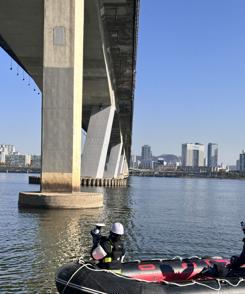
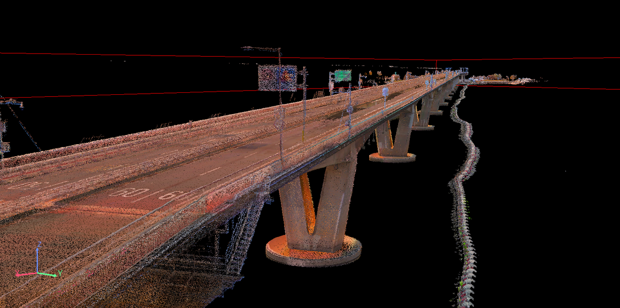
Bridge inspection is among the most demanding tasks in digital twin work. The underside of a bridge is especially difficult: drone flight is constrained, and GPS shadowing, strong winds, and obstructions make stable data capture hard to achieve. On this project, the team used the XGRIDS Lixel L2 Pro to record the entire bridge in 3D using a safer and more efficient method than the conventional approach.
| Parameter | Value |
| Scan time | ~30 minutes |
| Bridge length | ~1.2 km |
| Scan speed | 2–3 m/s |
| Capture method | Single round trip by boat under the bridge |
Standard methods for scanning a bridge underside carry several problems:
Structurally complex sections, like inside truss members and under girders, are particularly hard, because securing a viable drone flight path is a problem in itself.
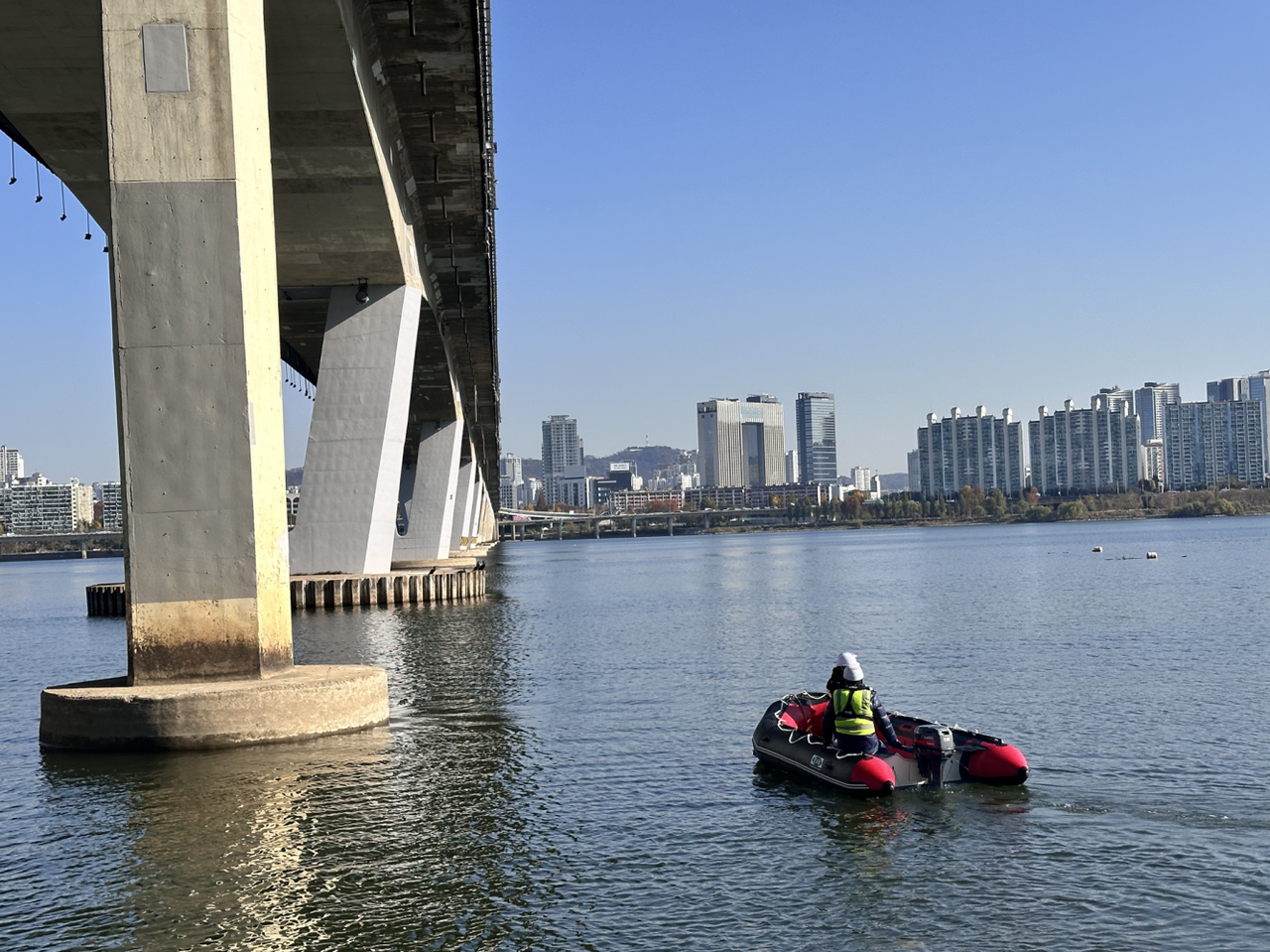
This project used the Lixel L2 Pro, XGRIDS' multi-SLAM LiDAR scanner. A complete scan of the bridge underside was fully captured without a drone.
The Lixel L2 Pro's Multi-SLAM runs several SLAM engines in parallel, enabling stable pose estimation even in GPS-denied environments. On site, the practical advantages were:
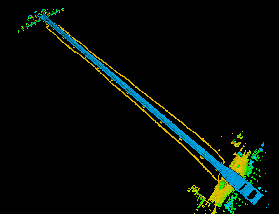
One round trip captures the full dataset. The operator simply travels the bridge underside once and back by boat:
Generating high-quality 3D data from a simple capture path is a notable strength of the Lixel L2 Pro among SLAM devices.
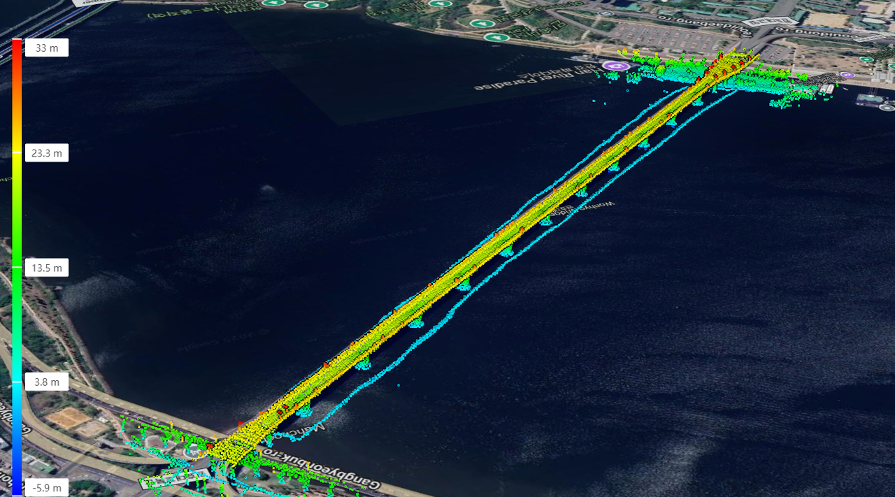
The Lixel L2 Pro supports RTK (Real-Time Kinematic). This writes accurate absolute coordinates directly into the captured point cloud, which means:
In short, the scan data can be used as a digital twin aligned to real-world space, with no separate registration step.
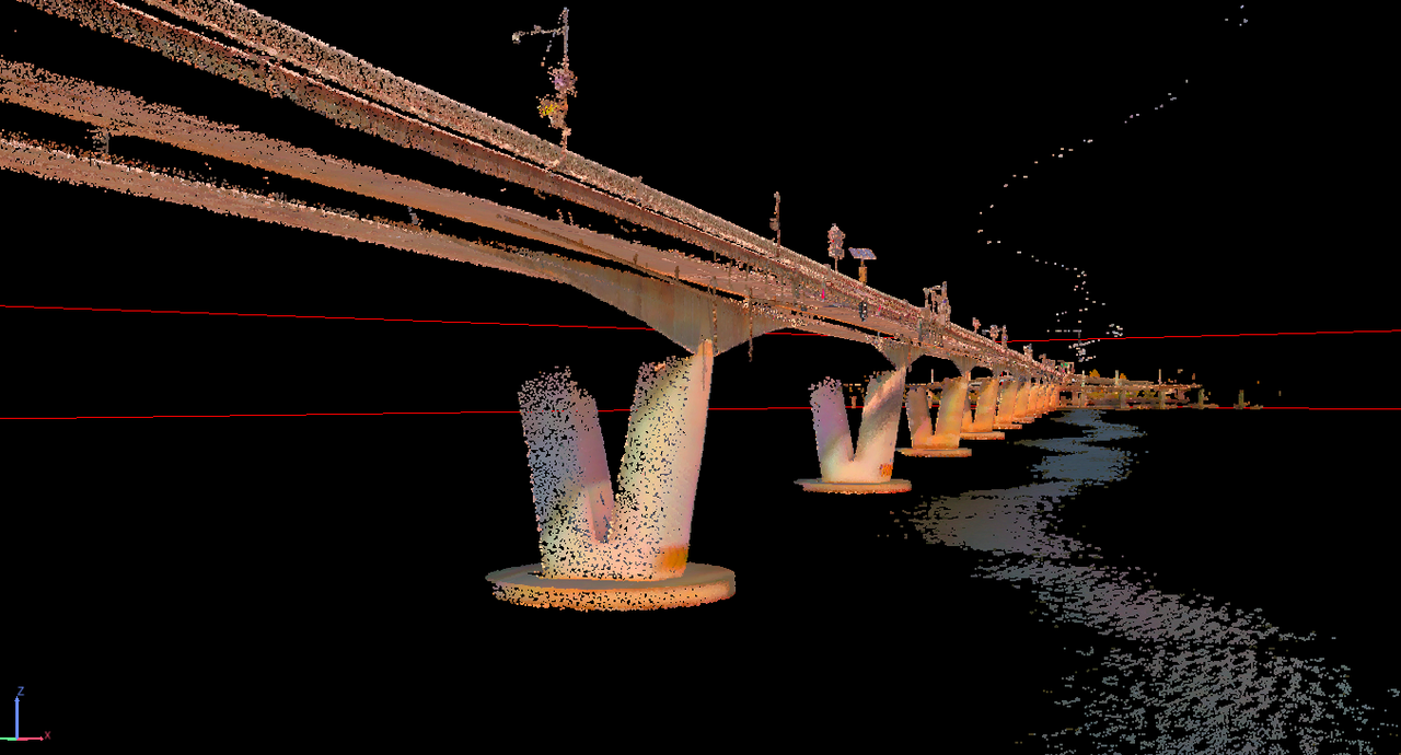
The high-density point cloud from the Lixel L2 Pro is not just a visualization. In inspection and maintenance work, it serves as core engineering data.
The point cloud supports accurate measurement of cross-sections, girder height, width, and incline.
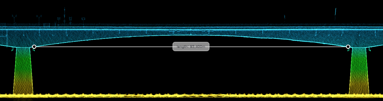
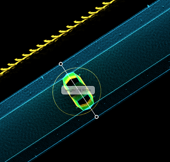
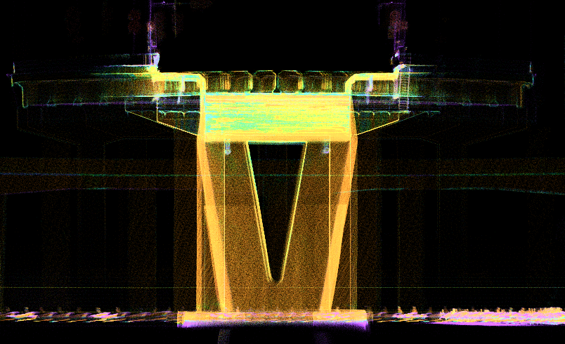
Working from the high-density 3D model, the team can:
Comparing scan data collected across multiple years makes it possible to quantify deterioration trends.
Areas that are difficult or unsafe to access — the top of girders, the inside of truss members, around pipework — can be recorded precisely as point cloud data, enabling safer inspection.
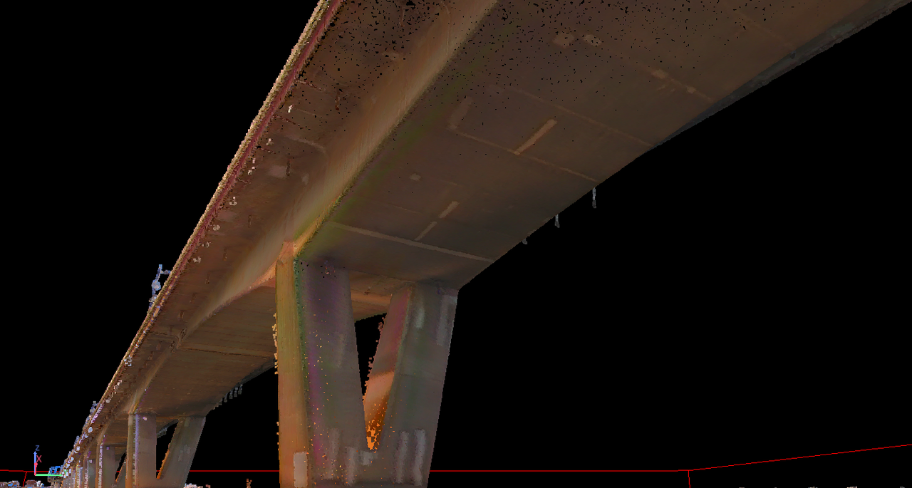
The point cloud from the Lixel L2 Pro can be converted through post-processing into:
This lets inspectors review the structure in PC, VR, or web environments as if walking through the bridge itself — a level of detail that paper drawings and 2D photos can't capture.
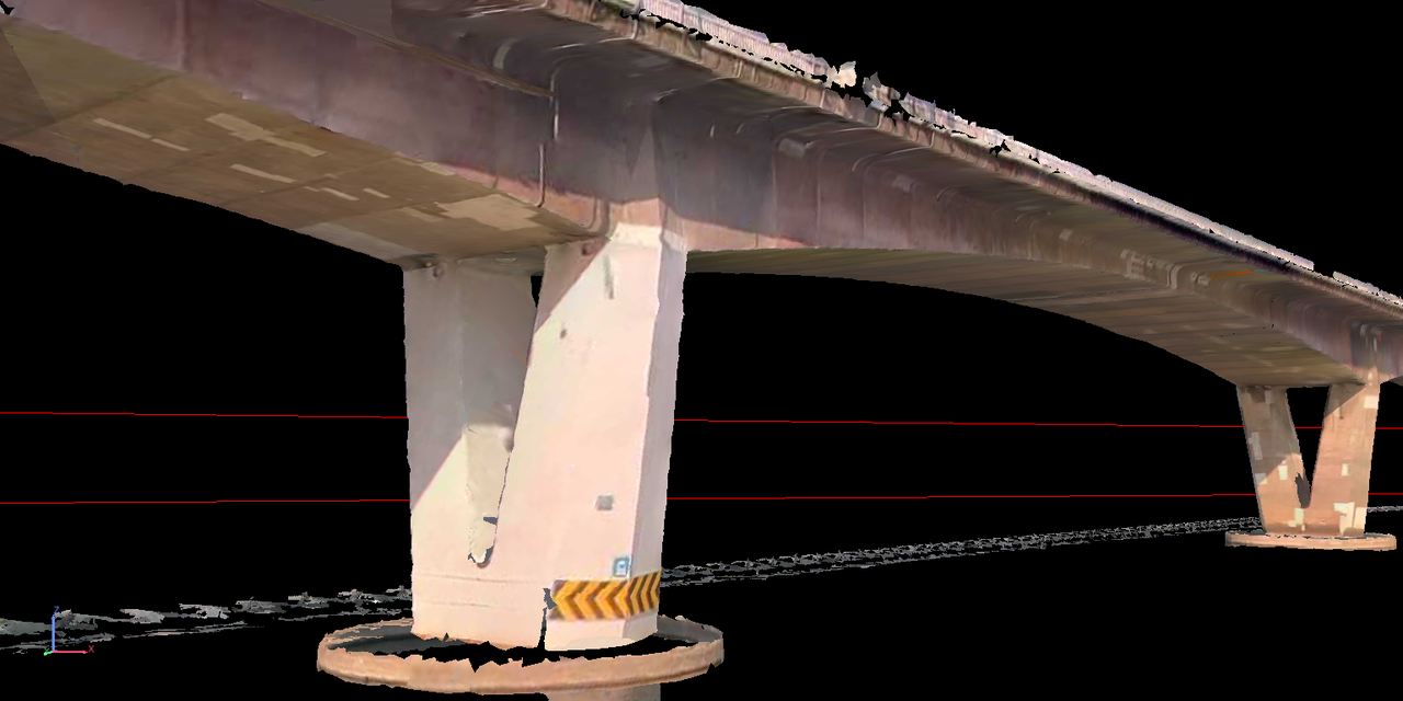
Figure: 3D Mesh — textured mesh reconstruction of the bridge underside and pier.
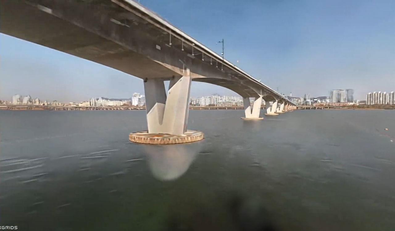
Figure: 3D Gaussian Splatting — photorealistic splat reconstruction viewable in browser
On this project, the Lixel L2 Pro demonstrated:
The result is a single field workflow that produces georeferenced, engineering-usable 3D data for bridge inspection — without the access constraints and blind spots of drone-based capture.
With thanks to SQ Engineering for sharing this case.
Reality capture let Netflix's Monster scout 35 Italian locations in four days with PortalCam, then plan shots remotely through virtual scouting of 3DGS scans.
.png?x-oss-process=image/resize,w_800/quality,Q_50)
A one-hour Lixel K1 scan of six Culver City blocks gave a generative film pipeline the fixed geometry it needed to keep six locations consistent.

Handheld 3DGS by PortalCam helped CyArk document three landmark interiors for America 250, solving mirror reflections and low-light field challenges.

Handheld 3D capture brings real museum spaces to LED volumes, replacing green screens and photogrammetry for fast, cinematic virtual camera moves.