
Case Studies
Virtual Pre-Production for Netflix's Monster: The Lizzie Borden Story.
Reality capture let Netflix's Monster scout 35 Italian locations in four days with PortalCam, then plan shots remotely through virtual scouting of 3DGS scans.
110m × 27m Bridge: SLAM vs. Terrestrial Laser Scanner
Atlıhan Engineering needed as-built documentation of a 110-meter highway bridge with heavy pedestrian and vehicle traffic. The question: could handheld SLAM technology deliver accuracy approaching terrestrial laser scanner (TLS) standards while dramatically reducing field time and traffic disruption?
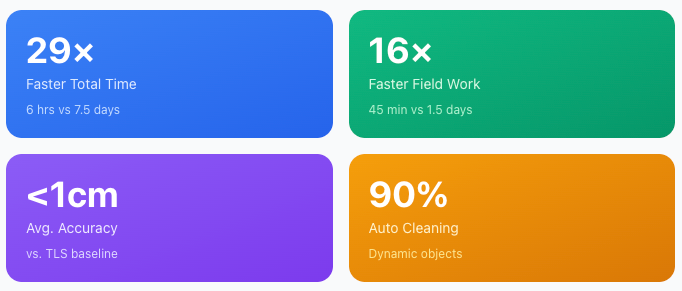
Head-to-head comparison between XGRIDS Lixel L2 Pro handheld SLAM and Leica RTC360 terrestrial laser scanner (TLS) for as-built bridge documentation. The L2 Pro completed the full 110m × 27m survey in 6 hours total versus 7.5 days for TLS, while achieving sub-centimeter accuracy validated against the TLS baseline.
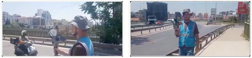
Operational efficiency breakdown:
L2 Pro required just 3 overlapping scan loops versus 350 individual TLS setups.
Field time reduced from 1.5 days to 45 minutes, with full mobility access to areas restricted by traffic—a key advantage for infrastructure surveys on active roadways.
| Metric | L2 Pro | TLS (RTC360) | Advantage |
| Scan Method | 3 loops | 350 setups | 117× fewer setups |
| Field Time | 45 minutes | 1.5 days | 16× faster |
| Site Access | Full mobility | Limited (traffic) | No constraints |
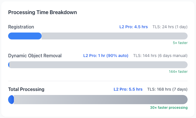
LixelStudio's automated dynamic object removal feature cleaned up around 90% of the heavy pedestrian and vehicle traffic present during the scan, and the remaining manual clean-up completed in 1 hour, versus 6 days of manual cleanup for TLS data.
Total processing: around 5.5 hours for L2 Pro versus 7 days for terrestrial scanning.
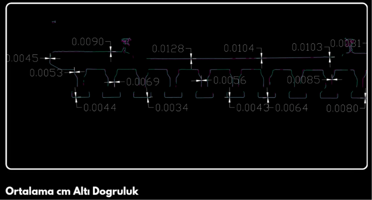
Cross-section comparison against TLS data:
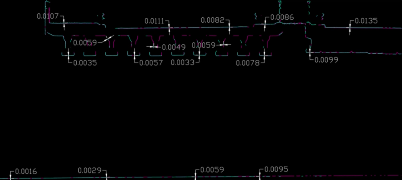
Cross-section accuracy diagram with deviation measurements at multiple points.
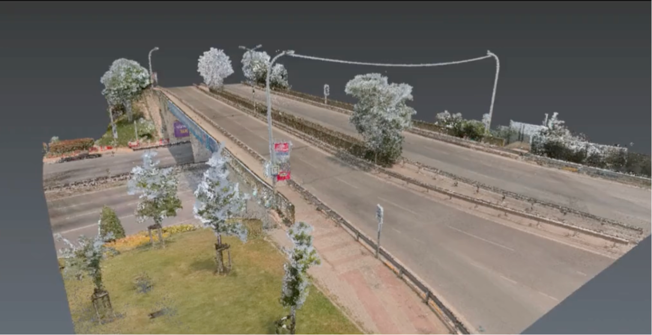
Colorized Point Cloud Model of the Bridge
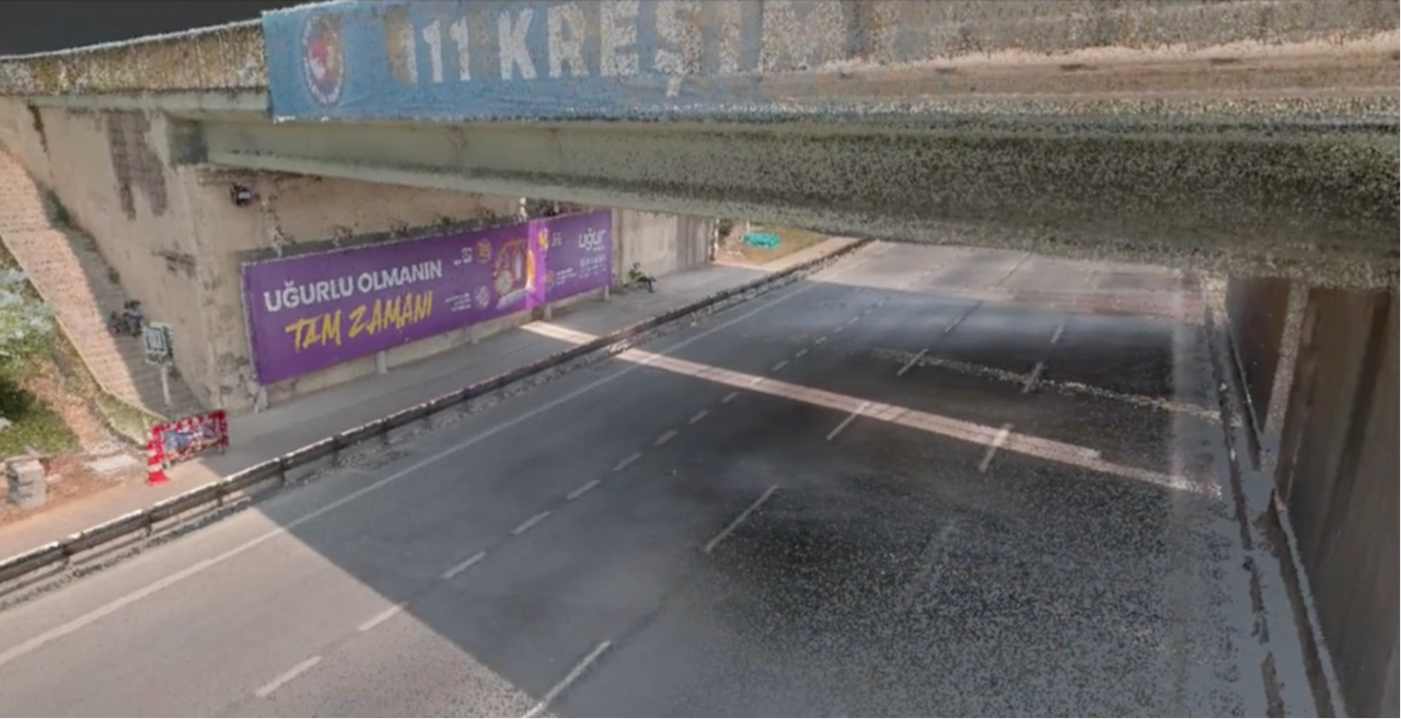
Colorized Point Cloud Model of the Bridge
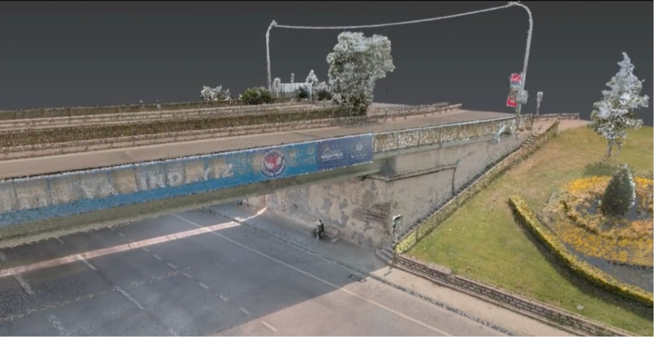
Colorized Point Cloud Model of the Bridge
Complete as-built documentation including site plans, cross-sections at specified intervals, and bridge wear analysis. The L2 Pro data proved sufficient for structural assessment without requiring TLS-level detail.
Okan ATLIHAN, Atlıhan Engineering:
"For this type of work, the achieved level of accuracy and detail meets expectations, so I prefer the L2 Pro. Time, cost, and the benefit index are the most important factors. Another reason for choosing it is the very high level of detail in the L2 Pro compared to other SLAM devices, which is also due to its software algorithm."
Choose L2 Pro for: Bridge inspections, as-built documentation, condition assessments where <1.5cm accuracy is acceptable, particularly when traffic, safety constraints, or time pressure exist.
Choose TLS for: Applications requiring maximum detail and sub-millimeter precision where additional time and cost are justified.
Reality capture let Netflix's Monster scout 35 Italian locations in four days with PortalCam, then plan shots remotely through virtual scouting of 3DGS scans.
.png?x-oss-process=image/resize,w_800/quality,Q_50)
A one-hour Lixel K1 scan of six Culver City blocks gave a generative film pipeline the fixed geometry it needed to keep six locations consistent.

Handheld 3DGS by PortalCam helped CyArk document three landmark interiors for America 250, solving mirror reflections and low-light field challenges.

Handheld 3D capture brings real museum spaces to LED volumes, replacing green screens and photogrammetry for fast, cinematic virtual camera moves.