Digital Twins 100 Meters Down: Precision 3D Mapping Transforms High-Risk Mining Operations
Case Studies10 min read
Create accurate digital twins of challenging underground mining environments, including 100m vertical shafts and subterranean rivers
In the depths where light fails and traditional surveying falters, a limestone mining operation faced the seemingly impossible task of documenting treacherous underground networks. The challenge: accurately map vertical shafts exceeding 100 meters and subterranean rivers without endangering personnel.
The solution: XGRIDS' Lixel L2 Pro scanner with Multi-SLAM technology, which created precise 3D models while cutting survey time by 80%. This digital twin now powers critical safety protocols, volumetric analysis, and operational planning—proving that when the mining industry's most challenging environments meet advanced 3D capture technology, the impossible becomes routine.
The resulting digitized version of the mine can help evaluate and eliminate safety risks commonly found in flooded mines and improve maintenance routines while reducing operational downtime. More importantly, digitizing mines can enhance management efficiency, improve overall operational control, and mitigate uncertainty, enabling mining companies to navigate industry challenges and pursue growth in a changing landscape.
Challenge: The Limitations of Traditional Underground Surveying
Dark limestone mine cavern with a wooden ladder, an environment too hazardous for traditional underground surveying
Underground mining operations present some of the most challenging environments for accurate spatial documentation.
A mining operation in eastern Guangdong, China deployed the Trimble SX10 total station to create a georeferenced 3D model of their limestone caverns. Despite establishing over 100 scanning stations, critical areas remained unmapped:
Dynamic Water Features: Underground rivers and flooded sections creating unstable conditions
Complex Tunnel Networks: Geometries inaccessible to tripod-based equipment
Safety Concerns: High-risk environments where minimizing human exposure is critical
Limited Access Points: Many areas unreachable with conventional equipment
"Some of these environments were simply impossible to document safely with traditional methods. We were making critical operational decisions based on incomplete data." — Mine Planning Engineer
When evaluating new technologies to complement traditional surveying tools, mining operators often encounter SLAM-based solutions promising flexibility and centimeter-level accuracy in a portable package. However, the underground environment demands careful technology selection, as not all SLAM systems can handle mining's unique challenges.
SLAM Technology Limitations in Mining Environments
It's important to note that underground mines pose exceptional challenges even for SLAM technology. In this limestone mine especially, the following features would render many SLAM solutions unviable:
Feature-poor surfaces: Limestone walls often lack distinct visual features needed for traditional SLAM algorithms
Reflective wet surfaces: Water features create unpredictable reflections that confuse standard sensors and create nightmares during post-processing
Dust and particulate matter: Airborne particles interfere with optical systems
GPS signal absence: Complete lack of satellite positioning for drift correction
Presented with these challenges, it's not uncommon for mining operators to be hesitant about investing in a SLAM solution to complement or even replace traditional tools like total stations.
Advanced Multi-SLAM: The XGRIDS Difference
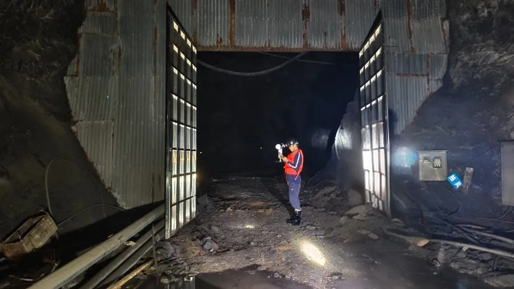
After evaluating multiple options, the mining operation implemented the XGRIDS Lixel L2 Pro (32-channel / 120m), a flagship handheld 3D laser scanner weighing less than 2kg (4.4lbs), to complement their existing surveying equipment.
Surveyor holding a Lixel L2 Pro handheld LiDAR scanner at a corrugated-metal mine portal in the dark
Key Technology Components
The Lixel L2 Pro employs Multi-SLAM technology, combining:
Advanced LiDAR: 360° × 270° field of view capturing 640,000 points per second
Dual Visual Positioning: Two 48MP cameras, with the front camera providing visual SLAM capabilities
Inertial Measurement Unit (IMU): Enabling accurate positioning without GPS signals
Real-time Processing: On-device computation providing immediate data verification via LixelGO app
Ruggedized Design: IP54-rated protection against dust and water splashes
Multi-sensor fusion: Maintains accuracy even in feature-poor environments
Lightweight design: Under 2kg handheld device for easy maneuverability in tight spaces
Implementation Process
The implementation followed a strategic workflow designed to maximize data quality while addressing extreme environmental challenges.
Data Capture
Preliminary Site Assessment: Safety protocols and scanning routes established. Control points were marked with reflective targets and would be captured in multiple passes.
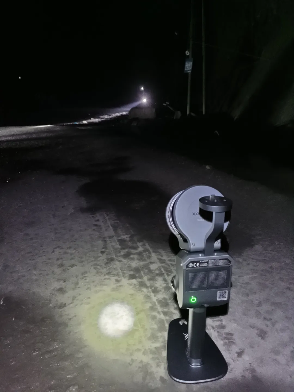
Initialization: the L2 Pro initialized on a flat surface for 20 seconds.
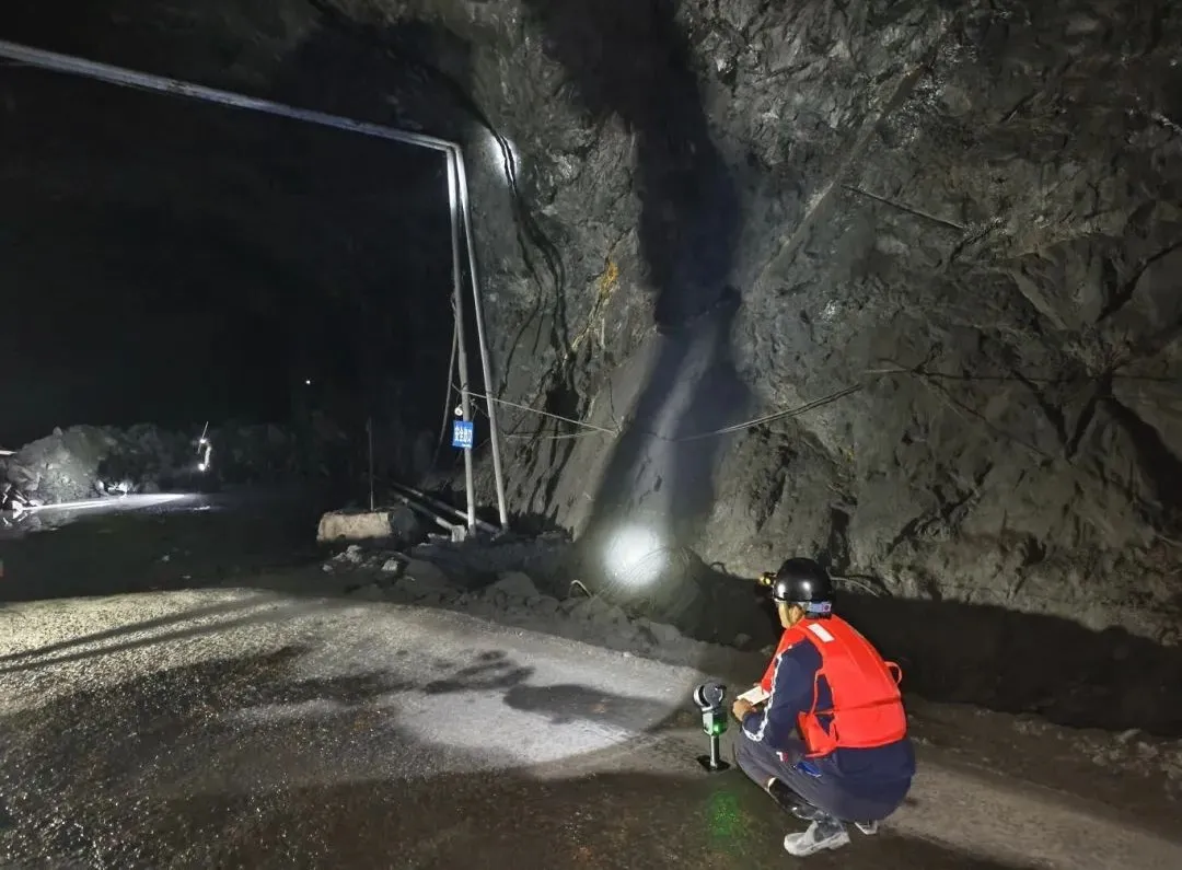
Lixel L2 Pro scanner initializing on its base on a mine haul road before an underground scanOperator capturing a ground control point along the rock wall with the L2 Pro on a mini tripod
3. Applying best practices in scanning an underground environment:
Each survey control point was captured carefully to ensure complete coverage by both the LiDAR sensor and cameras.
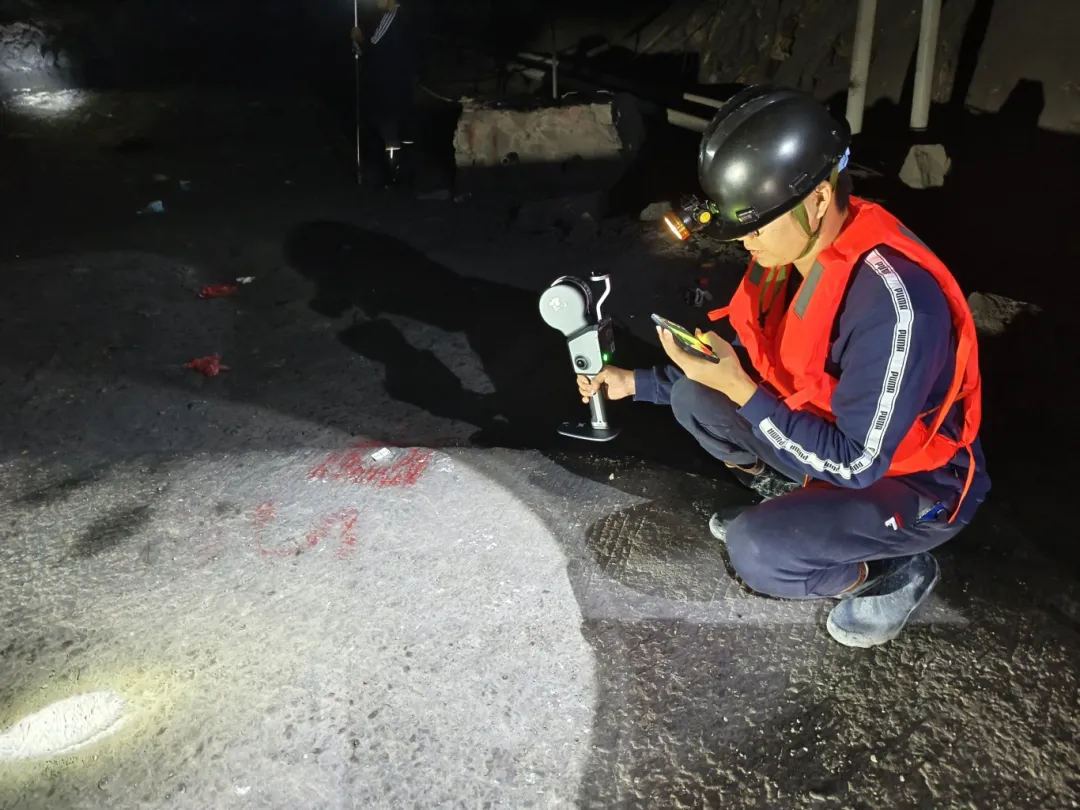
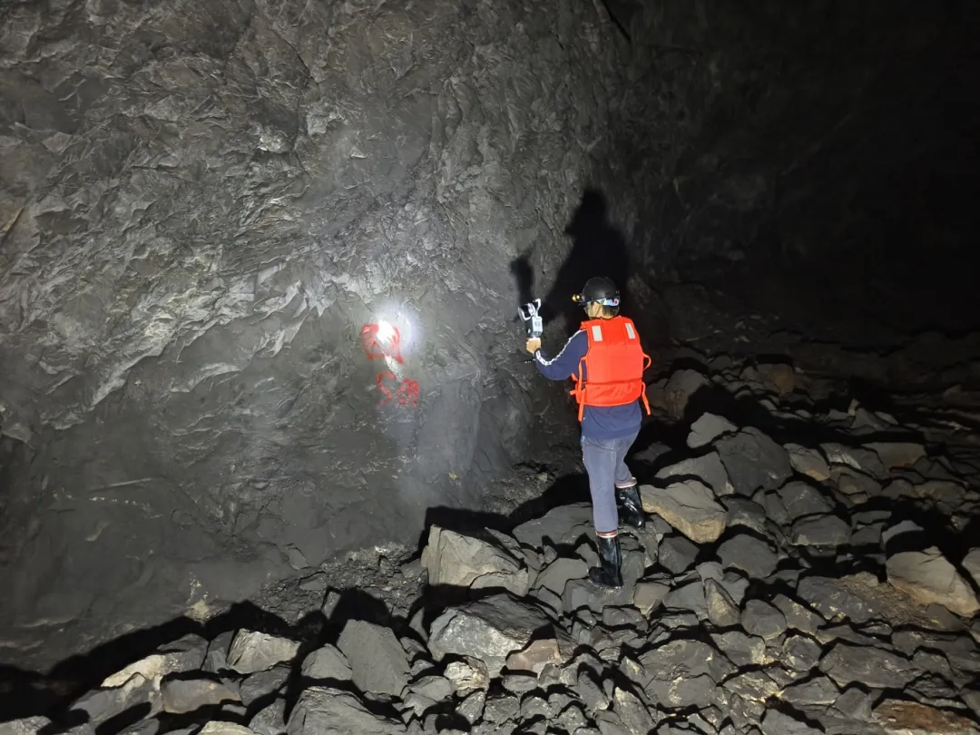
Whenever possible, the operator created small closed loops to bring the scanner back to a known location, minimizing drift.
Surveyor scanning a marked control point while monitoring the live point cloud in the LixelGO appOperator walking a closed loop toward a wall control point to minimize drift during handheld 3D scanning
4. Specialized Capture Techniques:
Subterranean River Mapping
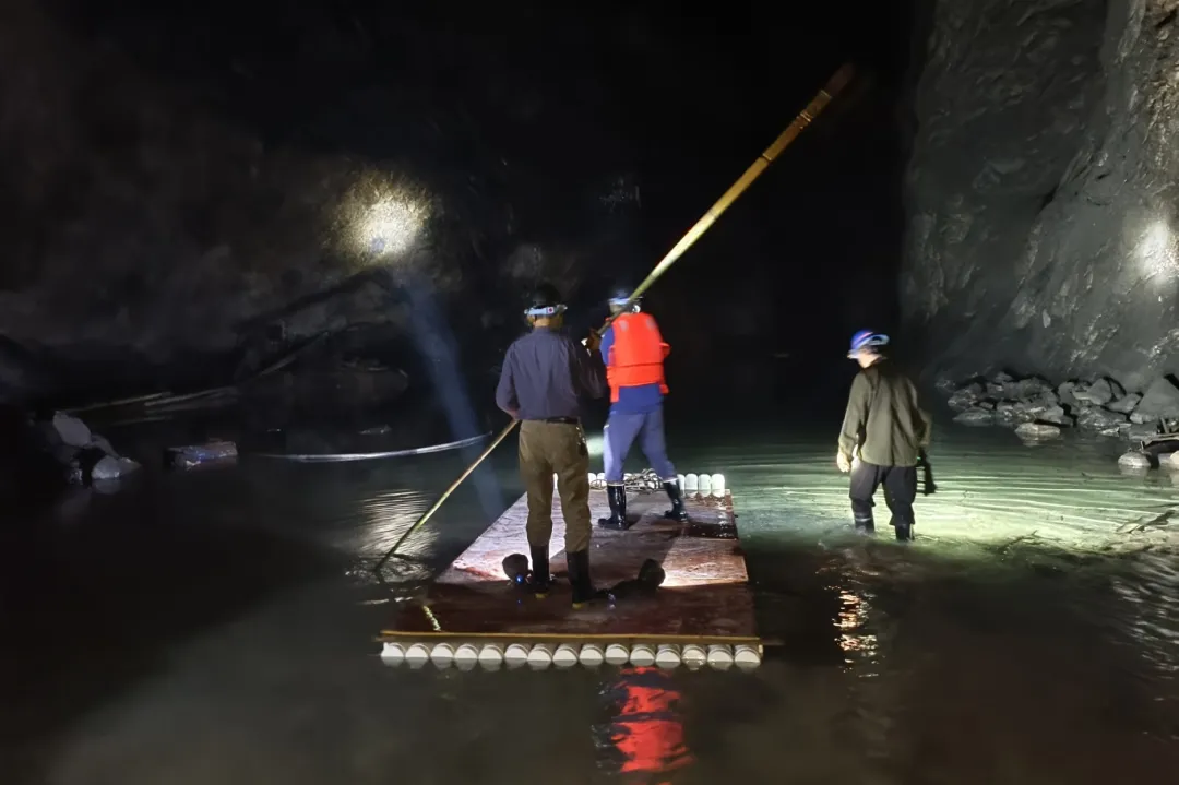
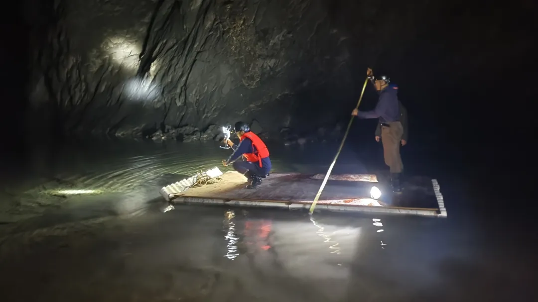
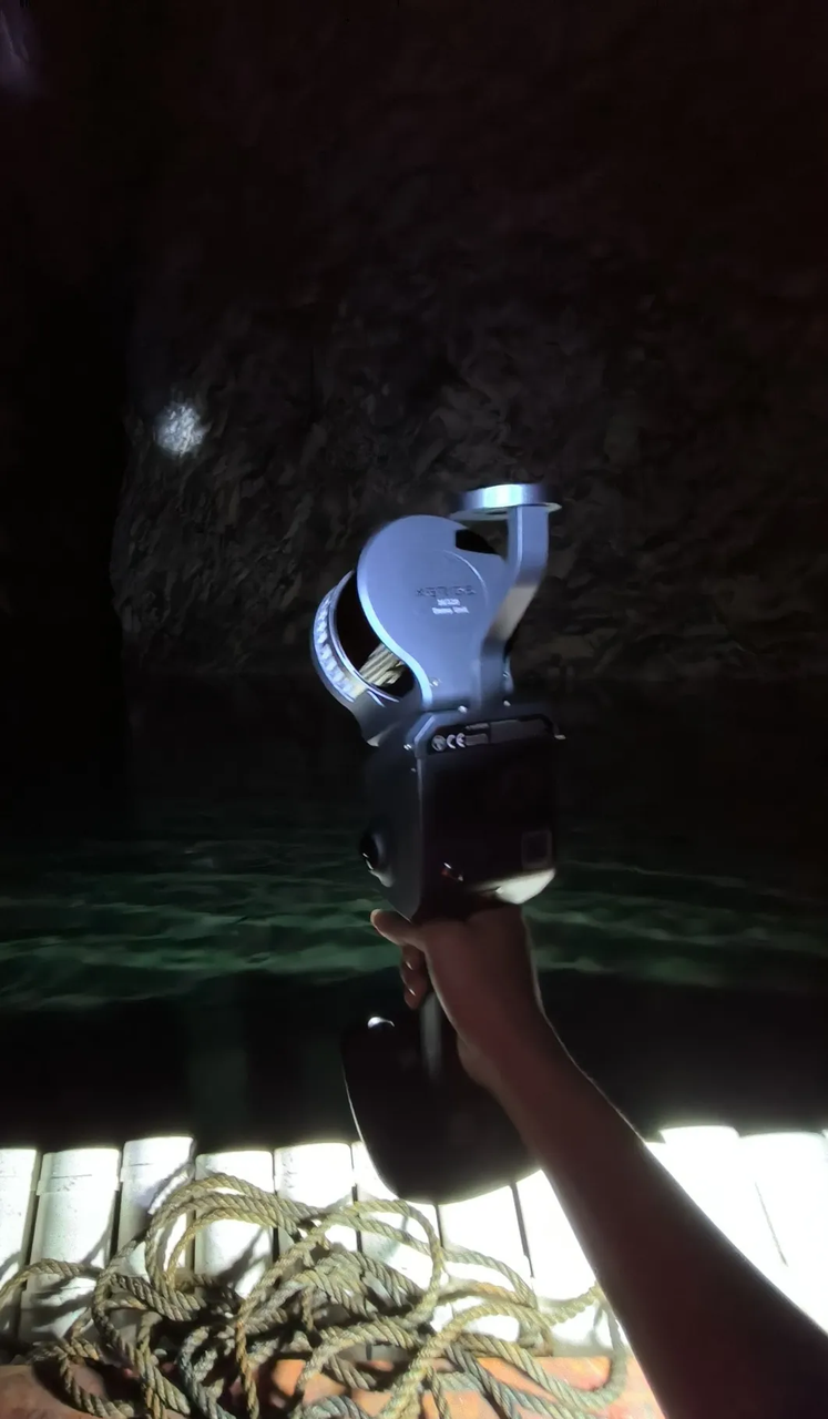
Traditional static scanners like total stations cannot effectively document flowing water features or areas in their vicinity, especially when access is limited to small boats. The Lixel L2 Pro's handheld operation enabled operators to:
Continuously scan while navigating on a small raft
Survey team on a makeshift raft scanning an underground river inside the flooded mineOperator crouching on a raft to scan the ceiling, walls and water surface of a subterranean riverClose-up of the Lixel L2 Pro handheld scanner carried across the underground river on a raft
Maintain real-time visualization through the LixelGO mobile app
LixelGO app showing a real-time colorized point cloud of the tunnel during continuous scanning
Ensure complete coverage of ceiling, walls, and water surface
Consistently capture data despite the movement of the boat
Vertical Shaft Documentation
With drops exceeding 100 meters, vertical shafts presented extreme safety and technical challenges:
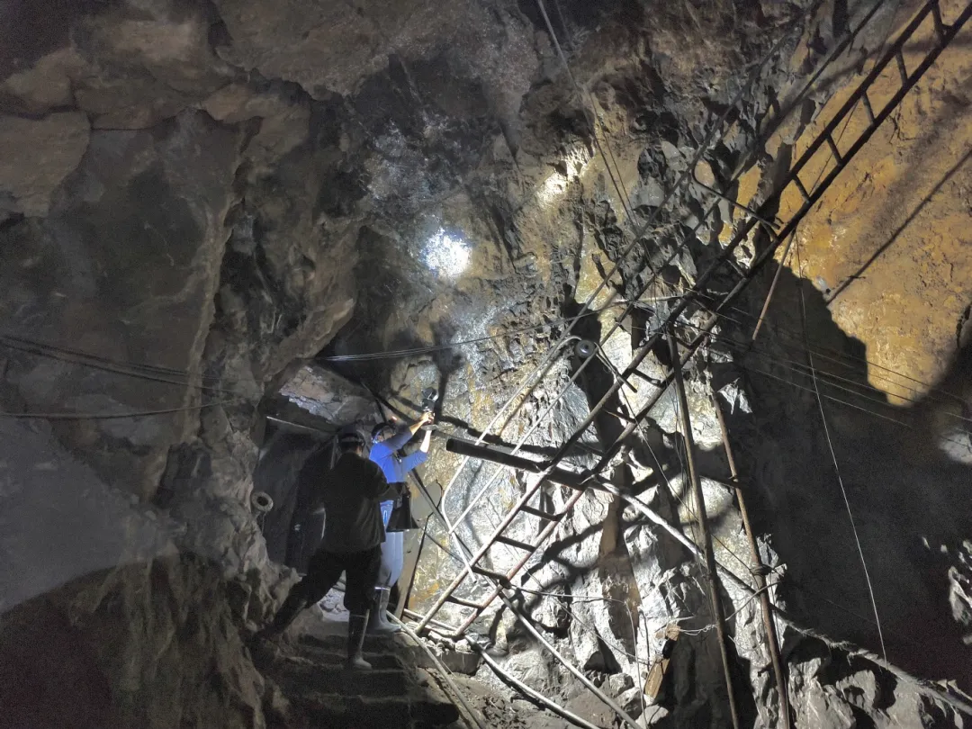
Operators documenting a vertical shaft with a steel ladder using the handheld scanner from the edgeSurvey team scanning the rock face at a vertical shaft edge where tripod equipment cannot reach
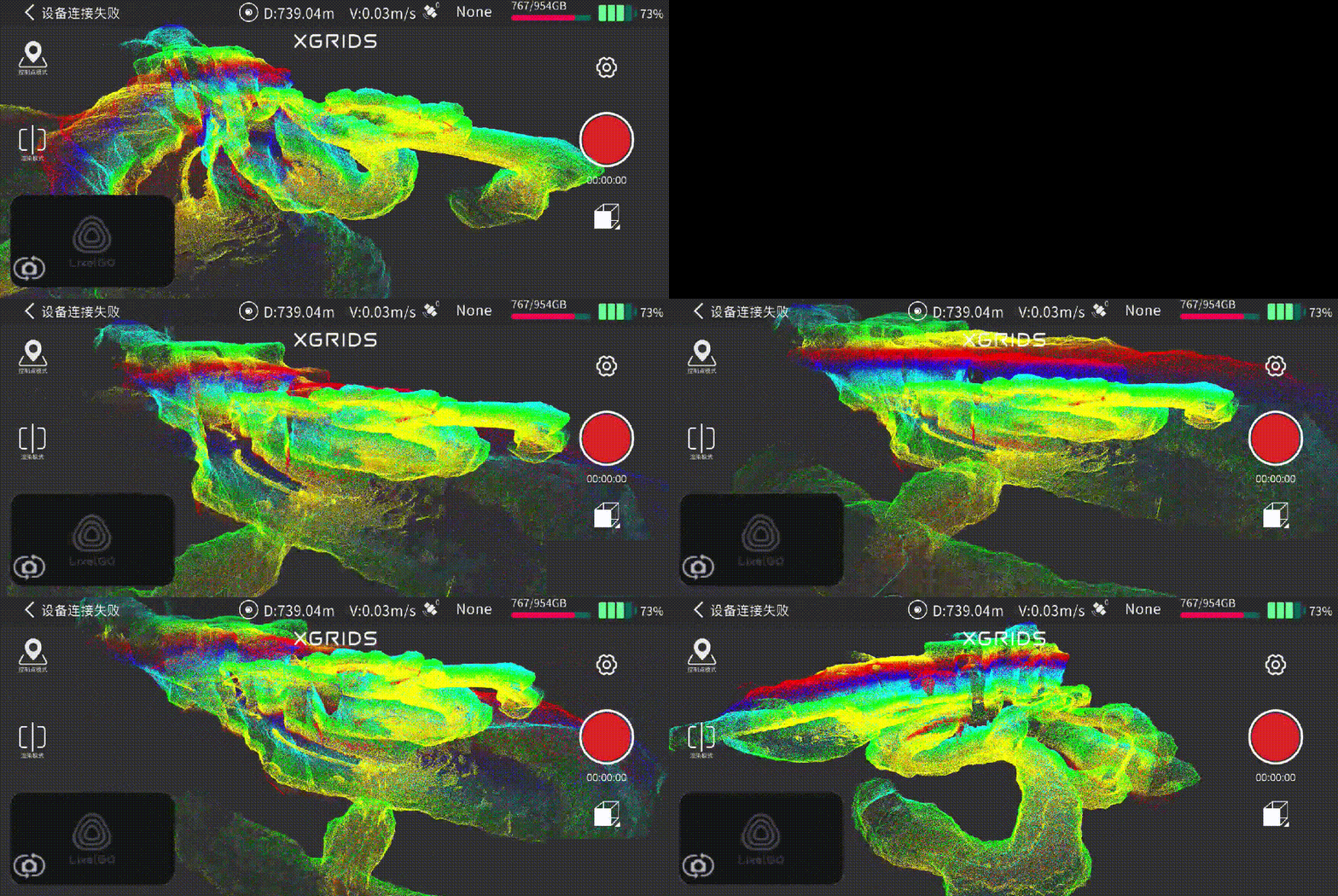
LixelGO real-time preview of the vertical shaft point cloud captured during the handheld scan
The lightweight, handheld Lixel L2 Pro allowed safer operation at shaft edges
Multi-SLAM technology maintained positioning accuracy despite the challenging geometry
Overlapping scan patterns ensured complete coverage of vertical surfaces
Real-time feedback allowed immediate identification of data gaps
Data Processing and Integration
A preview of the point cloud model of the section of the mine that was flooded and inaccessible by foot:
Height-colored point cloud of a previously flooded, inaccessible mine section with surveyed checkpoints
Here's a closer look at the tunnel:
Detailed point cloud of the underground river channel with figures for scale inside the cavern
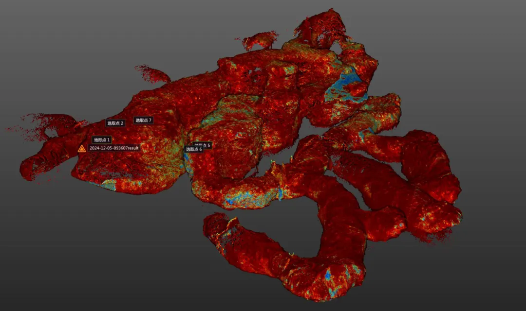
Overview of the vertical shaft:
Colorized point cloud overview of the vertical shaft and connecting tunnel network with survey checkpoints
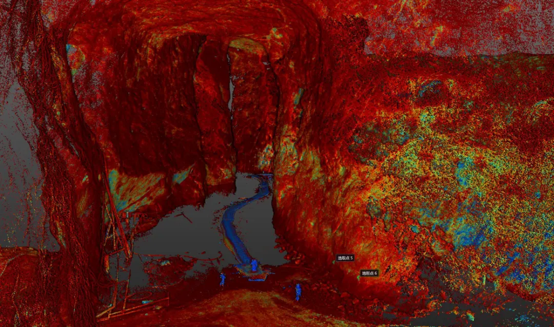
View from within the shaft:
Point cloud of the vertical shaft interior showing timber structures captured from a safe standoff
Incorporating new scan data with existing survey information required precise alignment:
The Trimble RealWorks coordinate transformation tool achieved registration accuracy of 4.8mm
Point clouds from different sources merged seamlessly with no visible misalignment
Consistent point density was maintained across all data sources
Coordinate Transformation
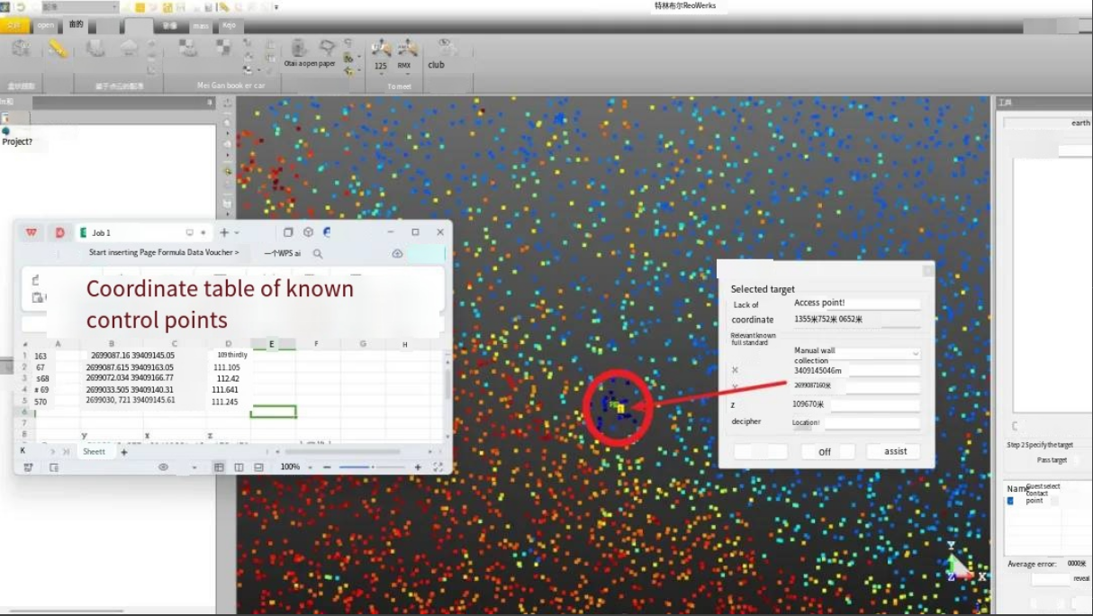
Trimble RealWorks with the geographic coordinate transformation tool highlighted on the mine point cloudRegistering the point cloud to known control points using a coordinate table in Trimble RealWorks
For precise georeferencing, the team utilized Trimble RealWorks' point cloud registration module to perform coordinate transformation. By selecting reflective target centers at established traverse control points and inputting a minimum of three absolute coordinates, they ensured the point cloud data maintained absolute positional accuracy throughout the model.
Verifying Accuracy
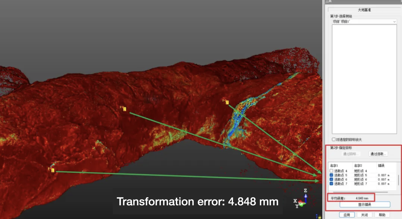
Point cloud registration report confirming sub-centimeter transformation accuracy at the river channel
Transformation error at the river channel: 4.848 mm
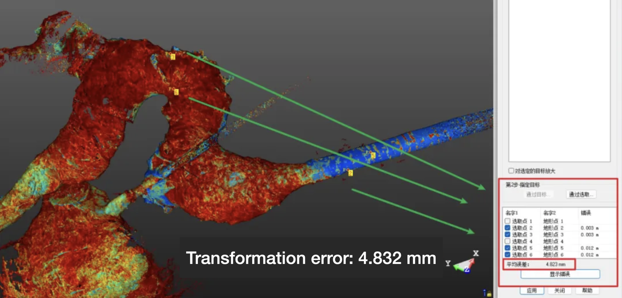
Registration report confirming sub-centimeter transformation accuracy at the vertical shaft
Transformation error at the vertical shaft: 4.823 mm
Data Integration
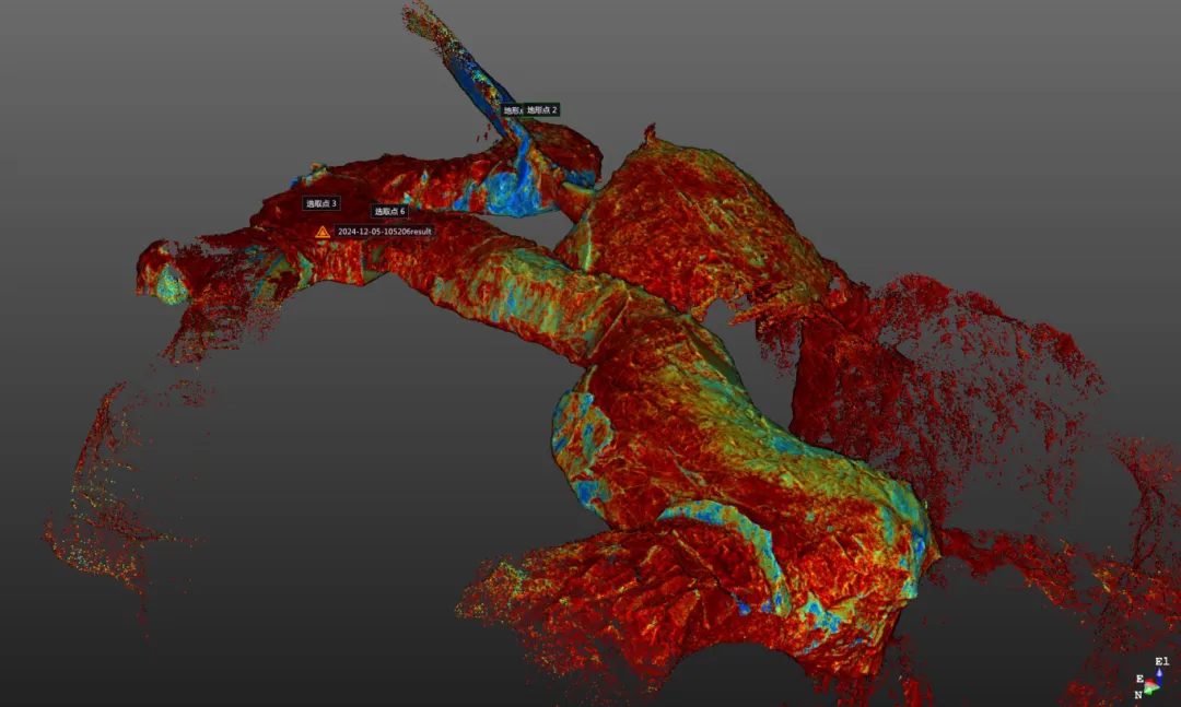
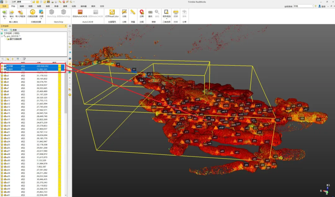
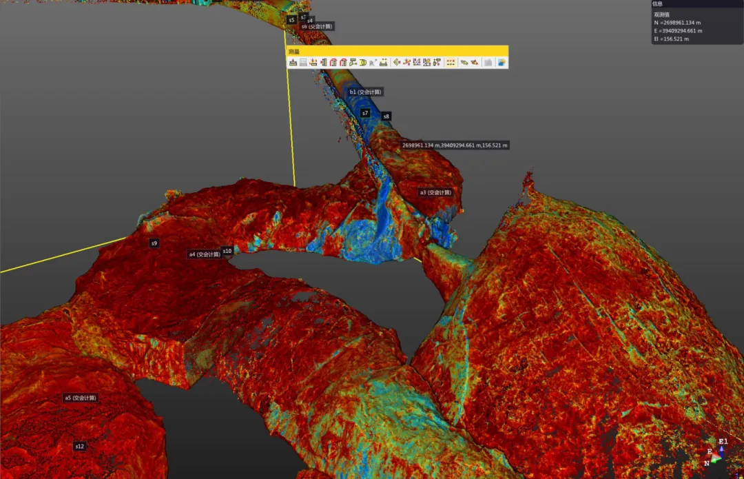
To build a complete 3D model of this limestone mine, the team imported the point cloud data of the river channel and shaft from the L2 Pro into the model created using the Trimble SX10 total station. After applying absolute coordinate transformation, both datasets aligned perfectly without any registration errors.
Merged mine point cloud aligned in Trimble RealWorks to build a complete georeferenced digital twin
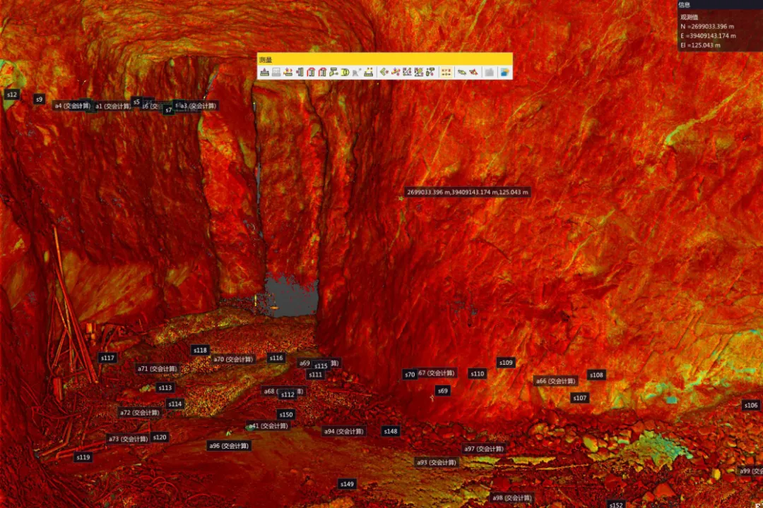
River channel
River channel point cloud before fusing the handheld scan with the total-station survey
Before
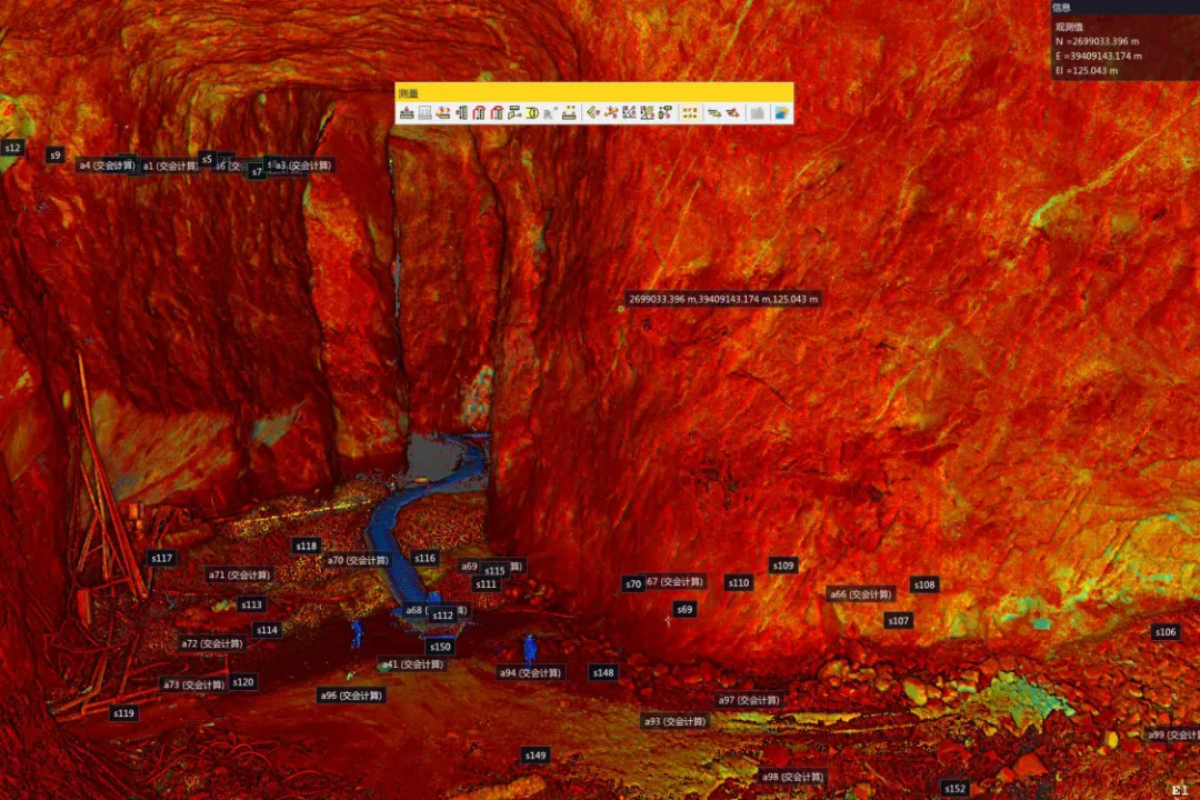
River channel after fusing the L2 Pro point cloud, filling gaps the total station could not reach
After
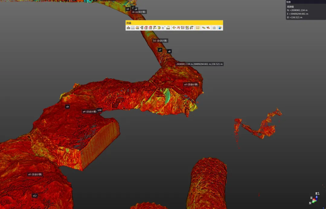
Vertical shaft
Vertical shaft point cloud before integration, showing the gap left by traditional survey equipment
Before
Vertical shaft after merging the handheld scan data into a seamless 3D model
After
3D Mesh Volumetrics
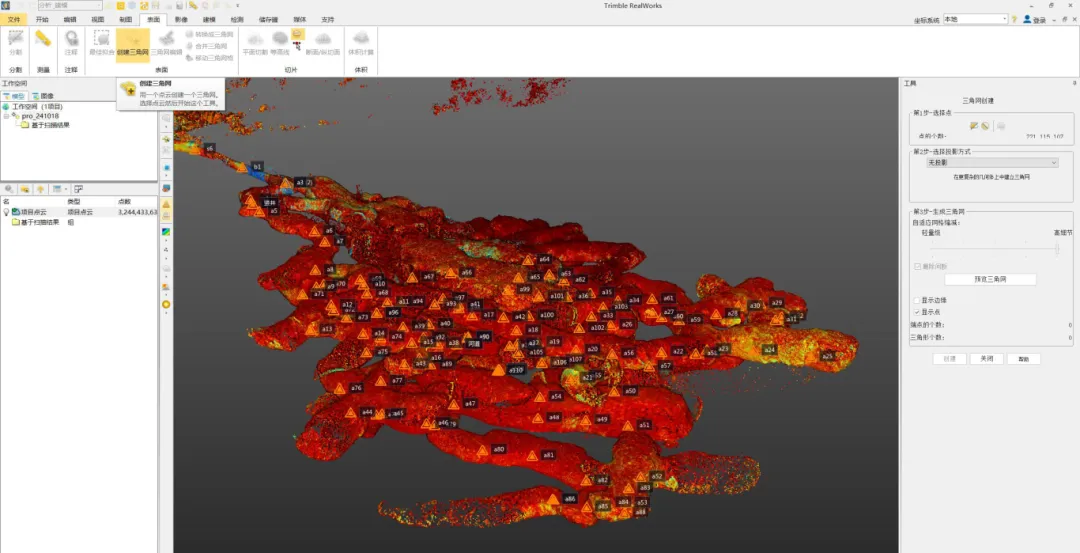
Generating a triangulated 3D mesh of the mine cavern from the registered point cloud in Trimble RealWorks
Using Trimble RealWorks' triangulation mesh creation tools, a complete 3D mesh model of the mine cavern was generated. The raw mesh underwent post-processing refinement in the GeoMagic software to ensure accuracy and eliminate artifacts.
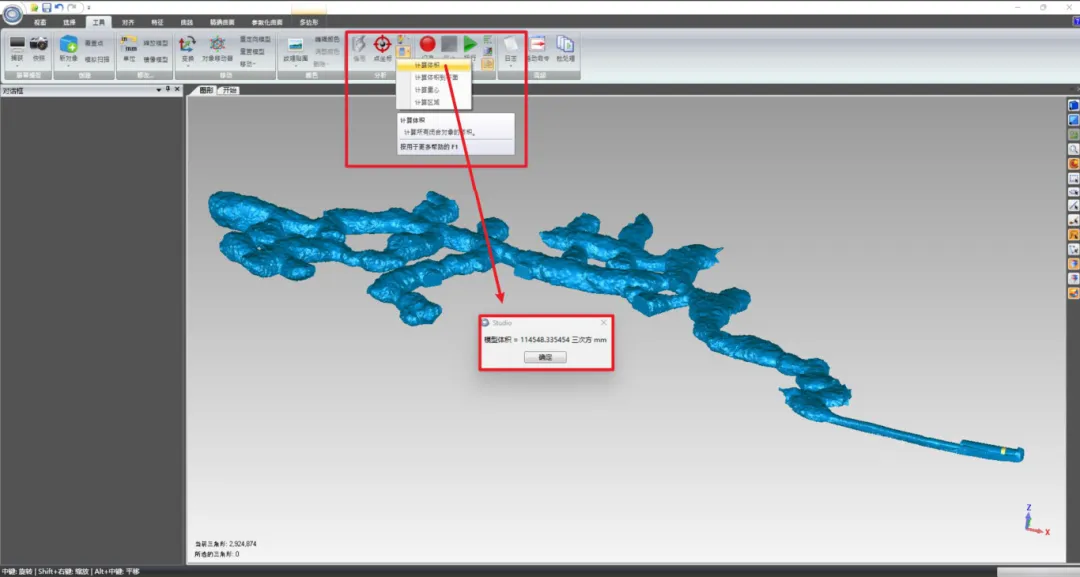
Completed 3D mesh of the mine cavern used to calculate the total cavern volume
The final volume calculation determined the mine cavern's total volume to be 114,548.34m³.
Results: Transforming Underground Documentation
The implementation of XGRIDS' technology delivered multiple benefits:
4.8mm registration accuracy when aligning L2 Pro point clouds with existing control networks
114,548.3m³ volume calculation enabling precise measurement of previously unmappable areas
Zero safety incidents by eliminating high-risk manual measurements in hazardous locations
Qualitative Benefits
Comprehensive digital twin supporting advanced planning and simulation scenarios
Enhanced safety management through detailed visualization of unstable zones and escape routes
Improved extraction planning optimizing resource utilization with accurate geological modeling
Environmental monitoring tracking water infiltration patterns and potential structural weaknesses
Knowledge preservation creating permanent digital record of inaccessible areas for future reference
Reduced operational disruption with faster scanning requiring minimal site preparation
Business Impact: Beyond Mapping
The comprehensive digital documentation has the potential to transform mining operations in several ways:
Operational Efficiency
Extraction Planning: More precise targeting of high-value deposits
Equipment Routing: Optimized pathways for mining machinery
Maintenance Scheduling: Better prediction of potential structural issues
Safety Enhancement
Risk Assessment: Visual identification of hazardous areas
Emergency Planning: Detailed evacuation routes and ventilation modeling
Training: Immersive visualization for worker orientation
Regulatory Compliance
Environmental Monitoring: Documentation of water management systems
Structural Integrity: Verification of support systems and stability
Records Management: Comprehensive documentation for regulatory reporting
Future Applications: The Digital Mine Ecosystem
The XGRIDS solution's flexibility and accessible data format enables mining operators to explore new ways to improve mining operations:
Create predictive digital twins simulating extraction scenarios before implementation
Develop VR training environments using actual mine geometry for worker education
Implement autonomous vehicle navigation with high-fidelity reference maps
Establish real-time monitoring systems comparing current conditions against baseline models, improving mine management and meeting compliance requirements.
With its intuitive operation requiring minimal technical training, the XGRIDS L2 Pro democratizes advanced 3D mapping technology for mining operations of all sizes worldwide, creating a foundation for digitalization initiatives with immediate ROI and long-term strategic value.
Conclusion: Redefining What's Possible Underground
This limestone project demonstrates how XGRIDS' advanced 3D scanning technology is changing what's possible in underground mapping. Environments that were previously considered too dangerous, complex, or inaccessible can now be documented with unprecedented accuracy and efficiency.
The combination of mobility, precision, and real-time feedback offered by the Lixel L2 Pro has set a new standard for underground documentation, with implications extending far beyond mining to tunneling, civil engineering, hydroelectric facilities, and other subsurface infrastructure.

.png)
.png)
.png)

.png)
.png?x-oss-process=image/resize,w_800/quality,Q_50)

