
Tech Insights
True 5 mm Accuracy, Put to the Test: Inside the Lixel L3 Accuracy Validation
Lixel L3 achieves ≤5 mm accuracy at 1σ across 1,524 point pairs. See the five-step validation workflow and Leica TS60 benchmark test data.
he combination of these published metrics, an architecture that constrains drift through Multi-SLAM fusion, and a verification layer that produces auditable records is what defines engineering-grade in practice.
Point clouds are no longer scarce. A decade ago, capturing a 3D point cloud of a building required a terrestrial laser scanner costing six figures, a trained surveyor, and days of setup. Today, a smartphone with LiDAR can produce a point cloud in minutes. Drones, handheld SLAM scanners, and photogrammetry software have made spatial data capture faster and more accessible than at any point in the history of surveying.
Accessibility introduced a problem the industry has been slow to confront. Most of the point clouds being produced today cannot support the decisions professionals are making with them. The capture barrier has collapsed. The trust barrier has not moved.
The gap between "a point cloud" and "a point cloud you can build from" is where projects succeed or fail. As Scan-to-BIM workflows, digital twins, and AI training pipelines consume more reality-captured data, the consequences of that gap get more expensive: rework, disputes over quantities, decisions based on geometry that doesn't hold.
This is what "engineering-grade" means, and why the distinction matters more now than at any point since the industry started talking about reality capture.
A point cloud is a set of data points in three-dimensional space. Each point has X, Y, and Z coordinates and may carry additional attributes: color (RGB), reflectivity, intensity, classification, or timestamp.
Point clouds are generated through several methods — LiDAR (time-of-flight or phase-shift), photogrammetry (triangulated from overlapping images), structured light, or hybrid SLAM systems that fuse multiple sensors with motion estimation. They are not all equivalent. A photogrammetric point cloud generated from a phone in a low-textured room and a LiDAR point cloud generated with control points and RTK corrections share a file format. They do not share much else.
The question that matters is whether the point cloud you have can support what you intend to do with it.
The term can be used loosely in marketing. It has a more specific meaning in the standards that govern measurement work.
Three properties define engineering-grade capture:
Absolute accuracy — how close the point cloud is to true position in a defined coordinate system. The current ASPRS standard (Edition 2, Version 2, 2024) requires RMSE-based reporting against a minimum of 30 independent checkpoints and, for the first time, defines a dedicated three-dimensional accuracy class (RMSE3D) — an acknowledgement that 3D models are increasingly the deliverable, not an intermediate product.¹ Construction QA standards typically require ±10–20 mm tolerance on surface levels.
Relative accuracy — how internally consistent the cloud is over distance. A scanner can be 3 cm off absolute and still deliver 1 cm relative accuracy within any 10-meter section. Relative accuracy controls whether features extracted from the cloud (walls, openings, structural members) are dimensionally faithful to each other, which is what BIM and CAD work depends on.
Traceability — whether the accuracy can be verified after capture. An engineering-grade deliverable comes with a control point report, an RMSE statement, and a method note. Without that record, downstream users cannot validate the data against their own tolerance requirements. They discover the error the expensive way.
To these three, mature workflows increasingly add a fourth: repeatability — the ability to scan the same site twice and recover the same geometry within a known threshold. Without it, change detection and as-built comparison fail in non-obvious ways.
A fifth property ties everything together: point cloud quality. Accurate, traceable, repeatable data should be clean and legible enough to use without extensive manual cleanup. Three attributes govern quality:
Most point cloud capture failures are not exotic. They follow predictable failure modes.
SLAM drift is the most common. Over distance, small errors in the trajectory estimate accumulate. A scanner that maintains 1 cm relative accuracy over 50 meters may show 3–5 cm of drift over 200 meters if loop closure or external corrections are unavailable. On a linear tunnel, a long corridor, or a repetitive facade, drift is the default outcome rather than the exception.
Photogrammetry's accuracy ceiling is controlled by image overlap, texture, lighting, and camera geometry. In ideal conditions, photogrammetry can deliver centimeter accuracy. In real construction sites with reflective glass, featureless concrete, low light, and moving equipment, accuracy degrades, and the visual quality of the output is a poor proxy for its geometric reliability.
Registration errors in multi-scan workflows compound quietly. Each registration between scan stations introduces residual error. Without rigorous control, the error at the far end of a building can exceed the error of any single scan by an order of magnitude.
No QC means no ground truth. If a point cloud is delivered without an accuracy report, the downstream user has no way to know whether it meets their tolerance. They discover the error by discovering the rework.
Each failure mode shares a root cause: the scan was captured without the structural constraints or the reporting layer that make accuracy verifiable.
Engineering-grade capture is defined by a combination: publishing the full accuracy stack, backing it with a fusion architecture that constrains drift, carrying the data through a verification layer that produces auditable records, and delivering it in a format that survives downstream reuse.
Multi-SLAM fusion as the structural answer to drift. XGRIDS' Multi-SLAM architecture fuses LiDAR, high-resolution vision, high-precision IMU, and where RTK is available — satellite corrections in real time. Each sensor constrains the weaknesses of the others: LiDAR anchors geometry, vision closes loops, IMU handles rapid motion, RTK locks absolute position. The result is that absolute accuracy on a mobile platform approaches what was previously only achievable through static terrestrial workflows.
The accuracy stack, in full.
| Spec | L2 Pro | K1 | K2 |
| Absolute accuracy, horizontal (RMSE) | 3 cm | 3 cm | 3 cm |
| Absolute accuracy, elevation (RMSE) | 3 cm | 3 cm | 3 cm |
| Relative accuracy (RMSE) | 1 cm post-processed / 2 cm real-time | 1.2 cm | 1 cm |
| Repeatability | 2 cm | 2 cm | 2 cm |
| Post-processed point cloud thickness | ≤ 0.5 cm | ≤ 1 cm | ≤ 1 cm |
| LiDAR point rate | 640,000 pts/s (32-ch) | 200,000 pts/s | 200,000 pts/s |
| Effective range | 120 m (16-ch) / 300 m (32-ch) | 40 m @10% / 70 m @80% | ≥40 m @10% / ~100 m max |
| Weight | ~1.7 kg | ~1 kg (with battery) | ~1.2 kg (with battery and base) |
| RTK support | Yes (standard / survey-grade module) | Optional module | Built-in |
Three details worth highlighting from this table:
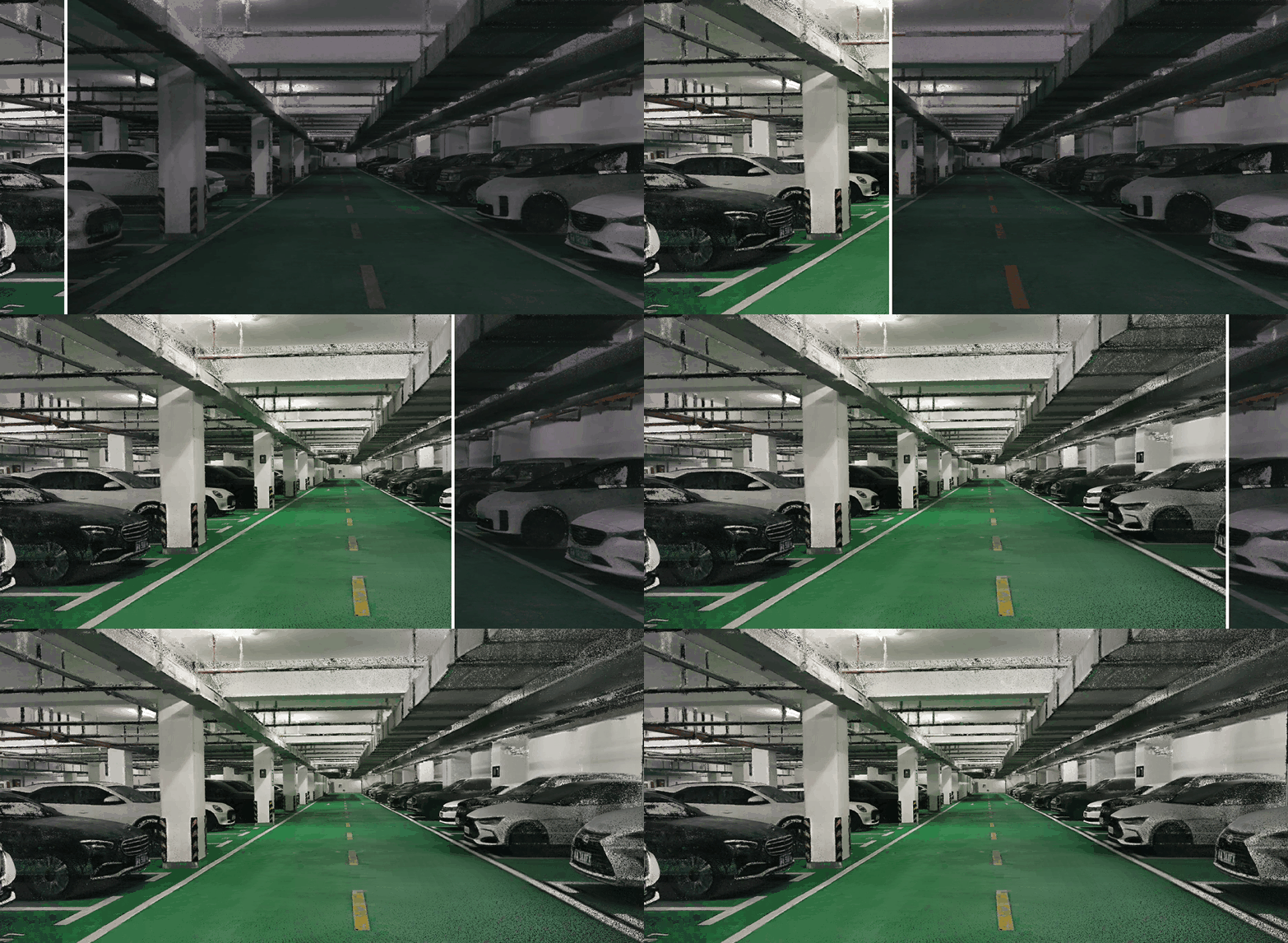
Point cloud thickness governs whether features can be extracted from the cloud as clean CAD lines without manual cleanup. The thinner the cloud, the less interpretive work between raw data and a usable deliverable. Thin linear features — railings, pipes, structural members, conduit — are where thickness matters most. A 2 cm cloud blurs them into noise; a sub-centimeter cloud preserves them as extractable geometry, which is the difference between a point cloud that can feed a mesh or a BIM model directly.
LixelStudio 4.0's AI-powered filtering reinforces this in processing, clearing the trailing noise that builds up between such structures while leaving the structures intact, so the thin-cloud advantage carries through to the deliverable rather than being traded back during cleanup.
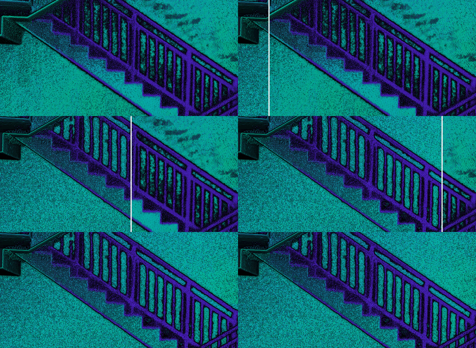
Repeatability is published here as a standalone spec at 2 cm. Most handheld SLAM systems publish absolute and relative accuracy without separately reporting repeatability, which is the metric that governs whether a scan can serve as a baseline for change detection.
Real-time vs. post-processed accuracy is published as separate data points because the field workflow and the office workflow produce different deliverables. Both numbers matter because both numbers describe what the operator can act on at the relevant moment. Most competitors publish a single accuracy figure; the field-vs-office distinction matters because it determines what the operator can act on in the moment.
The verification layer.
LixelStudio — released as version 4.0 alongside the K2 in May 2026, raised point cloud quality at the processing stage: sharper color that holds in low light, leveling that comes out aligned without manual correction, and AI-powered filtering that clears trailing noise while keeping fine structure intact. The quality is produced in processing, not recovered by hand.
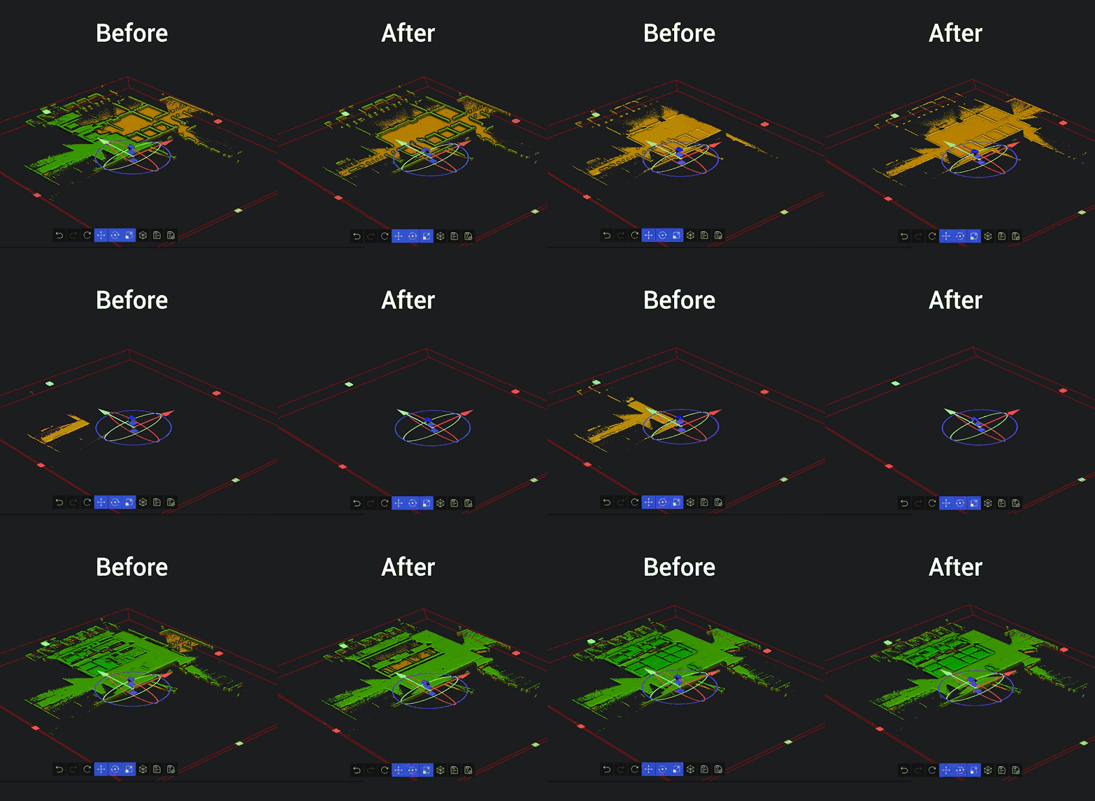
On that foundation, it generates an accuracy report for every project, comparing scanned positions against independent control points and outputting horizontal and elevation error statistics. This is the auditable record that engineering-grade deliverables require. Without it, the spec sheet is a claim. With it, the spec sheet is a measurement that can be checked against the actual job.
A capture that survives its second use.
Point clouds are increasingly being asked to do more than feed the workflow they were captured for. The same site will be referenced for as-built documentation, then for change detection, then for a visualization for stakeholders, then for a digital twin, then for training data for a robotics or simulation pipeline. Each downstream use compresses or transforms the data differently. None of them recover accuracy that wasn't in the source.
This is where 3DGS enters the workflow as a complement. A 2025 paper in Automation in Construction compared 3DGS and LiDAR across the full documentation workflow for a modern heritage building and concluded that LiDAR provides the structural accuracy and segmentation reliability, while 3DGS provides the visual expressiveness and dissemination layer.³ The two are not substitutes for each other. They occupy different roles in the same pipeline.
The XGRIDS capture is built around this duality. A single scan produces both an engineering-usable point cloud and a 3DGS reconstruction through the open LCC (Lixel CyberColor) pipeline. This means one capture, two measurable outputs, no second mobilization. The point cloud carries the geometry the audit depends on; the 3DGS layer carries the visual context the stakeholders depend on. Both inherit their reliability from the same source capture.

The combination of these published metrics, an architecture that constrains drift through Multi-SLAM fusion, and a verification layer that produces auditable records is what defines engineering-grade in practice.
Underground stope scanning, Chile. Engineering PR, a surveying firm working with the Chilean dealer GEOCOM, used the L2 Pro to document stope cavities in an active underground mine. The conditions were GPS-denied, low-light, and structurally repetitive — the failure profile that decides whether a mobile scanner is a survey tool or a content tool.
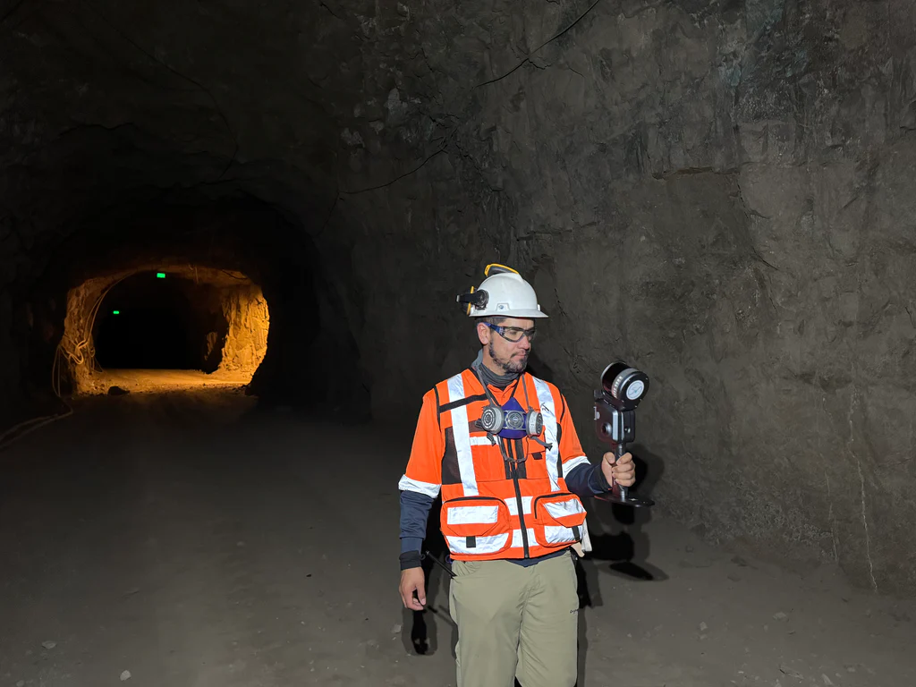
The team captured 250 meters of tunnel in 18 minutes of continuous scanning, referenced the trajectory through three control points placed at the start, midpoint, and end of the run, and produced a point cloud dense enough to support three downstream deliverables from a single capture: 3D solid generation for cavity volume calculation (cubicaciones), plane estimation on exposed rock faces, and vectorization of the structural geological model.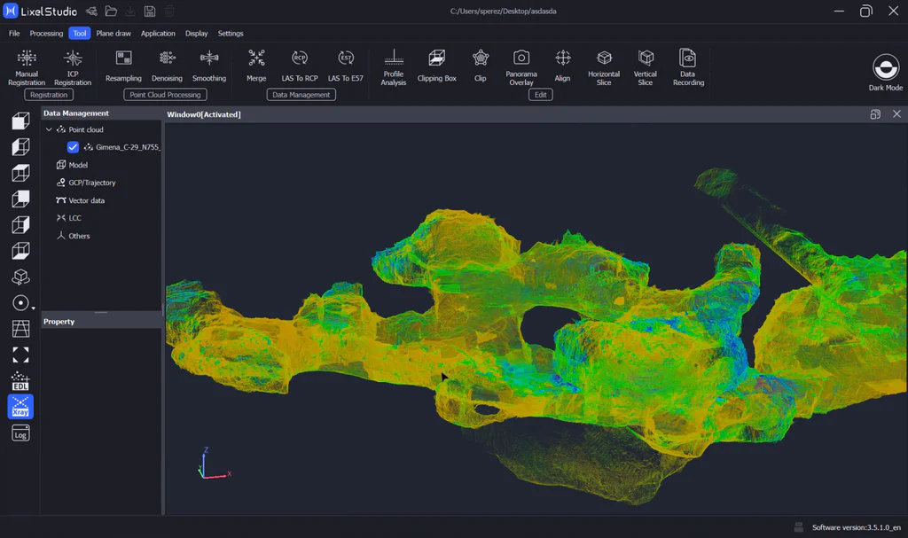
Pablo Reyes, Engineering PR: "With the level of detail in the point cloud, we'll also be able to estimate planes, model the planes, and vectorize the structural model. That's one of the main advantages this density gives us."
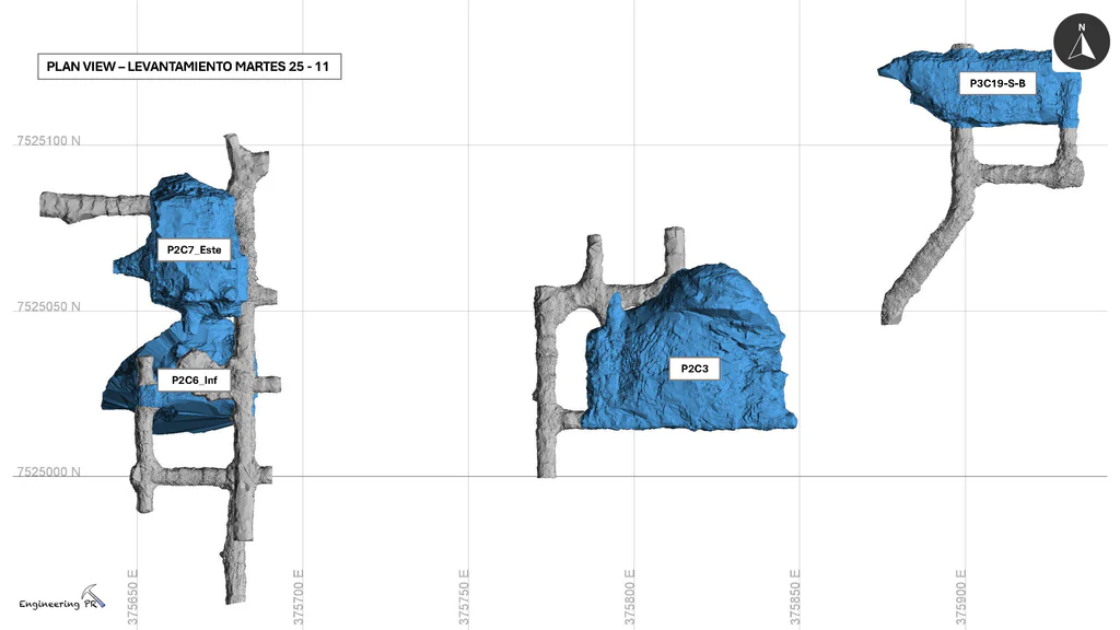
The deliverables — measurable artifacts that feed mine planning and structural geology — depended entirely on the geometric trustworthiness of the source. They could not be reconstructed after the fact.
Industrial Scan-to-BIM, Europe. A European AEC team led by Philipp Posch used the L2 Pro to capture a 7,800-square-meter beverage processing facility — indoor and outdoor — for renovation planning. Four hours of on-site scanning produced point clouds that flowed through LixelStudio for automated SLAM registration, then exported directly to Revit as RCP for LOD 400 BIM modeling.
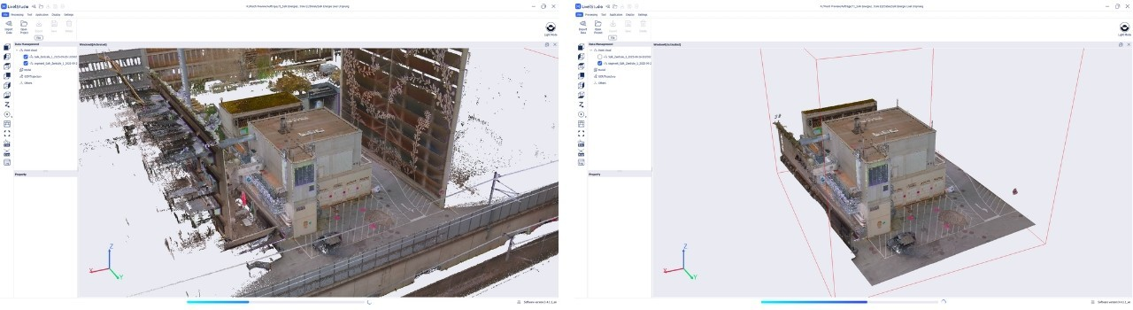
The estimated cost of a tripod-based equivalent: approximately €28,000. The completed XGRIDS workflow: approximately €8,000, with stable performance through low-light construction conditions.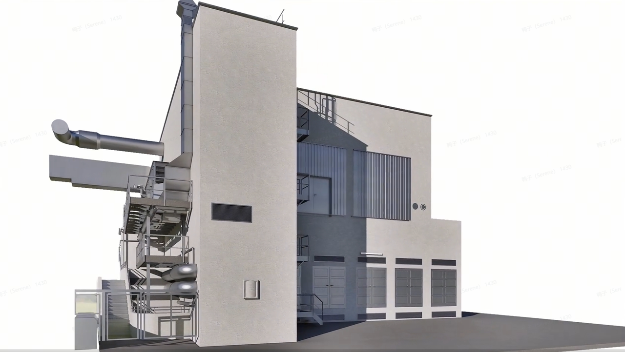
The accuracy is in the deliverable. An LOD 400 BIM model is built on geometry that does not drift; the model is the audit.
These two projects sit at opposite ends of what engineering-grade has to support. The mining case produces outputs that previously required a different capture method per deliverable. The factory case matches what TLS would have produced, at a fraction of the time and cost. Both depend on the same precondition: a source capture that holds together under scrutiny. Independent third-party validation has begun to accumulate around this in parallel. UK survey integrator Heliguy conducted a public scan of Durham Castle's Tunstall Chapel using the K2 and LixelStudio 4.0 in May 2026, adding another external data point to the published accuracy claims.⁴
Engineering-grade has long been synonymous with terrestrial laser scanning, and for good reason. TLS workflows deliver sub-millimeter accuracy, decades of regulatory acceptance, and a verification chain the industry trusts. For projects that demand them, such as high-precision metrology, structural deformation monitoring, or statutory work where tolerance is tighter than handheld can credibly deliver, TLS remains the correct tool.
The position of TLS at the top of the accuracy stack has not shifted. What has shifted is what's possible below it. The tradeoff has always been clear: TLS gives tighter accuracy at the cost of setup time, station-by-station registration, specialized training, and mobilization overhead that scales with site size. Handheld SLAM gives faster capture and a single mobile operator — historically at the cost of accuracy. That cost is the part that has narrowed. A handheld system with published 3 cm absolute, sub-centimeter relative, 2 cm repeatability, and a verification layer that produces auditable reports sits inside the tolerance band of most non-statutory work.
The right question for any project is whether a method's accuracy, traceability, and field practicality match the tolerance and the constraints of the job: sites with traffic, narrow timelines, restricted access, or projects where the deliverable has to support both engineering measurement and stakeholder visualization without a second mobilization. For a meaningful share of the work happening in surveying, AEC, heritage, and infrastructure today, handheld SLAM now sits inside that range, and the deliverables it produces hold up to the same audit as the work that comes off a tripod.
The category is larger than it was. The deliverable, not the device, is what the audit is about.
¹ ASPRS Positional Accuracy Standards for Digital Geospatial Data, Edition 2, Version 2 (2024). https://asprs.org/Main/Main/Standards/Positional-Accuracy-Standards.aspx
² Jiang, C., Gao, R., Shao, K., Wang, Y., Xiong, R., Zhang, Y. (2025). LI-GS: Gaussian Splatting With LiDAR Incorporated for Accurate Large-Scale Reconstruction.IEEE Robotics and Automation Letters, Vol. 10, No. 2, pp. 1864–1871. DOI: 10.1109/LRA.2024.3522846. https://ieeexplore.ieee.org/document/10816486
³ Yu, Y., Verbree, E., van Oosterom, P., et al. (2025). From comparison to integration: A workflow evaluation of 3D Gaussian splatting and LiDAR point cloud for modern architectural heritage.Automation in Construction, Vol. 180, 106509. https://www.sciencedirect.com/science/article/pii/S0926580525005497
⁴ heliguy field validation of Lixel K2 with LixelStudio 4.0 at Tunstall Chapel, Durham Castle, May 2026. https://www.heliguy.com/blogs/posts/xgrids-lixel-k2-lixelstudio-4-launch/
Lixel L3 achieves ≤5 mm accuracy at 1σ across 1,524 point pairs. See the five-step validation workflow and Leica TS60 benchmark test data.
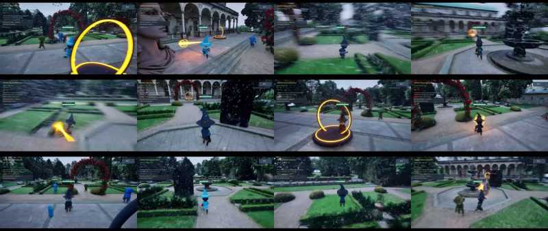
A garden scan became a playable Unreal Engine game in under two hours, with 3D Gaussian splatting for the level and an AI agent for the game logic.
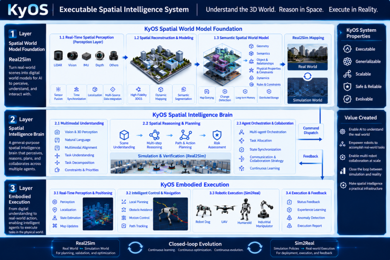
Scaling embodied AI requires KyOS, a closed-loop architecture coordinating perception, task planning, and reflex control across different timescales.
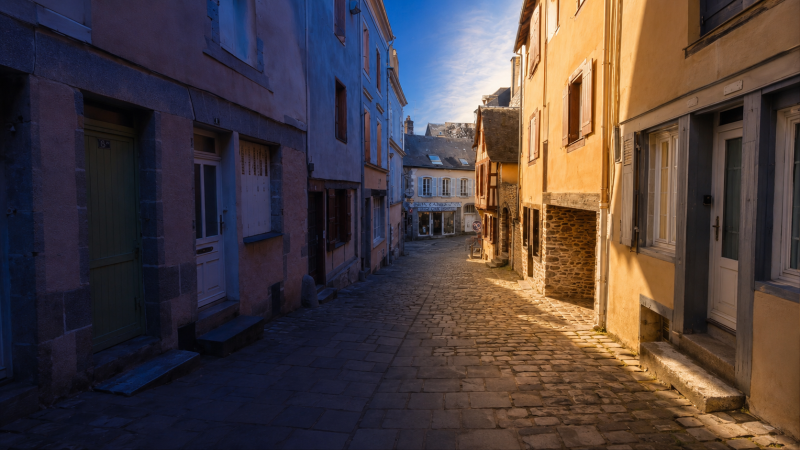
Turn static 3DGS captures into dynamic lighting variations using AI relighting tools to test sunsets, night looks, and mood changes in minutes.