
Tech Insights
True 5 mm Accuracy, Put to the Test: Inside the Lixel L3 Accuracy Validation
Lixel L3 achieves ≤5 mm accuracy at 1σ across 1,524 point pairs. See the five-step validation workflow and Leica TS60 benchmark test data.
What is Multi-SLAM Technology? The limitations of single sensor SLAM technology and advantages and effects of multi-SLAM.
Simultaneous Localization and Mapping (SLAM) technology refers to mobile robots using their own sensors to build environmental maps and use environmental information for autonomous positioning.
There are two mainstream technical solutions - visual SLAM and LiDAR SLAM. However, they have their own shortcomings when facing complex environments: visual SLAM systems are easily affected by changes in the visual environment, while LiDAR SLAM systems may experience accuracy degradation in environments without feature points. XGRIDS is the first company in the mobile SLAM scanning industry to apply multi-sensor fusion SLAM (i.e. Multi-Slam) technology to achieve more stable and higher quality data in complex scenes.

There is good complementarity between LiDAR, cameras, and Inertial Measurement Units (IMUs). IMU measurement is not affected by environmental characteristics, and inertial navigation systems can estimate the full parameters of speed, position, and attitude based solely on the inertial information generated by carrier motion. The motion parameters estimated by inertial navigation can be used to correct the distortion of LiDAR data, compensate for the missing scale information of monocular vision, etc.; while the carrier motion measured by LiDAR SLAM and visual SLAM can correct the cumulative error of inertial navigation systems. Multi-sensor fusion SLAM technology improves the performance of SLAM systems by combining the complementarity of different sensors.
Although multi-sensor fusion SLAM technology has obvious advantages, there are also many difficulties. These are also the directions that XGRIDS continues to invest in research and development efforts to solve.
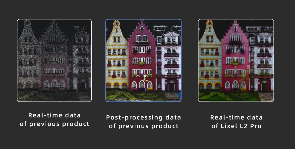
Post-processing data of previous product
In the field of mobile SLAM scanning, XGRIDS has led the innovation of multi-SLAM technology through unremitting technical pursuit and practice. Faced with the challenges of visual SLAM and LiDAR SLAM in complex environments, XGRIDS not only proposed a multi-sensor solution that integrates LiDAR, camera, and IMU in concept, but also achieved technological iteration from the first generation product Lixel L1 to the latest Lixel L2 Pro in practice, significantly improving the accuracy, robustness, and environmental adaptability of the system. By solving key difficulties such as real-time performance, sensor calibration, data fusion algorithms, information consistency, and computing resource requirements, XGRIDS demonstrates its pursuit of technological breakthroughs and down-to-earth approach, continuously promoting the development of 3D handheld SLAM scanning equipment towards more efficient and intelligent directions, and setting a new technological benchmark for the industry.
Lixel L3 achieves ≤5 mm accuracy at 1σ across 1,524 point pairs. See the five-step validation workflow and Leica TS60 benchmark test data.
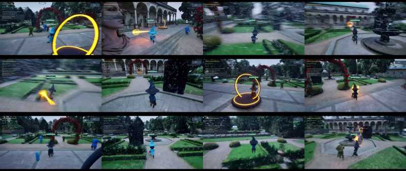
A garden scan became a playable Unreal Engine game in under two hours, with 3D Gaussian splatting for the level and an AI agent for the game logic.
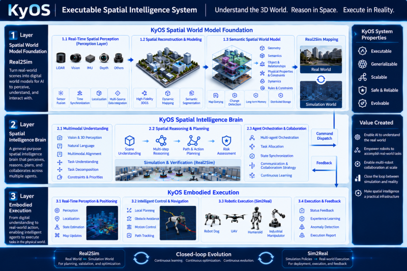
Scaling embodied AI requires KyOS, a closed-loop architecture coordinating perception, task planning, and reflex control across different timescales.

Turn static 3DGS captures into dynamic lighting variations using AI relighting tools to test sunsets, night looks, and mood changes in minutes.