Tech Insights
True 5 mm Accuracy, Put to the Test: Inside the Lixel L3 Accuracy Validation
Lixel L3 achieves ≤5 mm accuracy at 1σ across 1,524 point pairs. See the five-step validation workflow and Leica TS60 benchmark test data.
Partner product review
The involution industry is increasingly testing the innovation efficiency of hi-tech brands and business. In 2022, XGRIDS released the first mobile SLAM device for real-time solution , the Lixel L1. After two years, the newly launched flagship handheld scanning and modeling device of Lixel L2 Pro further breaks through the bottleneck of real-time computing, enhances the multi-SLAM fusion algorithm, and combines AI to bring real-time point cloud data with post-processing quality comparable to that of the previous generation products, leading SLAM equipment into the "zero processing era".
The new Lixel L2 Pro features real-time point clouds with absolute coordinates, exclusive Upsample™ algorithms, reaching 1mm point spacing, 5mm point cloud thickness , and self-developed Multi-SLAM algorithms to improve its adaptability and reliability in various scenarios, bringing a friendly and reliable new user experience. So what exactly is it like to use? Next, let's take a closer look at the device and see what surprises it can bring us.
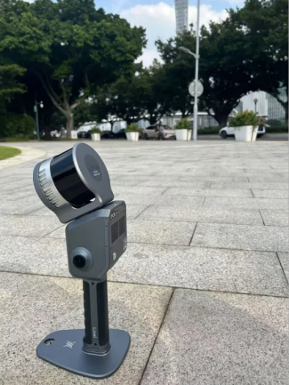
Lixel L2 pro
• Handheld weight: 1.7kg
• Storage capacity: 1TB
• Single battery life: 90 minutes
• Data interface: USB3.1Gen2
• Point cloud format: LAS
• Cameras: built-in color cameras 48 million ×2
• Working range: 0-120m
• Scan rate: 320,000 points/sec (16 channel)
• Device link: Use Android phone APP LixelGo and connect the device through Bluetooth hotspot
• Post-processing software:LixelStudio3.0、LccStudio1.5.0
• Special features: Visually Aided Positioning, Real-time True Color Point Cloud, Real-time RTK Fusion, Lixel CyberColor(3DGS solution)
As a new and upgraded version of the Lixel L series scanners, the Lixel L2 Pro achieves powerful real-time data processing capabilities through deep integration of LiDAR, vision, and IMU sensors, combined with AI algorithms. Color point clouds can be generated in real time without the need for external equipment, and the quality is comparable to that of last generation Lixel L2's post-processing data.
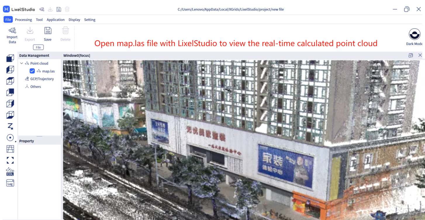
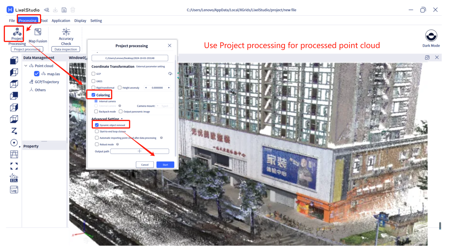
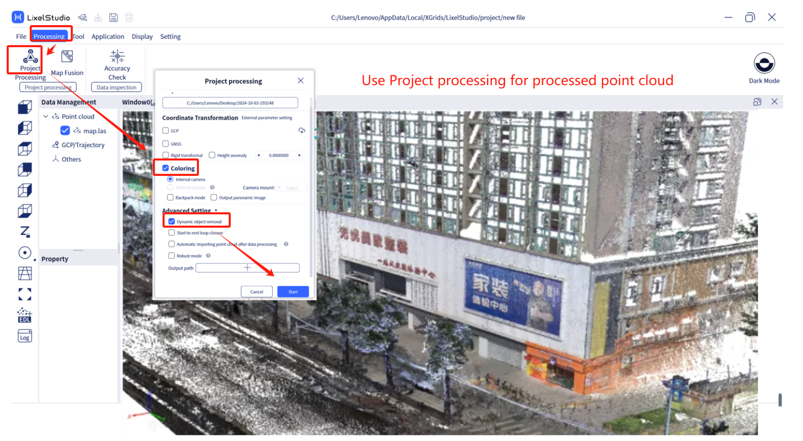
1. The point cloud filtering and smoothing are more refined, and the post-processed point cloud sorting is more regular, presenting a good light and shadow effect.
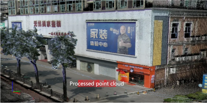
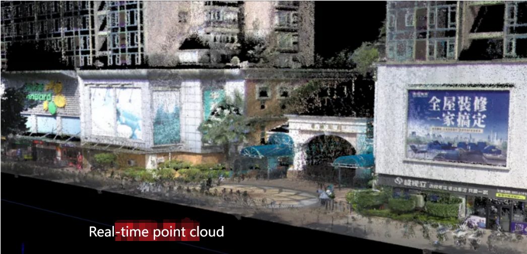
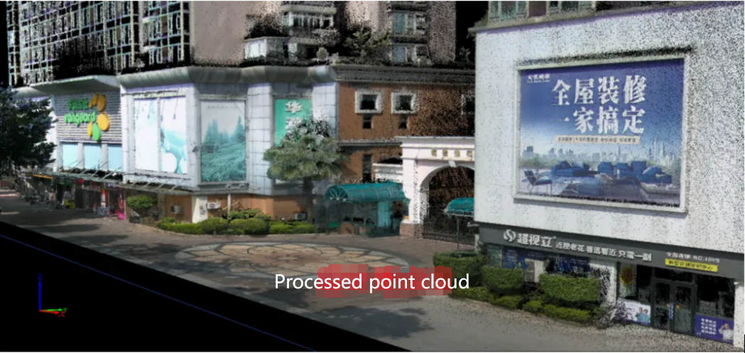
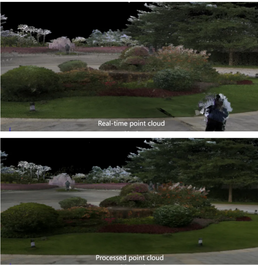
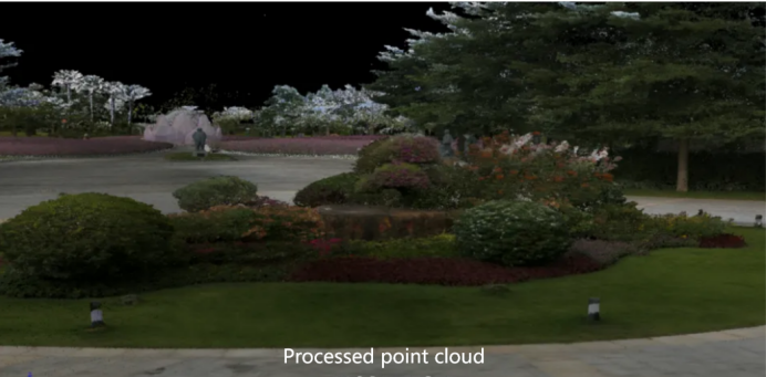
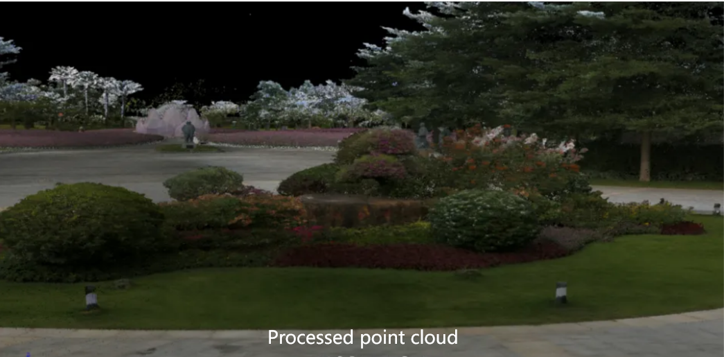
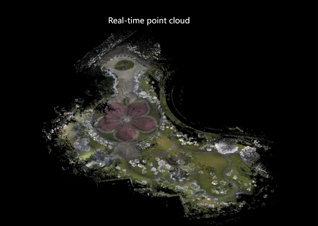
2. Post-processing can present point clouds farther away than preview real-time data.
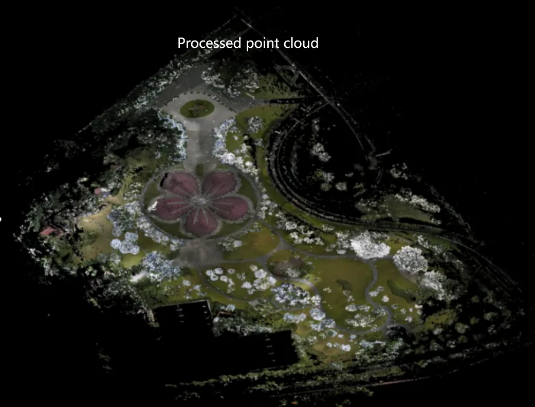
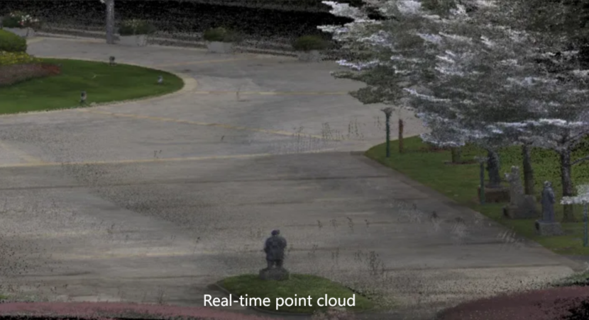
3. Compared with the previous generation, the L2 Pro real-time point cloud can remove a number of figures, and the effect of post-processing and eliminating shadows is close to perfect.
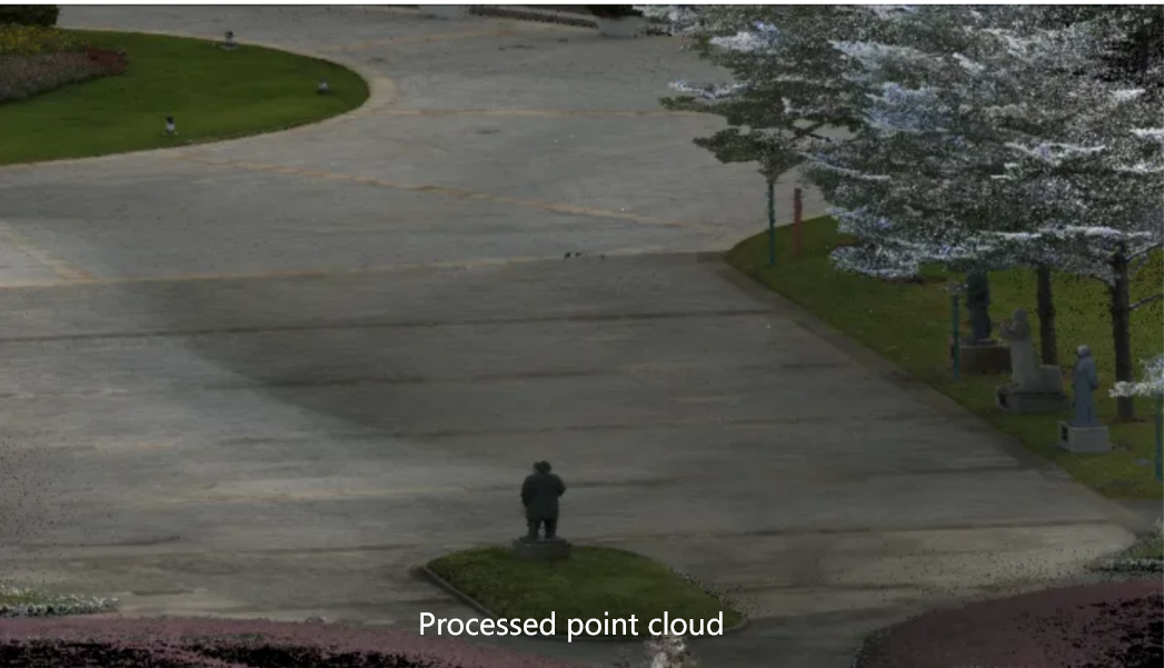
Compared with its predecessor, the Lixel L2 Pro has achieved a qualitative leap in color point cloud generation. The original product relied on an external Insta 360 panoramic camera for point cloud coloring, which had certain limitations in the outdoor point cloud acquisition process, especially in long-term acquisition or hot weather. The panoramic camera will automatically restart due to overheating of the camera, resulting in scanning process being interrupted. With the LixelStudio3.0 new algorithm, the processed point cloud removes the excessive point density in some areas and causes excessive color, and also increases the sparseness of some areas of the point puzzle resulting in insufficient color, and the coloring effect is better.
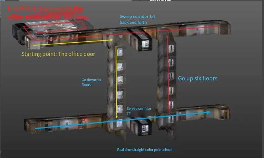
In the test, we started from the office door, walked vertically down six floors, scanned the corridor on the ground floor, went up six floors back to the office door, and finally scanned the inside of the office to form a closed loop. The results of the test are as follows:
1. The point cloud of real-time preview is coherent, and there is no large-scale offset and staggering.
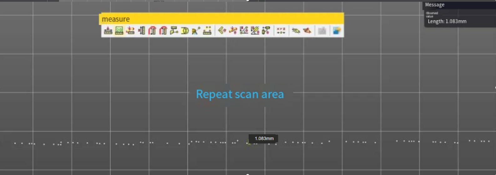
2. The point cloud post-processed, and the thickness of the point cloud slice at the thinnest part is about 2mm in the area of repeated scanning.
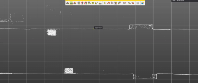
3. The point post-processed, and the thickness of the point cloud slice on a single floor is about 5mm in the corridor aisle.
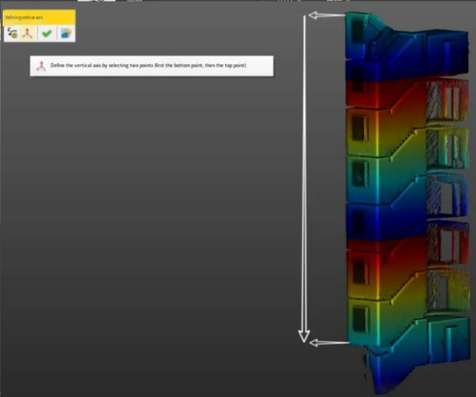
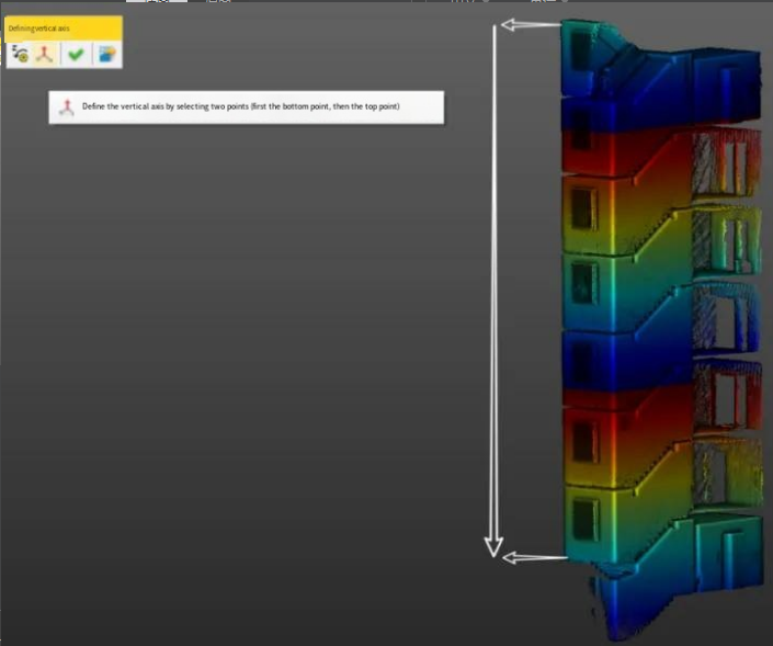
4. By defining the Z-axis, the six-story staircase is leveled and the offset distance is measured:
Through measurement, the north direction is offset by 1.6cm, the east direction is offset by 1.4cm, and the calculation can be √ 1.6²+√1.4²=2.13cm, and the vertical staircase is scanned, and the plane direction is offset at about 3 cm, and the effect is good.
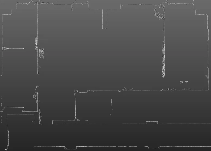
5. The internal scanning of the office, the lines are smooth and smooth, and the point cloud is smooth/filtered with good effect.
In this test, the point cloud collected by the Lixel L2 Pro is smooth, the point cloud filtering effect is good, there is no obvious noise, and the line outline is clear after cutting, which can be used to draw the outline CAD drawing of the house.
The Lixel L2 Pro is equipped with a high-precision RTK module, which allows you to log in to your CM or Qianxun account, connect to the CORS network, and directly output the point cloud data with absolute coordinates, with an absolute accuracy of up to 3cm.
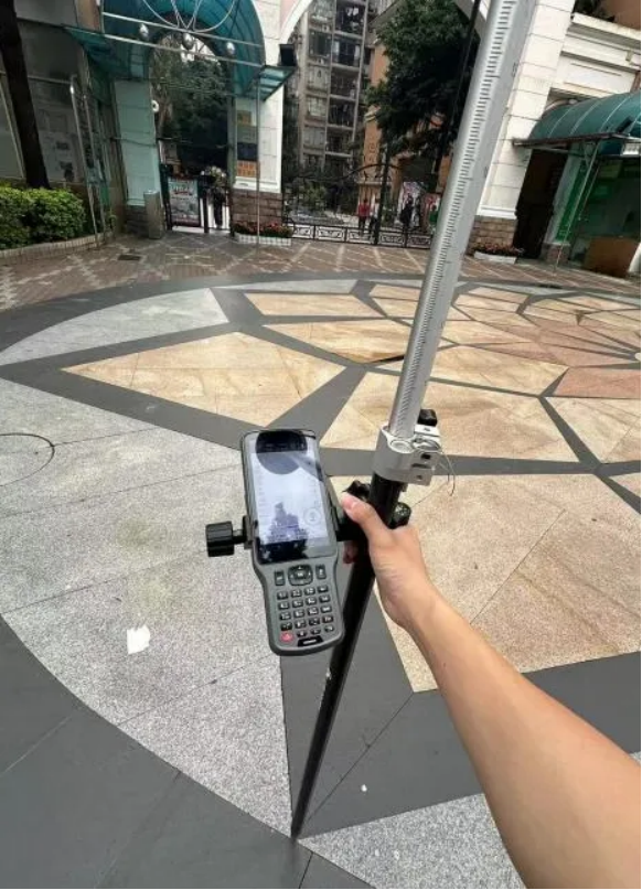
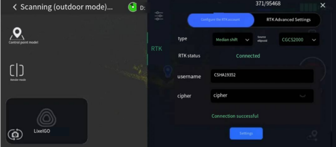
Since the RTK module had not yet arrived at the time of this test, the coordinate conversion accuracy of the Lixel L2 Pro was tested by manually using the RTK to set control points. Technicians surveyed and planned the route in advance, and used RTK to evenly lay control points every 50-100 meters along the route. During the scanning, the crosswire of the instrument base is aligned with the previously laid control points at the time of the passage and added in order.
1. Manually use RTK to set control points
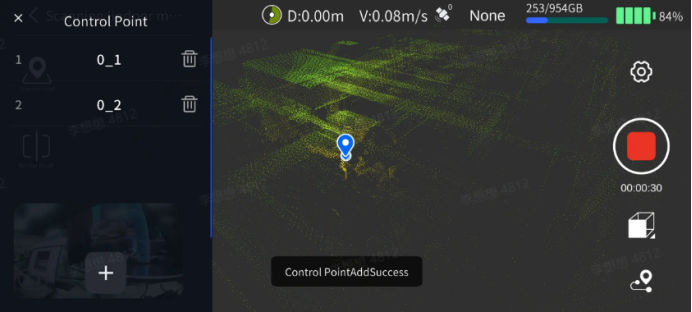
2. Add control points through LixelGo
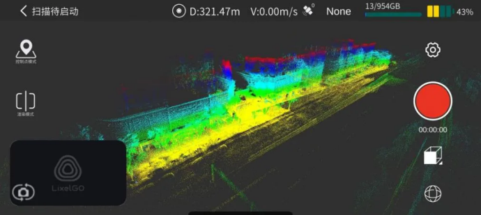
3. In the process of scanning, inspect the working situation and data quality by previewing the real-time displayed point cloud and trajectory in the APP interface
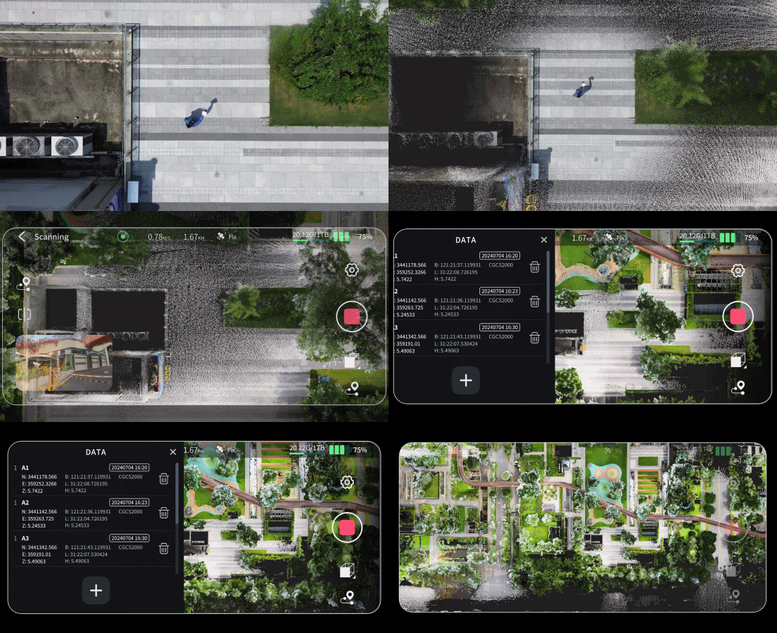
When the scanner is put down to mark points, avoid the vibration caused by a large collision with the ground. When picking up the instrument after hitting the control point, pick up the instrument slowly and steadily, otherwise the strenuous action will affect accuracy. After the APP feedback that the control point is successfully added, pick up the device and rotate around the control point for 1-2 times or stay for a period of time to get a more complete point cloud around the control point.
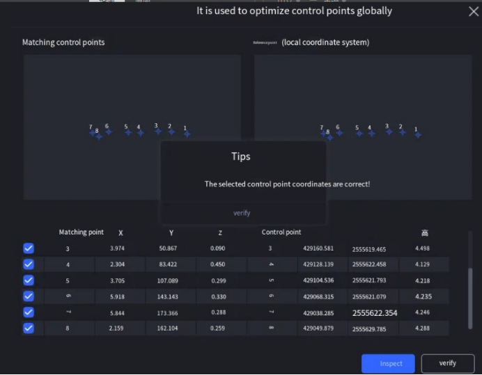
4. Control points conversion in LixelStudio
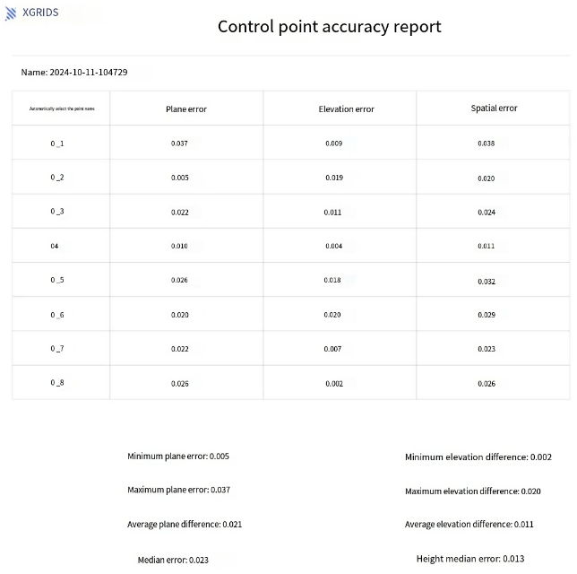
5. Control point accuracy report
By converting the point cloud with relative coordinates to absolute coordinates of the measured area, the point cloud is given an absolute coordinate, and the plane and elevation conversion error is about 3 cm, which meets the accuracy requirements of topographic surveying and mapping.
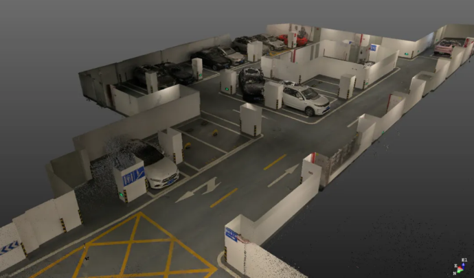
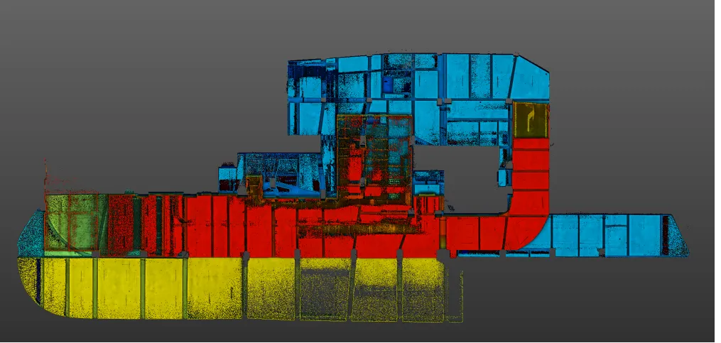
In order to verify the relative accuracy of Lixel L2 Pro, technicians used it to scan for point cloud data of B1 and B2 floor of an underground parking lot, and measured the edge length of the site by using an infrared laser rangefinder for comparative testing.
Colored point cloud inside the parking lot
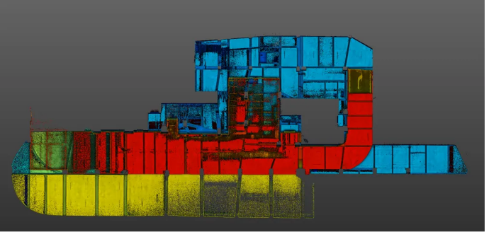
Parking lot point cloud top view
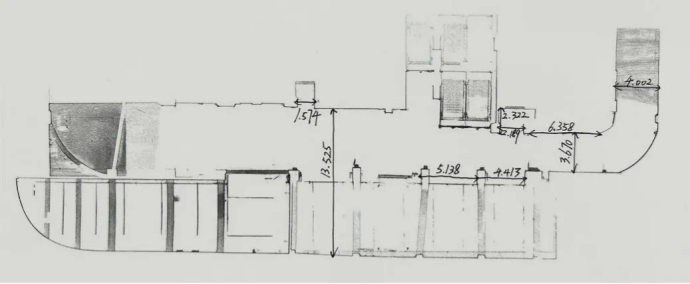
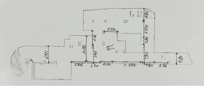
The measured edge length of B1 and B2 floor
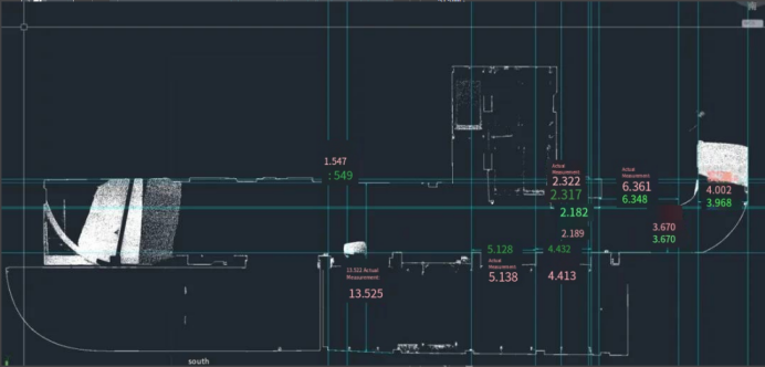
Comparison of the side lengths of the underground floors
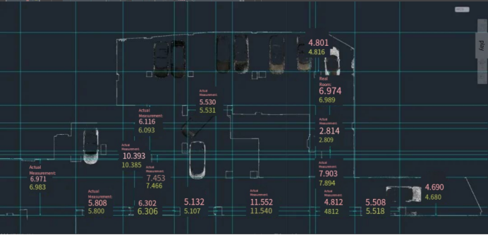
Comparison of the side lengths of the B2
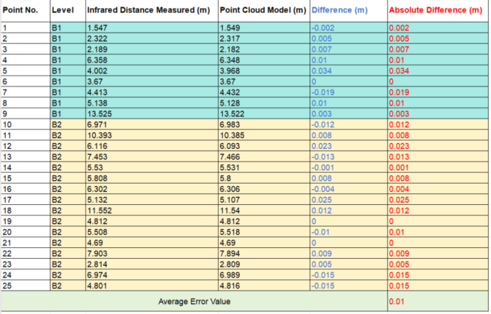
Error comparison
| Point No. | Level | Infrared Distance Measured (m) | Point Cloud Model (m) | Difference (m) | Absolute Difference (m) |
| 1 | B1 | 1.547 | 1.549 | -0.002 | 0.002 |
| 2 | B1 | 2.322 | 2.317 | 0.005 | 0.005 |
| 3 | B1 | 2.189 | 2.182 | 0.007 | 0.007 |
| 4 | B1 | 6.358 | 6.348 | 0.01 | 0.01 |
| 5 | B1 | 4.002 | 3.968 | 0.034 | 0.034 |
| 6 | B1 | 3.67 | 3.67 | 0 | 0 |
| 7 | B1 | 4.413 | 4.432 | -0.019 | 0.019 |
| 8 | B1 | 5.138 | 5.128 | 0.01 | 0.01 |
| 9 | B1 | 13.525 | 13.522 | 0.003 | 0.003 |
| 10 | B2 | 6.971 | 6.983 | -0.012 | 0.012 |
| 11 | B2 | 10.393 | 10.385 | 0.008 | 0.008 |
| 12 | B2 | 6.116 | 6.093 | 0.023 | 0.023 |
| 13 | B2 | 7.453 | 7.466 | -0.013 | 0.013 |
| 14 | B2 | 5.53 | 5.531 | -0.001 | 0.001 |
| 15 | B2 | 5.808 | 5.8 | 0.008 | 0.008 |
| 16 | B2 | 6.302 | 6.306 | -0.004 | 0.004 |
| 17 | B2 | 5.132 | 5.107 | 0.025 | 0.025 |
| 18 | B2 | 11.552 | 11.54 | 0.012 | 0.012 |
| 19 | B2 | 4.812 | 4.812 | 0 | 0 |
| 20 | B2 | 5.508 | 5.518 | -0.01 | 0.01 |
| 21 | B2 | 4.69 | 4.69 | 0 | 0 |
| 22 | B2 | 7.903 | 7.894 | 0.009 | 0.009 |
| 23 | B2 | 2.814 | 2.809 | 0.005 | 0.005 |
| 24 | B2 | 6.974 | 6.989 | -0.015 | 0.015 |
| 25 | B2 | 4.801 | 4.816 | -0.015 | 0.015 |
| Average Error Value | 0.01 | ||||
The results show that the absolute difference between the point cloud measurement and the field measurement is controlled at about 3 cm, and the average error value is plus or minus 1 cm, which is good. The product can present a good point cloud smooth post-processing effect in the underground space, and can be used to draw the outline plan of the basement and civil air defense space.
Exclusive Upsample™ point cloud algorithm makes the point cloud spacing 5mm after post-processing, while the matrix is evenly arranged.
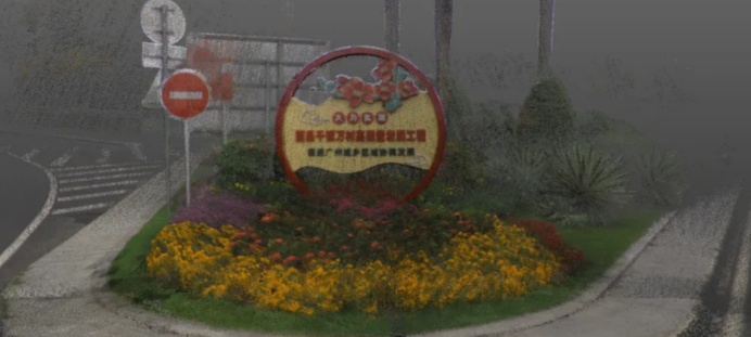
5 mm matrix point cloud
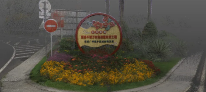
Real-time true-color point cloud
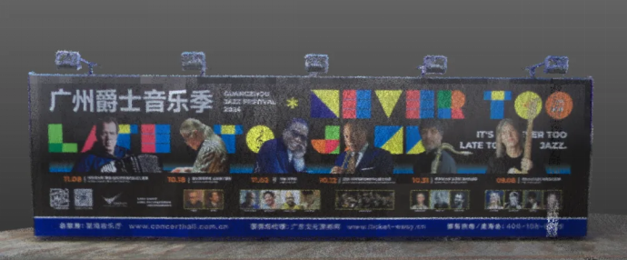
5mm post-processing point cloud through Upsample™
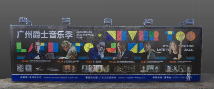
Real-time true-color point cloud

5mm post-processing point cloud through Upsample™
The exclusive Upsample™ enhancement algorithm of Lixel L2 Pro further enhances the point cloud density and structural details, combined with ultra-high coloring accuracy, so that the color point cloud effect reaches a photographic level, which can accurately capture every detail, allowing users to accurately reproduce the real scene and realize "what you get is what you see".
Overall, as a flagship-level handheld scanning and modeling device, the Lixel L2 Pro performs well in terms of hardware specifications, scanning performance, and data processing. It not only provides users with more efficient and accurate scanning solutions, but also injects new vitality into the development of 3D intelligent technology through the introduction of innovative technologies such as seamless point clouds. If you're looking for a handheld SLAM product that can handle a variety of complex scenarios and provide high-quality scan data, then the Lixel L2 Pro is definitely an option worth considering.

Founded in 2001, TBNET is a leading provider of positioning and 3D visualization products and solutions in China, and is committed to the sales and service of surveying and mapping optical products, 3D laser measurement systems, GNSS positioning services and equipment, marine surveying and building construction products in China. It is a national high-tech enterprise, a specialized and new "little giant" enterprise in Hubei Province, an enterprise research and development center in Wuhan, and one of the first batch of digital economy service resource pool enterprises in Wuhan.
Lixel L3 achieves ≤5 mm accuracy at 1σ across 1,524 point pairs. See the five-step validation workflow and Leica TS60 benchmark test data.
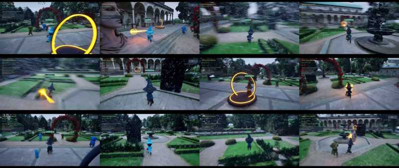
A garden scan became a playable Unreal Engine game in under two hours, with 3D Gaussian splatting for the level and an AI agent for the game logic.
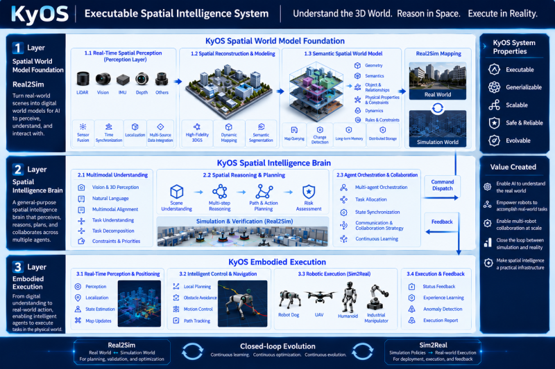
Scaling embodied AI requires KyOS, a closed-loop architecture coordinating perception, task planning, and reflex control across different timescales.
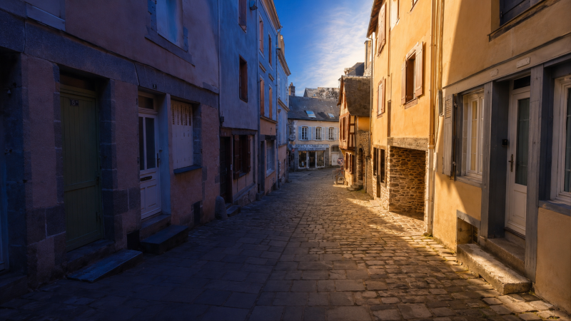
Turn static 3DGS captures into dynamic lighting variations using AI relighting tools to test sunsets, night looks, and mood changes in minutes.