Capture, Measure, and Understand the Natural Resources.
From mining operations and forestry surveys to stockpile measurement and infrastructure inspection, XGRIDS transforms complex field environments into accurate, measurable, and photoreal digital assets. Powered by mobile LiDAR, high-precision SLAM, and 3D Gaussian Splatting, the XGRIDS workflow delivers centimeter-level results across challenging outdoor or underground environments while seamlessly integrating with the software platforms professionals already use.
Why Field Surveying Needs a New Workflow
Why Natural Resource Workflows Are Moving Beyond Traditional Surveying
Natural resource projects demand reliable spatial information. But field environments are rarely simple. Dense forests. Open-pit mines. Stockpile yards. Remote infrastructure. Power plants. Traditional workflows often require multiple instruments, repeated site visits, complex registration, and lengthy post-processing. The challenge isn't collecting more data. It's collecting accurate data faster.
Centimeter-Level Accuracy
Deliver engineering-grade results for measurement and spatial analysis.
Stable Performance in Complex Environments
Maintain reliable data capture across forests, mines, tunnels, construction sites, and large outdoor areas.
Faster Field Operations
Reduce setup time and complete surveys through continuous mobile scanning.
Multiple Deliverables from One Survey
Generate point clouds, 3DGS environments, terrain models, sections, and measurements simultaneously.
Large-Scale Surveying
Capture extensive environments without sacrificing efficiency or data quality.
Open GIS & Engineering Workflows
Seamlessly integrate with the software platforms already used across surveying, engineering, and geospatial industries.
The XGRIDS Natural Resource Workflow
From Field Collection to Engineering Deliverables
Natural resource projects often require multiple data products. Point clouds. Terrain models. Volume calculations. Cross-sections. Visual documentation. Traditionally, each deliverable requires separate workflows.
Step 1
Mobile Capture
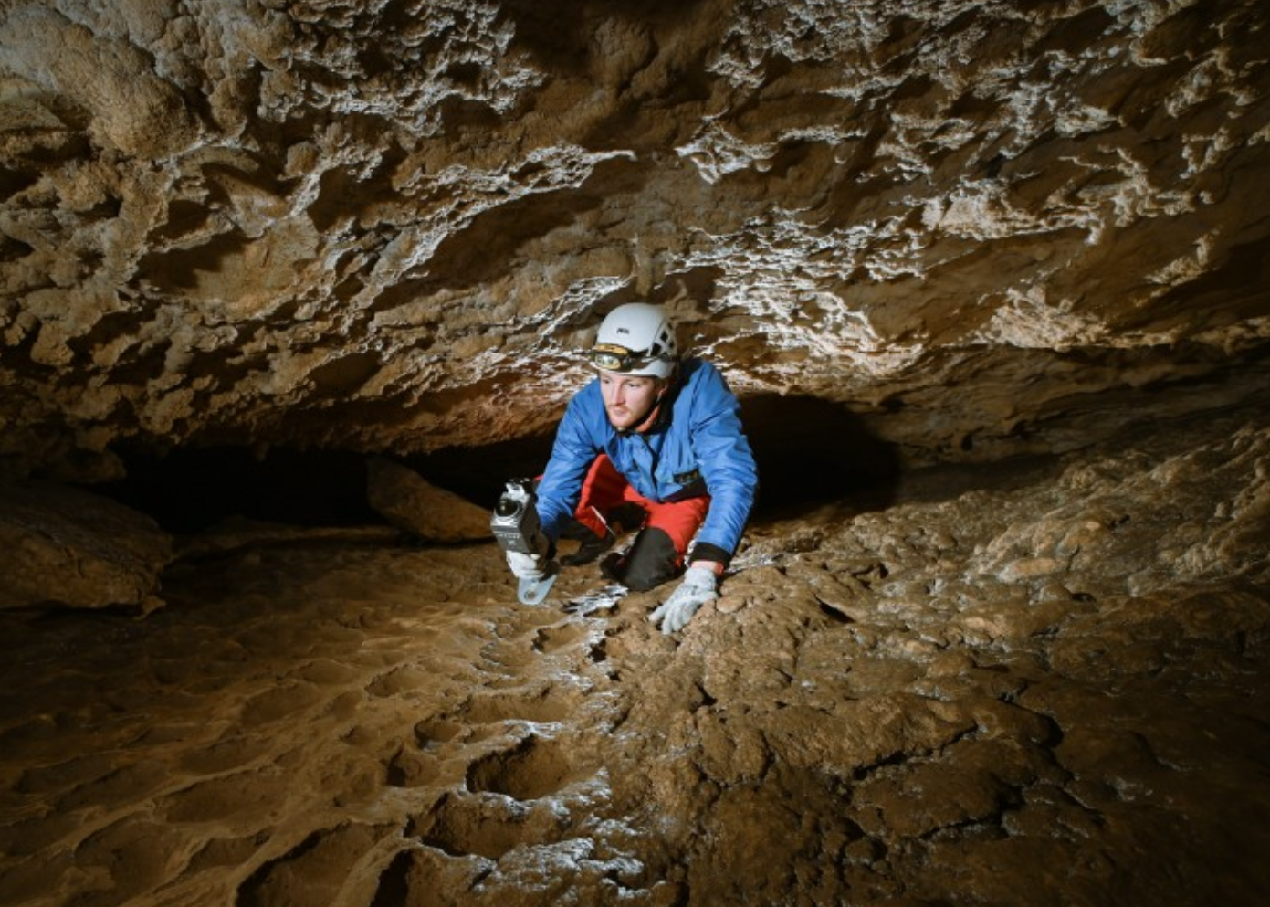
Capture environments with Lixel series scanners. Built for challenging field conditions, Lixel scanners combines LiDAR, IMU, RTK/PPK, and visual sensors. The system maintains stable positioning and reliable data collection across large and complex environments.
Step 2
Automatic Data Processing
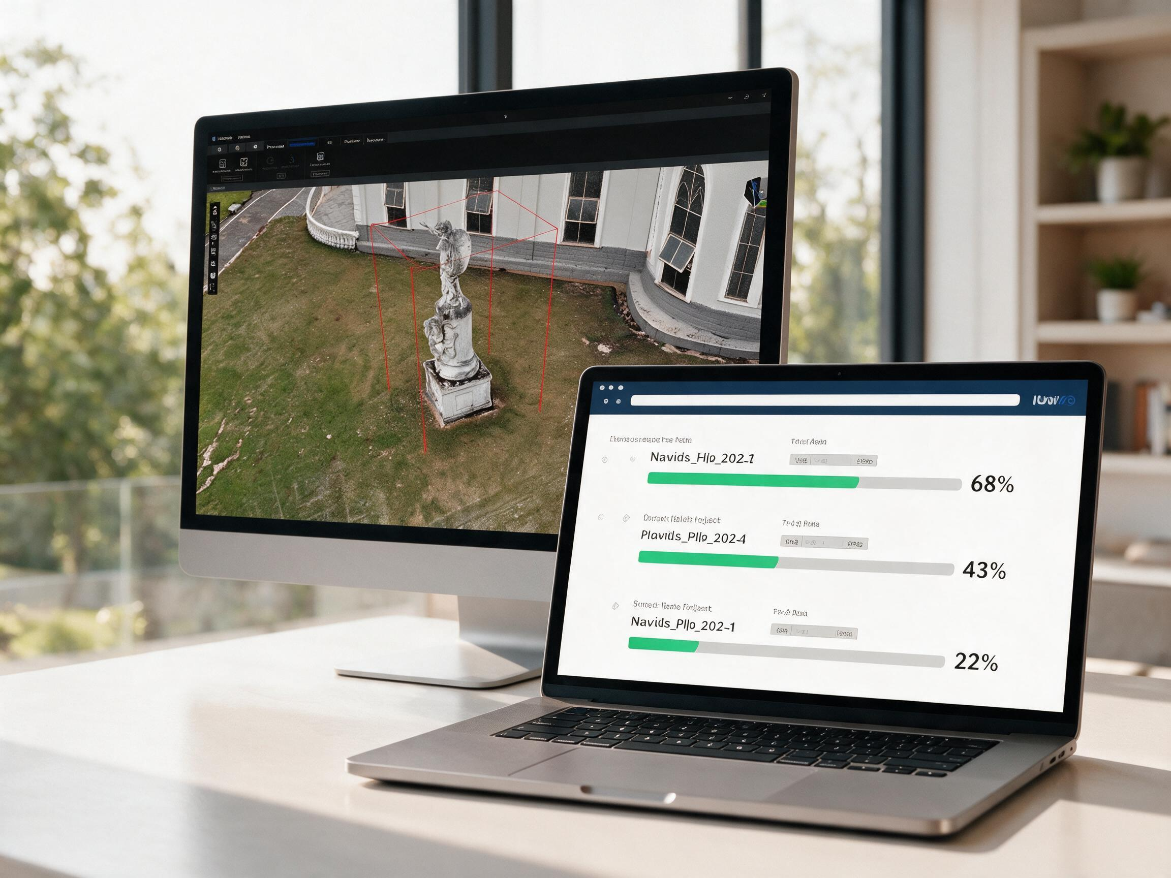
LixelStudio automatically processes captured datasets. Generate registered point clouds, 3D Gaussian Splatting scenes, terrain models, cross-sections, measurements, and engineering deliverables.
Step 3
Spatial Analysis
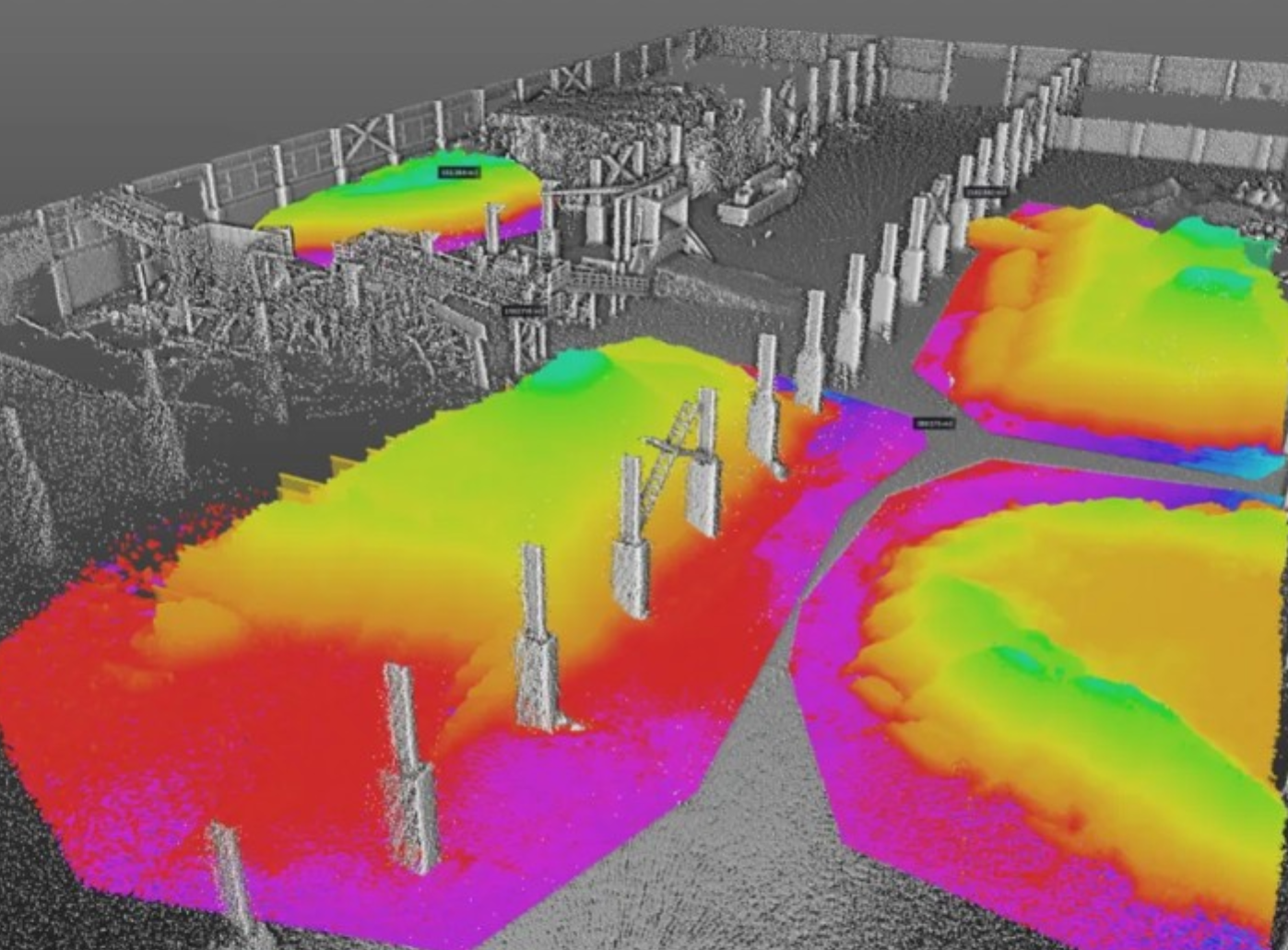
Analyze captured environments directly within LixelStudio. Perform distance measurements, surface analysis, elevation analysis, volume calculations, and terrain interpretation.
Step 4
Export to Industry Software
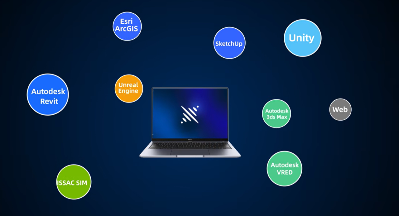
Survey data should not remain inside a proprietary ecosystem. LixelStudio exports data into widely used geospatial and engineering workflows. Captured datasets can be integrated into GIS, CAD, BIM, and visualization platforms.
Step 5
Share and Collaborate
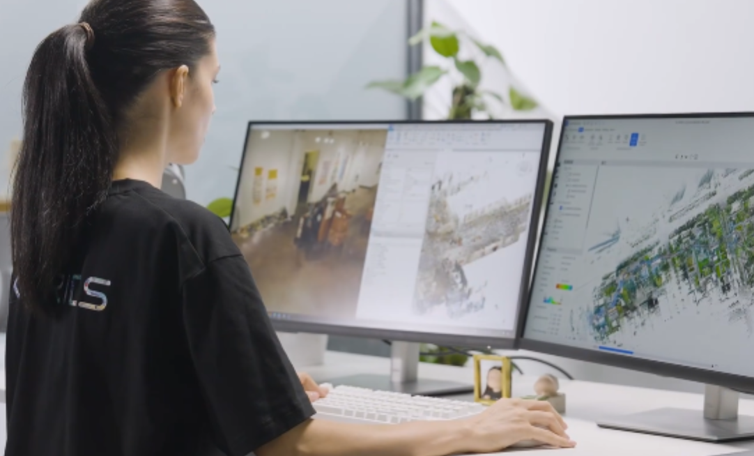
Publish results across web-based viewers and professional software environments. Engineers, surveyors, planners, and project stakeholders can access the same dataset throughout the project lifecycle.
Lixel Scanners
Handheld mobile scanners with millimeter-level accuracy — handheld, backpack, vehicle or airborne with RTK support; lightweight models (~870 g) suit tunnels, culverts and other confined spaces.
ProcessLixelStudio
Point-cloud processing and export: LAS, E57 and RCP straight out, into GIS and survey software without conversion.
ReconstructLCC Studio
Generates a photorealistic 3DGS scene for visualization and remote review of mines, facilities and other complex sites.
Inspect / TwinUnity / Unreal / Omniverse
Bring real-world spatial data into real-time engines and simulation platforms for inspection, monitoring and digital twins.
Step five loops back to step two: what matters here is change, and change needs at least two rounds on one datum. Only once capture gets cheap does "how often" follow the production cycle.
Where Teams Use It
Each scenario is broken down the same way: the problem you have today, how we solve it, and what changes.
Scenario 1
Mining
Capture Complex Mining Environments with Confidence
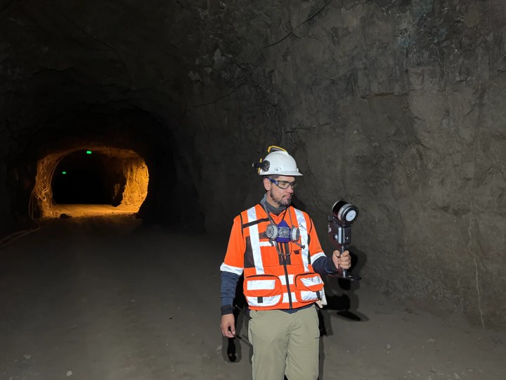
Mining environments are constantly changing. Traditional surveying often struggles to keep pace with excavation activities, transportation routes, and evolving terrain. Repeated measurements increase both costs and operational risks.
Lixel L3 enables rapid mobile surveying across open-pit mines, processing facilities, and transportation corridors. High-precision positioning and mobile LiDAR provide reliable measurements even across large operational areas.
- Faster mine surveying
- Improved operational safety
- Reduced field time
- More frequent spatial updates
Scenario 2
Resource Exploration
Survey Large Areas More Efficiently
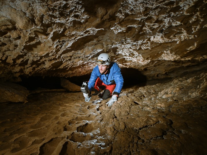
Exploration projects often cover extensive and difficult terrain. Traditional workflows require significant time for deployment, setup, and post-processing.
Continuous mobile scanning accelerates field operations while preserving spatial accuracy. Survey teams can document larger areas with fewer interruptions and faster data processing.
- Larger daily survey coverage
- Reduced deployment complexity
- Faster data turnaround
- Improved operational efficiency
Scenario 3
Stockpile & Volume Measurement
Measure Material Volumes with Confidence
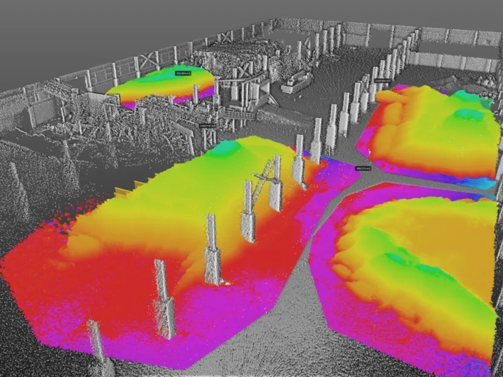
Accurate stockpile measurements are essential for inventory management, operational planning, and financial reporting. Manual measurements are slow and often inconsistent.
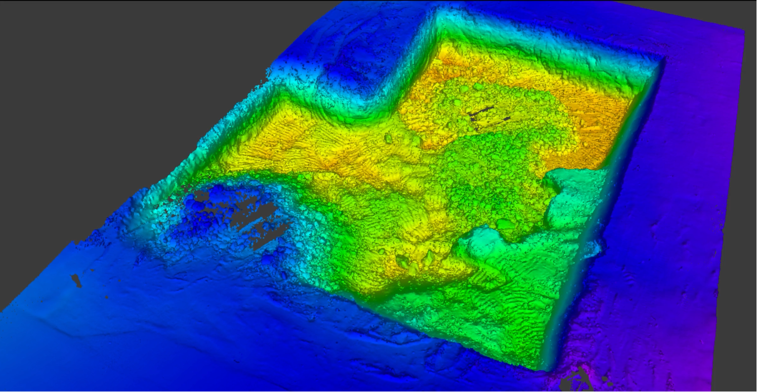
Generate terrain surfaces directly from captured point clouds. Calculate volumes quickly and produce repeatable measurements across stockyards, construction sites, mining operations, and material storage facilities.
- Faster volume calculations
- Improved measurement consistency
- Better inventory management
- Reduced manual work
Scenario 4
Engineering Inspection
Document Infrastructure Before Problems Become Failures
Bridges, tunnels, retaining walls, industrial facilities, and transportation infrastructure require continuous monitoring. Traditional inspections often depend on photographs and manual reporting.
Create complete spatial records through mobile reality capture. Inspectors can revisit the environment digitally, perform measurements, and compare conditions over time.
- Better documentation
- Reduced site revisits
- More comprehensive inspections
- Improved reporting workflows
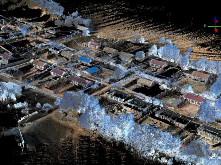
Scenario 5
Forestry Surveying
Capture Forest Environments Beyond GPS Constraints
Forested environments create challenges for traditional surveying methods. Dense vegetation reduces visibility and complicates positioning.
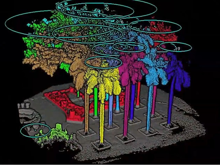
Lixel scanners combines LiDAR and SLAM to maintain stable data collection even in complex environments. Surveyors can document forest corridors, ecological sites, and natural environments while preserving accurate spatial information.
- Improved field mobility
- Better environmental documentation
- More efficient data collection
- Greater operational flexibility
Built for Geospatial Professionals
Integrate Seamlessly into Existing Workflows
LixelStudio was designed to fit naturally into established geospatial workflows. Survey teams can export data and continue working within their preferred platforms.
Frequently Asked Questions
Common questions about accuracy, underground work and where this fits.
Lixel L3 and Lixel K2 deliver centimeter-level positioning and measurement results through LiDAR, RTK, PPK, and high-precision SLAM technologies.
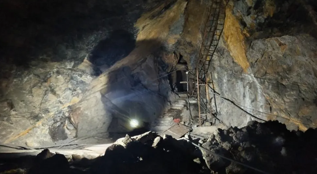
Yes. Lixel scanners combines multiple positioning technologies to maintain stable data collection in challenging environments, including forests, tunnels, and underground spaces.
Yes. LixelStudio supports terrain generation and volume analysis directly from captured datasets.
LixelStudio supports multiple export formats for point clouds in LAS, PLY, E57 format and panoramic views.
Captured datasets can be integrated into GIS, CAD, BIM, digital twin, and visualization platforms.
No. The same dataset can simultaneously support engineering analysis, measurement, visualization, and collaboration.
Works with the Software You Already Use
You do not have to change software. The point cloud enters survey, volumetric and GIS platforms in formats they already read.
Survey · GIS Formats
LAS, E57, RCP, OBJ and PLY straight out — into survey and GIS software with no conversion step.
RTK Absolute Coordinates
With RTK the result lands directly in your datum, with no coordinate transform needed.
LCC UE SDK
Production visualisation and control-room displays in Unreal, with billion-scale scenes still rendering live.
Browser Sharing
View the current state by link, so remote review and inspections need no site visit.
Capture the Field. Deliver the Data.
Tell us the site type and accuracy requirement, and we will map the capture-and-deliver path.