Bring the Real World into Simulation.
Capture real environments with multi-sensor spatial scanning and transform them into accurate, photoreal, simulation-ready digital twins. By combining LiDAR, high-precision IMU, RGB imaging, and spatial reconstruction algorithms, XGRIDS creates trusted 3D data that reflects the geometry, appearance, and spatial relationships of the physical world. Bring captured environments into NVIDIA Omniverse and Isaac Sim for robotics simulation, embodied AI training, synthetic data generation, and digital twin applications.
Why Physical AI Needs More Than Synthetic Worlds
Train in Worlds That Reflect Reality
Simulation allows robots and embodied AI systems to learn faster, test more scenarios, and reduce the cost and risk of real-world deployment. But simulation is only as useful as the world being simulated. Simplified models and manually built environments often miss the complexity of reality.
Reality-Based Simulation
Build simulation environments from real places instead of simplified approximations.
Trusted Spatial Accuracy
LiDAR and high-precision inertial sensing preserve real-world dimensions, geometry, and spatial relationships.
Photoreal Visual Context
3D Gaussian Splatting retains rich appearance, lighting, materials, and environmental detail for perception-oriented simulation.
Faster Environment Creation
Capture complex environments through a mobile walkthrough instead of rebuilding them manually.
Large-Scale Digital Twins
Reconstruct factories, campuses, warehouses, offices, streets, and other large environments for simulation.
Ready for Physical AI Workflows
Bring real-world spatial data into NVIDIA Omniverse and Isaac Sim for robotics simulation, embodied AI training, and digital twin applications.
From Physical Environment to Simulation
Creating a realistic simulation environment traditionally requires scanning, modeling, texturing, optimization, and manual scene assembly.
Step 1
Capture the Real Environment
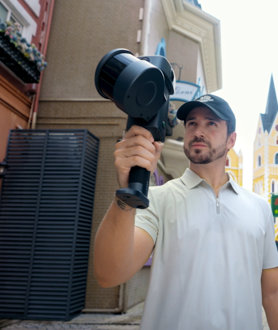
Walk through the environment with a Lixel spatial scanner or PortalCam. Capture factories, warehouses, offices, campuses, public spaces, underground environments, and other complex locations. LiDAR, RGB cameras, and high-precision inertial sensors record geometry and appearance simultaneously.
Step 2
Reconstruct the Digital Twin
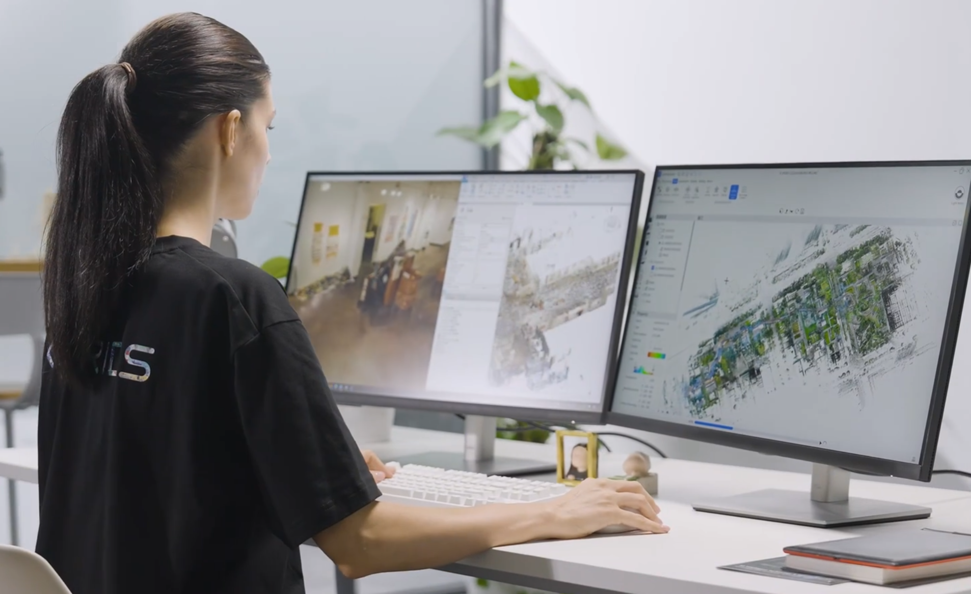
LCC reconstructs the captured environment into a photoreal 3DGS scene together with accurate spatial data. Teams can generate 3D Gaussian Splatting scenes, point clouds, mesh geometry, measurements, spatial coordinates, and additional simulation assets.
Step 3
Prepare for Simulation
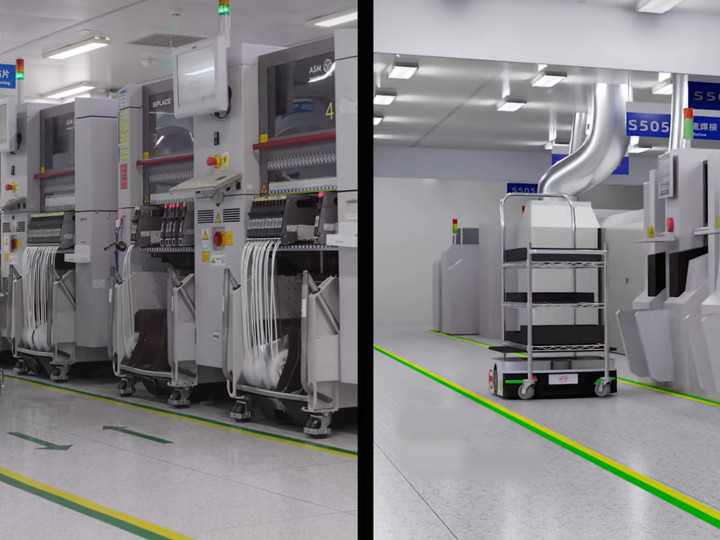
Process and organize captured environments for downstream simulation. Combine photoreal visual data with geometry required for collision, navigation, perception, and interaction.
Step 4
Bring Into Omniverse and Isaac Sim
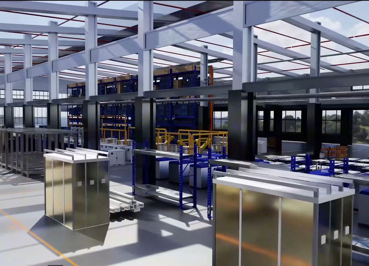
Use XGRIDS spatial data inside NVIDIA Omniverse and Isaac Sim workflows. The real environment becomes a simulation space for robot navigation, perception testing, embodied AI training, synthetic data generation, and digital twin applications.
Step 5
Simulate, Train, and Iterate
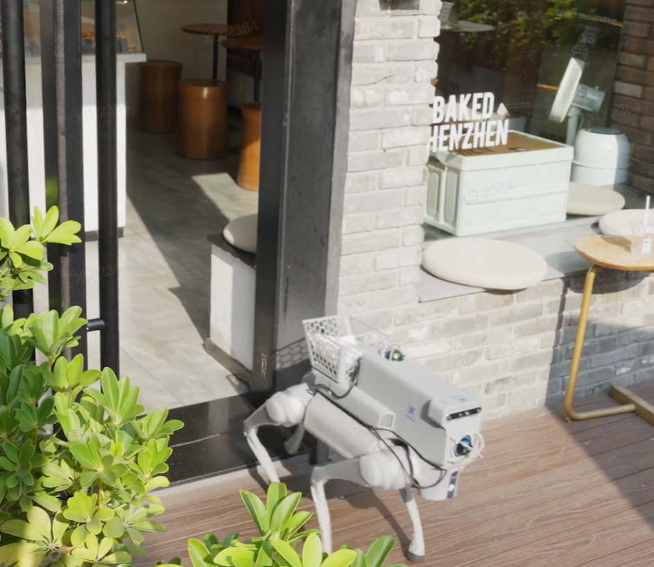
Test robots and AI systems against environments based on real operating conditions. Simulation results can then inform physical deployment, while updated scans can continuously improve the digital representation.
Lixel Scanners
Handheld mobile scanners at millimeter-level accuracy — larger models cover large-area sites with the geometry navigation and collision need; lightweight, more agile models suit storage aisles and equipment gaps, the tight spaces robots actually traverse.
ReconstructLixel CyberColor
Reconstructs the environment into a photoreal 3DGS scene with accurate spatial data, collision, and occlusion.
AccessLCC UE SDK
Renders billion-scale scenes live in Unreal; brings spatial data into real-time engines and simulation platforms via the SDK and plugins.
SimulateNVIDIA Omniverse / Isaac Sim
Enter Omniverse and Isaac Sim through USD workflows for robotics simulation and Physical AI.
The result is not simply a visually convincing 3D scene. It is a spatial representation grounded in real-world measurements.
Where Teams Use It
Each scenario is broken down the same way: the problem you have today, how we solve it, and what changes.
Scenario 1
Robotics Simulation · Simulation engineers, robotics teams
Train Robots in the Spaces They Will Actually Enter
Robots trained only in simplified virtual environments often encounter a gap when they enter the physical world. Real environments contain clutter, uneven geometry, narrow clearances, complex materials, and unexpected spatial relationships.
Capture the target environment directly. Instead of manually recreating a factory, warehouse, laboratory, or office, teams start from a reality-based digital twin. The environment can then be brought into simulation for robot navigation, perception, and interaction testing.
- More realistic training environments
- Less manual 3D scene creation
- Better alignment between simulation and deployment
- Faster iteration before physical testing
Scenario 2
Embodied AI Training · AI research, perception teams
Give AI Systems Real Spatial Context
Embodied AI must understand more than images. It needs to understand space — where objects are, how far apart they are, what can be navigated, what can be reached, and how the environment changes from different viewpoints.
XGRIDS captures geometry, appearance, and spatial relationships together. The resulting environments provide rich spatial context for embodied AI systems that need to perceive, navigate, reason, and act in 3D.
- Reality-grounded spatial data
- Richer perception training
- Better spatial reasoning
- More representative simulation environments
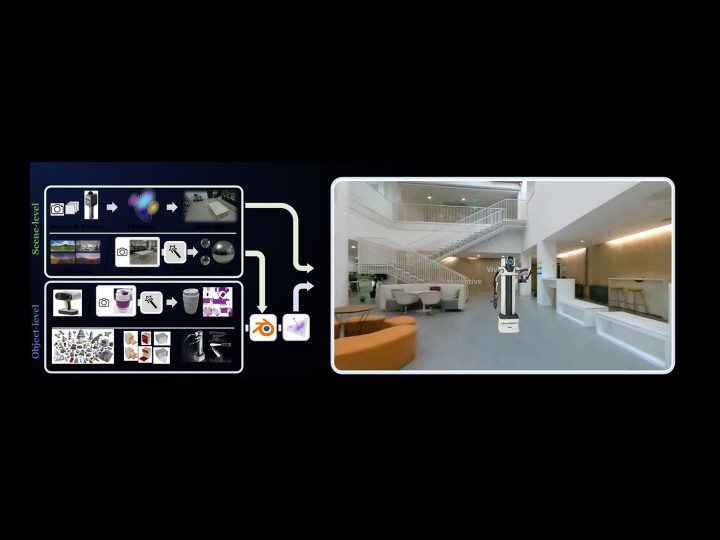
Scenario 3
Digital Factory Simulation · Industrial automation, planning teams
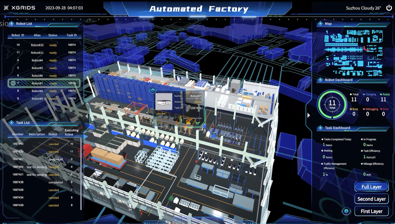
Turn Real Factories into Simulation Environments
Factories are highly dynamic and spatially complex. Building simulation environments manually requires significant modeling effort and often produces an idealized version of reality rather than the actual operating environment.
Capture the real factory with mobile spatial scanning. Preserve production spaces, machinery layouts, circulation paths, structures, and visual context in a reusable digital twin. Use the environment for visualization, robotics simulation, and industrial digital twin workflows.
- Faster digital factory creation
- Real factory layouts preserved
- Better planning and simulation
- Reusable spatial data across multiple teams
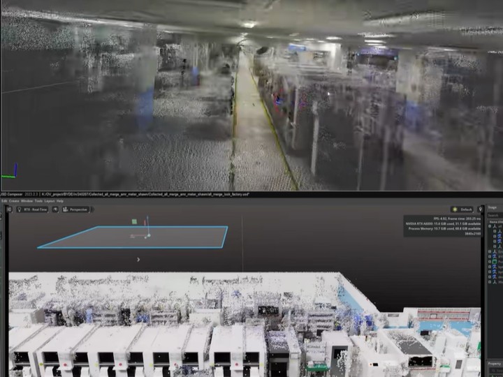
Scenario 4
Navigation & Perception Testing · Computer vision, navigation teams
Test Perception Against Real-World Complexity
Computer vision and navigation systems can perform well in clean synthetic environments but struggle with real-world visual complexity. Reflections, repetitive structures, changing lighting, clutter, and occlusion all affect perception.
3DGS preserves the visual richness of captured environments while LiDAR provides spatially accurate geometry. This gives simulation systems both photoreal visual context and reliable spatial structure.
- More realistic perception testing
- Better representation of complex surfaces
- Accurate geometry for navigation
- Reduced gap between synthetic and physical environments
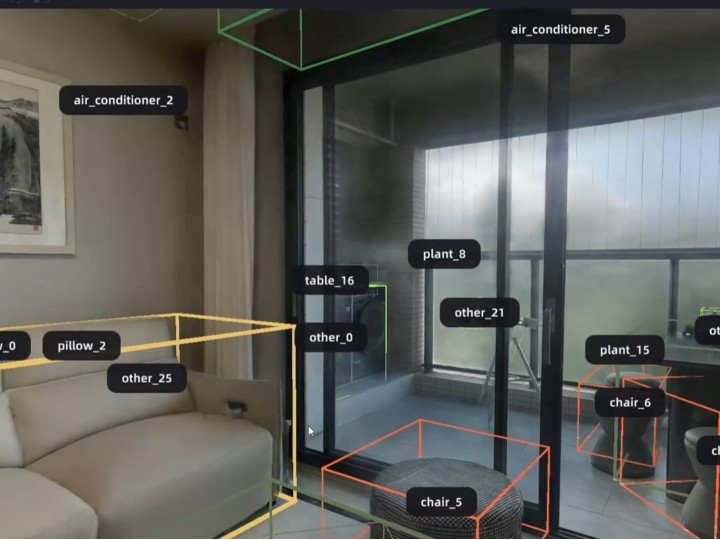
Scenario 5
Synthetic Data & Spatial AI · Research teams, platform builders
Create Training Data from Real Spatial Environments
Physical AI systems require large amounts of spatial data. Collecting every scenario physically is slow, expensive, and difficult to scale.
Capture representative real-world environments and use them as the foundation for simulation and synthetic data generation. Real spaces can be reused, modified, and extended to create more training scenarios without repeatedly returning to the site.
- Reusable training environments
- Lower physical data collection costs
- More scalable scenario generation
- Stronger foundation for spatial AI
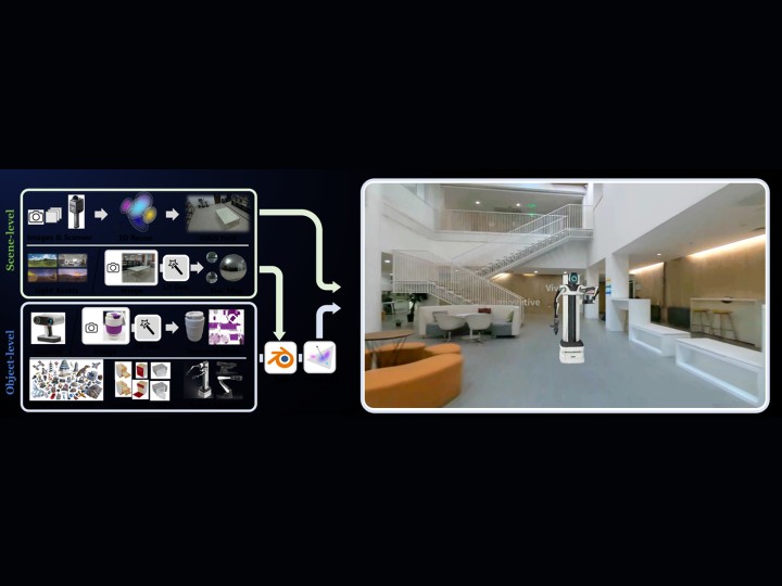
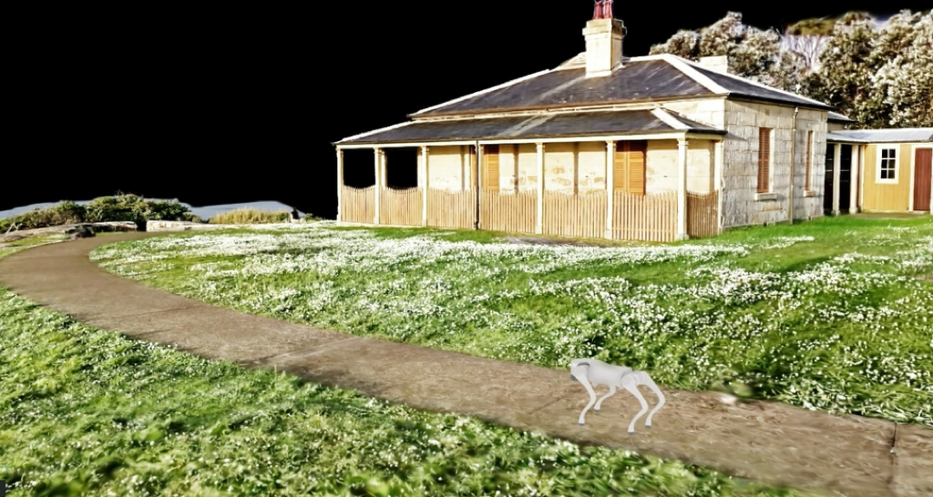
Real Environments for Real Machines
Simulation and Physical AI case studies built on XGRIDS reality capture.
Frequently Asked Questions
Common questions about XGRIDS spatial data for simulation, robotics, and Physical AI.
Robots interact with physical geometry. Distances, clearances, obstacles, floor levels, walls, and object positions directly affect navigation and movement. Reality-based scanning provides a more accurate spatial foundation than manually approximated environments.
LiDAR provides reliable geometry and measurements. 3DGS provides photoreal visual appearance. Together, they allow simulation environments to support both physical interaction and perception-oriented applications.
XGRIDS uses multi-sensor fusion rather than relying only on RGB images. LiDAR, high-precision inertial sensing, RGB cameras, and SLAM contribute to reconstruction, helping preserve both geometric accuracy and visual realism.
Yes. XGRIDS spatial data can be integrated into NVIDIA Omniverse and Isaac Sim workflows for simulation, robotics, digital twins, and Physical AI applications.
Yes. Lixel mobile spatial scanners are designed for large-scale indoor and outdoor environments and allow operators to capture complex spaces through continuous walking.
3DGS primarily provides photoreal visual representation. For workflows requiring accurate physical geometry, XGRIDS combines 3DGS with LiDAR-derived point clouds and geometry. This combination allows visual realism and spatial accuracy to coexist within the same reality-capture workflow.
Built for the Physical AI Ecosystem
Supported workflows and platforms for XGRIDS spatial data in simulation and Physical AI.
NVIDIA Omniverse
Bring XGRIDS spatial data into Omniverse for industrial visualization, digital twins, and simulation workflows.
NVIDIA Isaac Sim
Use reality-based environments for robot navigation, perception testing, and embodied AI training inside Isaac Sim.
Unreal Engine
Load and render 3DGS scenes live in Unreal Engine as the runtime for simulation and data generation.
Unity
Import mesh and textures for lightweight simulation and visualization on compute-limited targets.
Build Simulation from the Real World.
Book a demo, download a simulation dataset, or talk to a solutions consultant.