
Events & Webinars
XGRIDS at NVIDIA GTC 2026: Bridging Real-World Spaces and Physical AI Through Real2Sim
XGRIDS at NVIDIA GTC 2026: Bridging Real-World Spaces and Physical AI Through Real2Sim
Exploring the Future of LiDAR with AI: Key Insights from the Webinar with Ted Strazimiri

In the recent webinar: The Future of LiDAR with AI, Sunny, Ted Strazimiri (the top voice in 3D industry ) and Sunny Liao (the Head of International Sales at XGRIDS), explored the cutting-edge capabilities and applications of XGRIDS' LiDAR and AI technology. The conversation covered the integration of LiDAR with AI, the impressive features of XGRIDS' technology and products, as well as the potential applications in various fields, providing valuable insights for those interested in 3D spatial technology and its future direction.
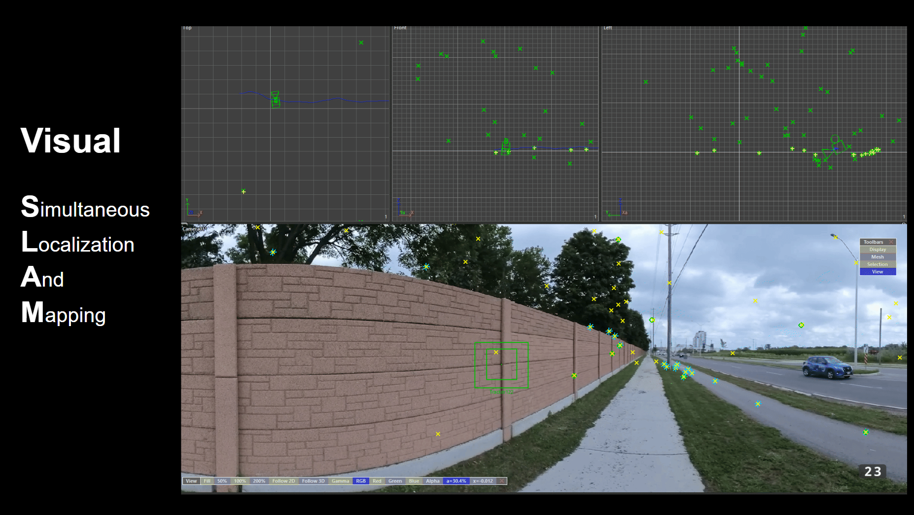
To kick off, the webinar introduced the concept of SLAM (Simultaneous Localization and Mapping), explaining its key role in both camera and LiDAR systems. SLAM technology is fundamental for tracking features over time and assigning spatial coordinates, creating a robust map in real-time. XGRIDS has taken SLAM a step further with their Multi-SLAM technology, which combines data from visual, LiDAR, IMU, and GPS sensors to ensure a more comprehensive capture of spatial environments. Sunny highlighted the versatility of SLAM in challenging environments, such as tight corners and interiors, where conventional data collection techniques may struggle.
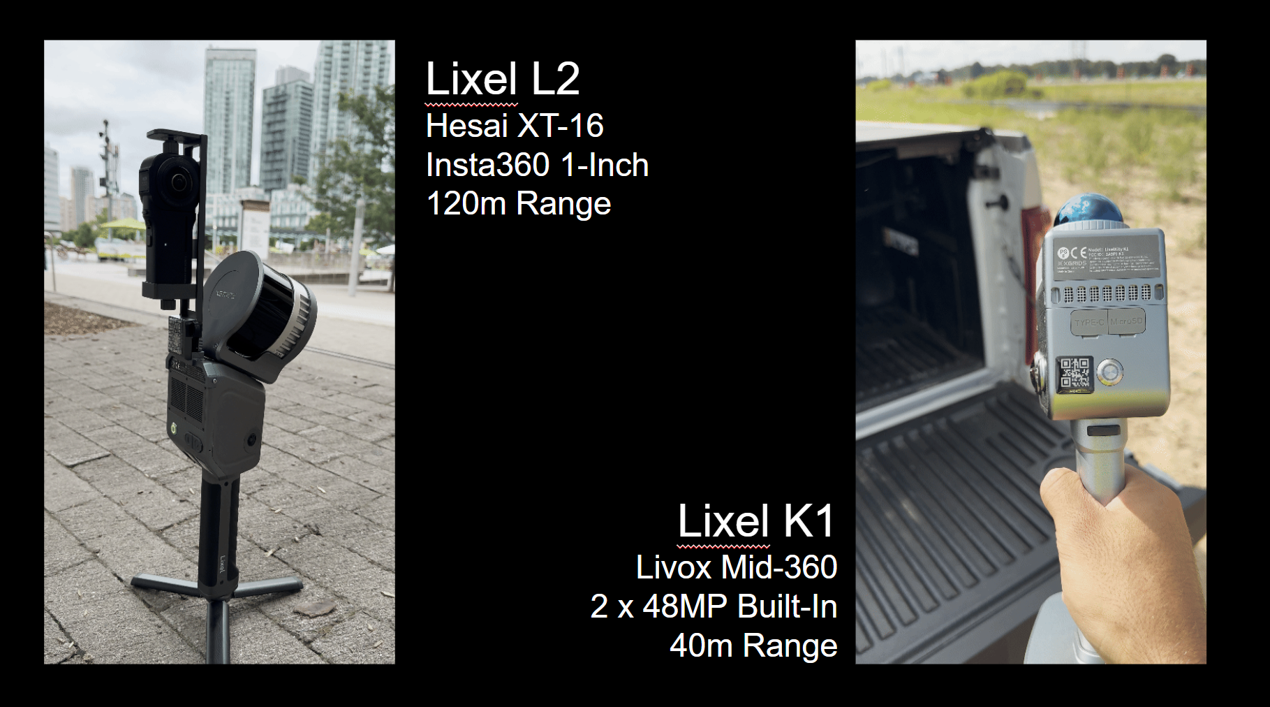
XGRIDS is making strides in the world of LiDAR by focusing on integrating various sensors to overcome the common limitations faced by typical SLAM systems. They offer two advanced scanning solutions, Lixel K1 and Lixel L series scanners, which were prominently discussed during the webinar. The Lixel K1 features Livox Mid-360 sensors, with a built-in range of up to 40 meters, and 48MP cameras for detailed visual capture. Meanwhile, the Lixel L2, featuring the Hesai XT-16, boasts a 120-meter range, enabling high-resolution scans with onboard storage for real-time, geo-referenced data.
These scanners provide unparalleled ease of use, compact form factors, and real-time feedback. Ted highlighted that the robustness of SLAM in XGRIDS’ scanners is a game-changer for tight interior spaces, such as doorways and staircases, where traditional scanners struggle. The integration of neural networks in their SLAM system allows XGRIDS to fuse all these different sources of data to get precise positioning, making their scanners particularly effective in both GPS-denied and GPS-available locations.
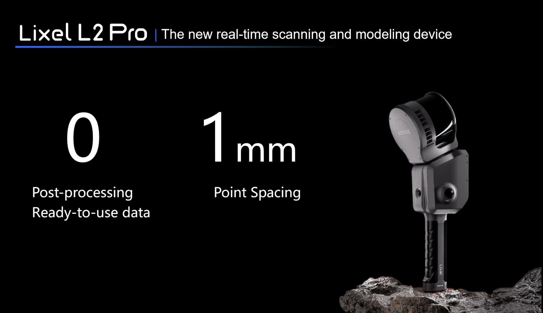
And Sunny emphasized the newly launched scanner LixelL2 Pro's capabilities, which can produce real-time output with point spacing as precisely as 1mm. Such accuracy is instrumental in applications like AEC (architecture, engineering, construction) and forensics, where every detail counts.
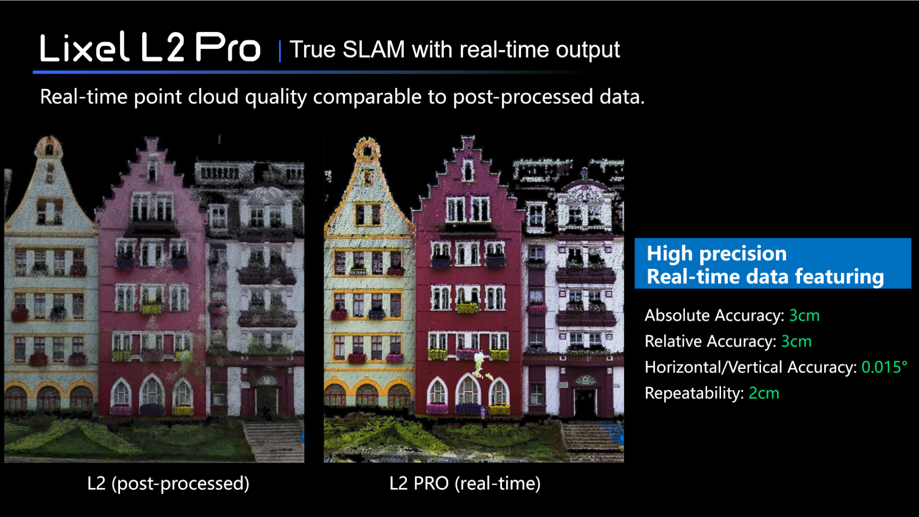
An important part of the webinar covered the data post-processing features offered through LixelStudio. After a scanning session, users can enhance the captured data by filtering moving objects and producing high-density point clouds. Ted and Sunny underscored the importance of post-processing in refining the quality of SLAM data and ensuring accurate geo-referencing. The integration with GCP (ground control points) and RTK (real-time kinematic) systems allows for absolute coordinates, increasing the reliability and precision of the output.
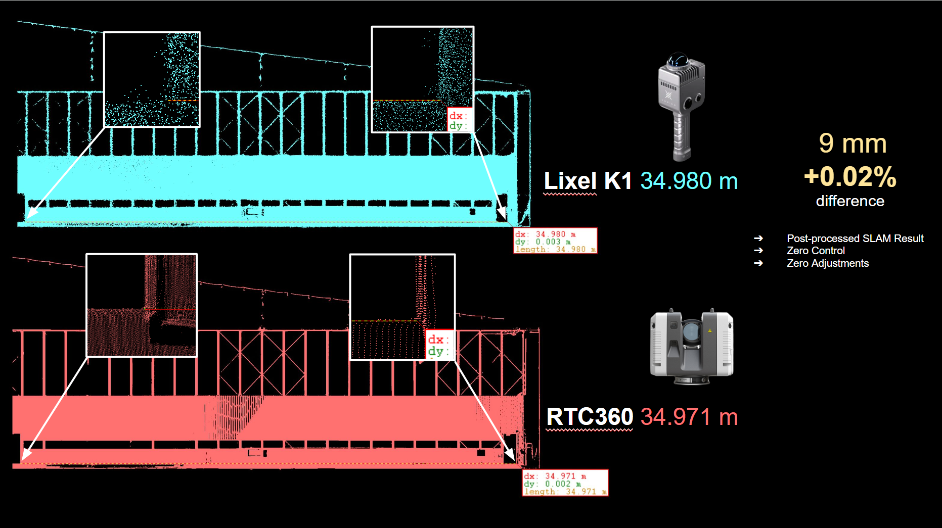
Ted also shared a comparison of post-processed data from the Lixel K1 scanner with data from the RTC 360, demonstrating XGRIDS' technological precision and the excellent results achieved with the systems. The webinar revealed that loop closure, a fundamental concept in SLAM technology, is less critical for XGRIDS' scanners thanks to their Multi-SLAM technology. This provides users with more flexibility in planning their scanning routes without always needing to return to the starting point.
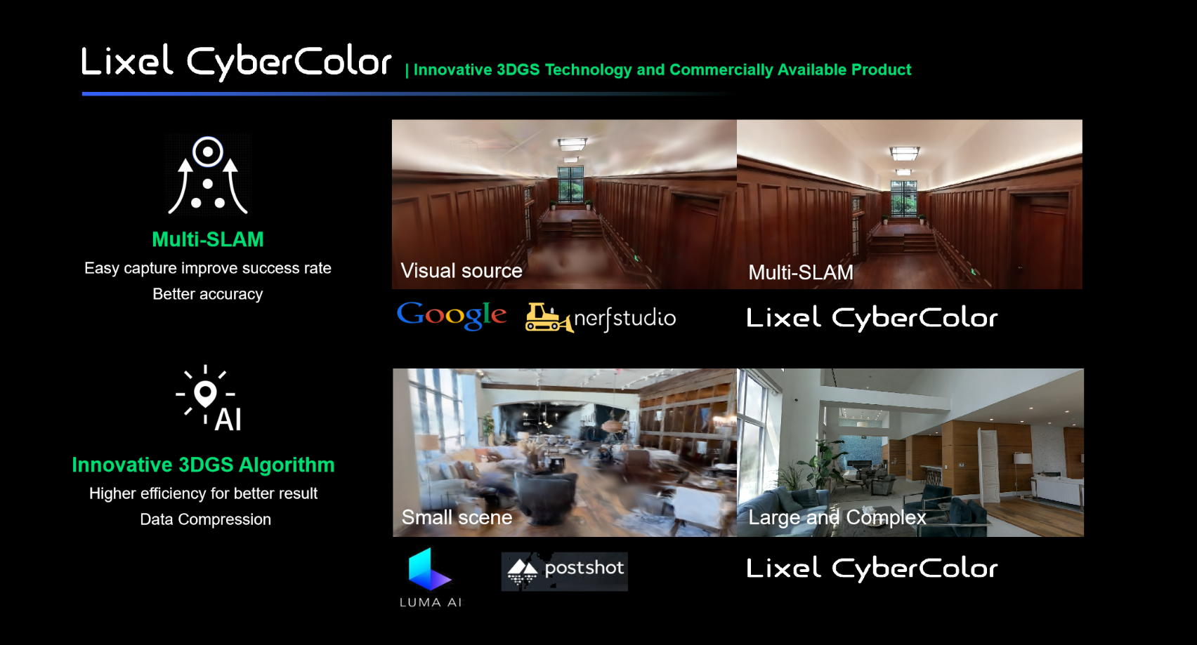
The webinar also introduced the concept of 3D Gaussian Splatting—a technology that enhances the visual representation of point clouds by fusing visual and spatial data. XGRIDS' Lixel Cybercolor, the first SLAM-based gaussian splatting solution is known for delivering high visual fidelity and improving dimensional accuracy in 3D modeling, making them suitable for use in industries like AEC, culture, forensics and design applications.
Ted shared his experience with LCC in specific scan cases, which are quite amazing with LCC's ease of use and impressive results. Gaussian splats are created through LCC Studio, which leverages advanced AI training for novel view synthesis. The result is a visually striking 3D model that is comparable in accuracy to traditional LiDAR outputs. This development bridges the gap between traditional LiDAR and new-age visual techniques, simplifying the process and making advanced 3D visualizations accessible for real-world use.
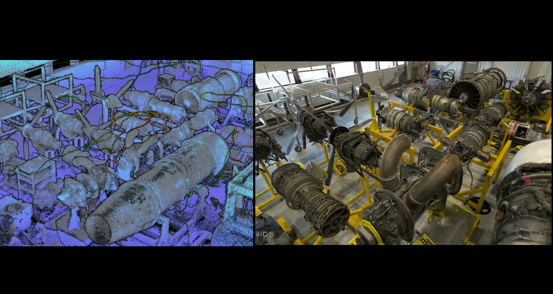
Sunny explained how XGRIDS uses LCC Studio to generate these splats, demonstrating how the integration of point cloud and visual data enriches the final output.
The presenters shared a sneak peek into the future of XGRIDS’ technology. One exciting development is the integration of LiDAR data with Apple Vision Pro for an immersive mixed-reality experience. Sunny also discussed the possibility of incorporating drone-mounted scanners, which would expand the potential use cases by enabling combined indoor and outdoor modeling. This advancement could transform how large areas are scanned, making the entire process more efficient and versatile.
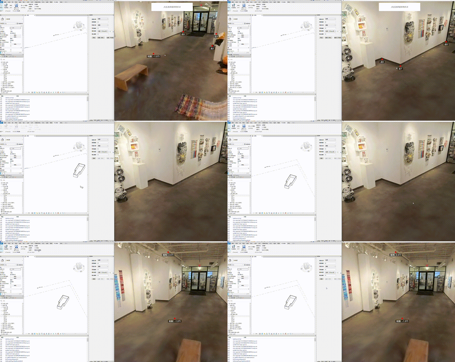
Another notable feature discussed was the integration of XGRIDS' data with BIM (Building Information Modeling) and CAD software, emphasizing the scanners' utility for professionals in construction and urban planning.
The webinar concluded with a compelling vision of the future—a future where LiDAR technology and AI combine to simplify and enrich spatial understanding. XGRIDS’ emphasis on integrating cutting-edge technology with practical applications makes them a company to watch in the evolving field of spatial computing.
Whether you're an enthusiast of advanced 3D spatial solutions or a professional in AEC, urban planning, or forensics, XGRIDS’ developments in LiDAR and AI represent an exciting opportunity to stay at the forefront of technological advancement in spatial intelligence. The future, as Sunny and Ted put it, is one where immersive, accurate, and highly accessible spatial data will reshape our interaction with the physical and digital worlds alike.
1. Full version of the webinar recording
2. Data sets mentioned in the webinar
3. The link to download the LCC Viewer for splats viewing
XGRIDS at NVIDIA GTC 2026: Bridging Real-World Spaces and Physical AI Through Real2Sim
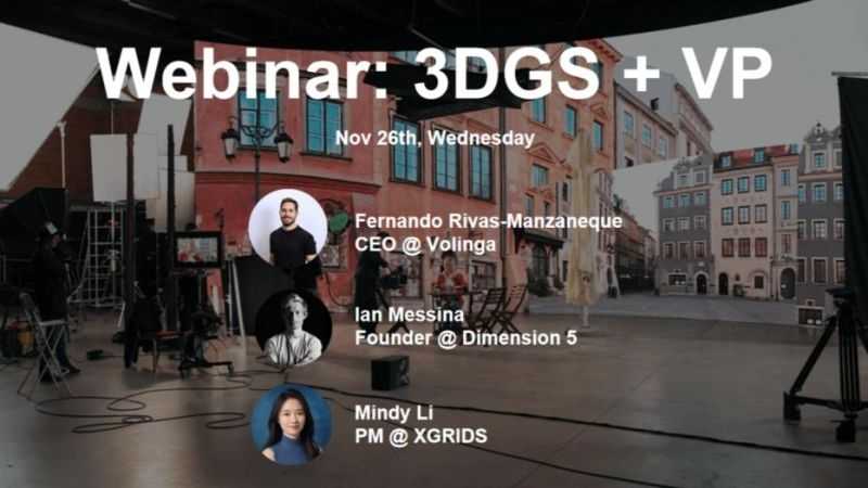
How 3D Gaussian Splatting is closing the gap between spatial capture and in-engine virtual production
Building Accurate, Photoreal 3D Environments for Real-Time Applications

On October 17th, XGRIDS hosted a session in its 3DGS Webinar Series titled "3DGS Documentation for Heritage Sites and Historic Buildings." Featuring Jasper van der Klooster (InformARbv) and Mindy Li (XGRIDS), the webinar explored how point clouds and 3D Gaussian Splatting (3DGS) are redefining the way we document, visualize, and preserve cultural heritage through photorealistic, explorable digital twins.