
Case Studies
Virtual Pre-Production for Netflix's Monster: The Lizzie Borden Story.
Reality capture let Netflix's Monster scout 35 Italian locations in four days with PortalCam, then plan shots remotely through virtual scouting of 3DGS scans.
XGRIDS 3DGS models power MultiSet's VPS behind 360 Maps, an AR navigation platform delivering centimeter-level positioning in complex Tokyo venues.
XGRIDS, the spatial intelligence company, is powering MultiSet’s Visual Positioning System (VPS) with high-fidelity, metric-scaled 3DGS models using XGRIDS 3DGS Solutions. By making detailed representations of real-world environments available as inputs for visual positioning, XGRIDS helps extend 3D spatial capture into intelligent localization applications. The approach is already being used in 360 Channel’s 360 Maps, an AR navigation platform deployed across complex environments in Japan.
360 Maps combines digital maps with augmented reality (AR) to enable seamless navigation across indoor and outdoor spaces. Since its launch, the platform has been deployed across a range of environments in Tokyo and Yokohama, including commercial facilities, large-scale arenas, public spaces and exhibition venues.
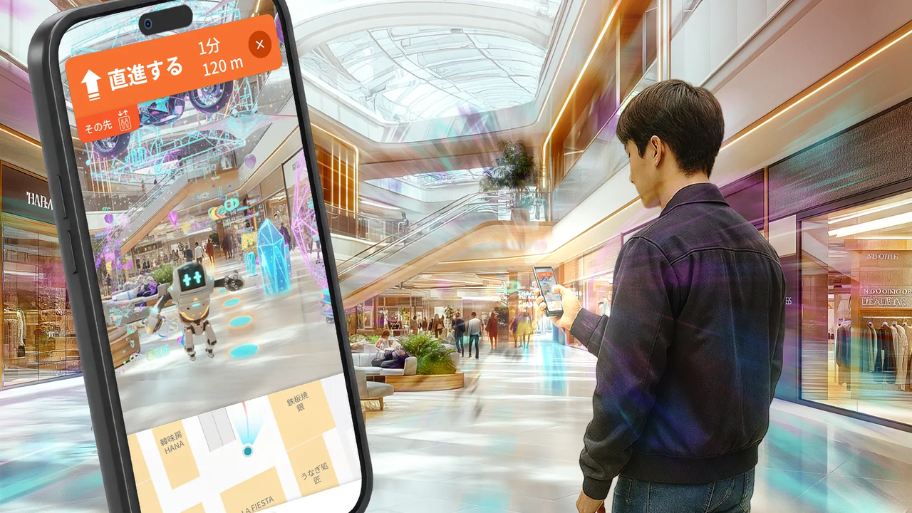
Traditional digital maps have long served as reliable tools for basic spatial orientation, showing users where objects and landmarks are located in two dimensions. However, when applied to complex, high-density, multi-layered environments, standard map interfaces and conventional positioning mechanisms reach clear technical boundaries. In large commercial facilities, multi-level architectural structures, subterranean transit hubs, and other complex spaces where GPS signals are severely degraded, reflected, or completely unavailable, achieving reliable, precise positioning requires far more than basic geographic coordinates. It demands a granular, high-fidelity spatial understanding of the physical environment.
The XGRIDS 3DGS Solution addresses this fundamental gap by establishing a seamless workflow from real-world capture to downstream spatial applications. With the XGRIDS Lixel K1, users can capture physical environments with LiDAR geometry accuracy and visual fidelity in a single workflow. The captured data is then processed locally through XGRIDS LCC Studio to reconstruct spatially accurate 3DGS models that preserve both the geometric structure and visual characteristics of the real space physical environment. These metric-scaled models can then be integrated into downstream positioning and spatial computing workflows, providing a detailed spatial reference for applications.
For MultiSet, these models serve as the spatial foundation for its Visual Positioning System (VPS), turning a detailed digital representation of a physical environment into a reference that can be used for real-world localization and navigation. With detailed visual and geometric information preserved in the spatial representation, the VPS can match a user’s surroundings against the mapped environment and determine their position with high precision, especially in a non-GPS signal situation. This moves 3D spatial capture beyond passive visualization or digital archiving, putting high-fidelity spatial models to work in a live positioning and navigation system.
Combining rich digital cartography with immersive augmented reality, 360 Channel’s 360 Maps platform enables seamless, step-by-step navigation across interconnected indoor and outdoor spaces. Since its commercial launch, 360 Maps has been broadly deployed across a diverse range of high-traffic locations in Tokyo and Yokohama, including sprawling commercial facilities, large-scale entertainment arenas, public transit plazas, and major exhibition venues.
Supported by the XGRIDS 3DGS solution, MultiSet’s VPS supplies the spatial intelligence backing 360 Maps across prominent landmark locations, such as:
Each of these iconic venues introduces a distinct set of real-world localization obstacles:
.PNG)
Navigating these varied, unpredictable conditions underscores the indispensable value of detailed, metric-scaled spatial data. With the XGRIDS 3DGS Solution serving as the core spatial foundation for MultiSet’s VPS, the platform proves that 3D Gaussian Splatting is not merely a visual rendering technique, but a functionally operational spatial backbone capable of handling diverse, large-scale, real-world localization scenarios.
The real-world deployment of 360 Maps offers concrete empirical evidence of the performance leaps achieved when connecting high-fidelity 3DGS spatial data directly into a visual positioning framework. The performance gains delivered by the XGRIDS 3DGS Solution and MultiSet’s VPS are defined by key benchmark metrics:
These quantifiable field results demonstrate that XGRIDS 3DGS solutions successfully transcend visual aesthetic representation. They provide the rock-solid, metric-grade backbone required for autonomous systems, AR applications, and spatial engines that must reliably understand, navigate, and localize within the physical world today.
The successful integration of the XGRIDS 3DGS Solution into MultiSet’s VPS and 360 Channel’s 360 Maps platform illustrates a major evolution in how digital spatial models are used. High-fidelity reality capture is moving rapidly away from passive offline viewing toward active, interactive real-time deployment.
Augmented Reality (AR), Virtual Reality (VR), Mixed Reality (MR), broader spatial computing ecosystems, and industrial digital twins all depend entirely on an accurate, metric-level understanding of the physical environments where digital content is anchored or experienced. If the spatial coordinate system is off by even a few centimeters, the virtual overlay breaks, ruining the user experience and compromising utility.
XGRIDS addresses this necessity head-on by providing a fully integrated end-to-end pipeline that spans from rapid physical environment scanning to the local reconstruction of detailed, metric-scaled 3DGS models. The MultiSet case stands as a powerful, live demonstration of what this technology delivers today: a commercial-grade 3DGS engine that translates raw physical spaces into digital engines of context, positioning, and navigation.
As spatial computing hardware and software continue to mature, the seamless integration of XGRIDS’ spatial intelligence tools points to a broader future. It is a future where humans, autonomous machines, and AI agents can effortlessly navigate, experience, and interact with context-aware digital content fully anchored in the real world.
XGRIDS is a spatial intelligence company. It reconstructs real places at engineering-grade accuracy so professionals, everyday users, and the AI that learns from these spaces can work from the same data. Hardware covers spatial scanners (Lixel L series and K series) and spatial cameras (PortalCam). Software includes LixelStudio and LCC. Products are in use with 8,000+ customers across 80+ countries. The open LCC format is used in the NVIDIA Isaac Sim official workflow. Customers capture, process, and export in the device and local software. XGRIDS supplies the hardware and local tools. It does not provide surveying services, and does not access or retain project data.
Bridge Reality. Build Digital Worlds.
media@xgrids.com
XGRIDS provides hardware capture devices and local software tools only, and does not provide surveying/mapping services. All data is captured, stored, processed, and exported by the user; XGRIDS does not participate in on-site capture and does not access, control, or retain any user project data or deliverables.
Reality capture let Netflix's Monster scout 35 Italian locations in four days with PortalCam, then plan shots remotely through virtual scouting of 3DGS scans.
.png?x-oss-process=image/resize,w_800/quality,Q_50)
A one-hour Lixel K1 scan of six Culver City blocks gave a generative film pipeline the fixed geometry it needed to keep six locations consistent.

Handheld 3DGS by PortalCam helped CyArk document three landmark interiors for America 250, solving mirror reflections and low-light field challenges.

Handheld 3D capture brings real museum spaces to LED volumes, replacing green screens and photogrammetry for fast, cinematic virtual camera moves.