
Case Studies
Virtual Pre-Production for Netflix's Monster: The Lizzie Borden Story.
Reality capture let Netflix's Monster scout 35 Italian locations in four days with PortalCam, then plan shots remotely through virtual scouting of 3DGS scans.
Whispers of the Vanishing Wild: Preserving Veracruz's Hidden Waterfall Through Digital Conservation
As ancient forests disappear at the rate of 10 million hectares annually, the hidden jungles of Veracruz represent one of Mexico's last untouched biodiversity sanctuaries. Within these emerald depths lie undocumented species, ancestral ecological relationships, and vital carbon sequestration systems that may hold keys to climate resilience.
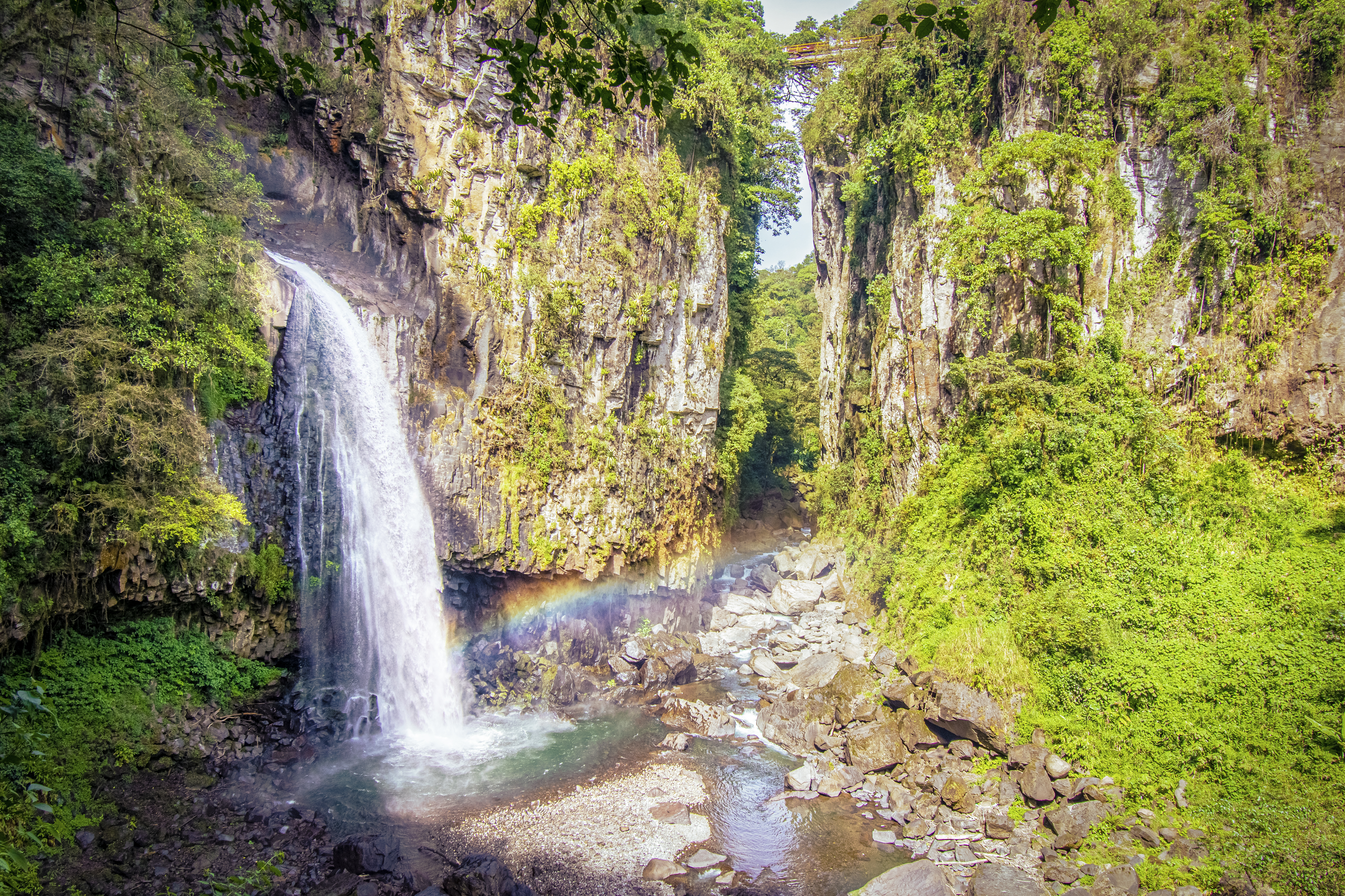
The digital preservation of these environments creates living archives that allow scientists to study intricate ecosystems without physical disruption. As human activity encroaches on these pristine areas and climate change accelerates habitat transformation, these digital twins become increasingly precious—frozen moments of ecological time that may outlive their physical counterparts.
[Video from https://www.arquiavis.com/digitizing-the-wild]
One hectare of upper‑Amazon forest can pack about 300 different tree species—more diversity than many temperate countries hold in total. From those wild chemistries come cures: 74 % of the top 150 prescription drugs rely on compounds first isolated from plants.
Veracruz is a major deforestation hotspot in Mexico. Nationally, Mexico lost 4.89 million hectares of tree cover (a 9.2% decrease) from 2001-2023, largely due to agricultural expansion and urbanization. This habitat destruction fuels immense biodiversity loss. Globally, over 100 species vanish daily from deforestation.
Forests used to disappear in silence. Their loss registers as little more than a footnote in humanity's ledger of progress. Until now.
High‑fidelity 3D capture offers a way to hit "Save" on forests. Projects like Hexagon's Green Cubes scan rainforest canopies and understories with airborne LiDAR and ground sensors, building centimeter‑accurate digital twins that scientists can measure, query, and revisit long after the chainsaws fall silent.
These living models preserve structural data, species distribution, and even acoustic signatures, creating a baseline for carbon accounting, early‑warning analytics, and storytelling that can rally funding for on‑the‑ground protection. In other words, 3D content tech doesn't just record vanishing worlds; it keeps them in play for the researchers, doctors, and communities who will need them next.
This is the very challenge ArquiaVis has taken up: deploying 3D context capture as a living archive that empowers us to safeguard, study, and ultimately tell the stories of Earth's most vulnerable landscapes.
"The goal of this project is to document environmental change by creating digital twins of vulnerable landscapes over time," explains Carlos Bausa Martinez, founder of ArquiaVis. "These digital reconstructions highlight the impact of human activity and climate change in ways that statistics and reports alone cannot convey."
ArquiaVis utilized XGRIDS' Lixel K1 spatial camera to capture data, and LCC with 3D Gaussian Splatting (3DGS) technology to process the data.
 (1).jpg)
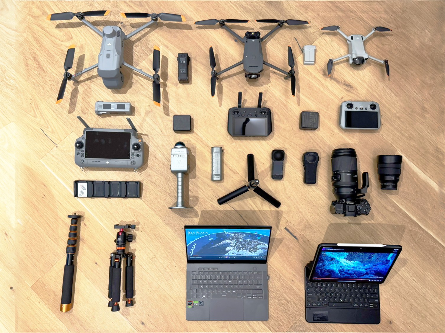
ArquiaVis Travel scanning equipment
Key technical details include:
Previous photogrammetry methods produced unwieldy digital meshes requiring extensive post-processing. 3DGS technology eliminated this issue while accurately capturing vegetation complexity.
Previous photogrammetry methods produced unwieldy digital meshes requiring extensive post-processing. 3DGS technology eliminated this issue while accurately capturing vegetation complexity.
.JPG)
Carlos Scanning (Photo by Dirce Medina)
.jpg)
Dirce Operating Drone (Photo by Carlos BM)
The team employed specific techniques to maximize data quality in this challenging environment:
The team was surprised by how effectively the technology captured dynamic elements: "When we first reached the waterfall and river rapids, we had no clear idea how the scene would ultimately translate into the digital model. It was a rewarding surprise to see that the LCC software rendered the motion of the water with a beautifully smooth, natural blur—similar to a long-exposure photograph, but in three dimensions", explained Carlos.
.png)
Carlos scanning (Photo by Dirce Medina)
The Project Successfully Addressed Several Field Challenges:
| Challenge | Solution | Result |
| Dense vegetation | 3DGS processing algorithms | Accurate plant representation without mesh complexity |
| Variable lighting | Scheduled capture during overcast conditions | Consistent texture quality across environments |
| Remote location | Lightweight, autonomous equipment | Complete capture despite difficult terrain |
| Moving elements | Dynamic capture capabilities | Realistic representation of flowing water |
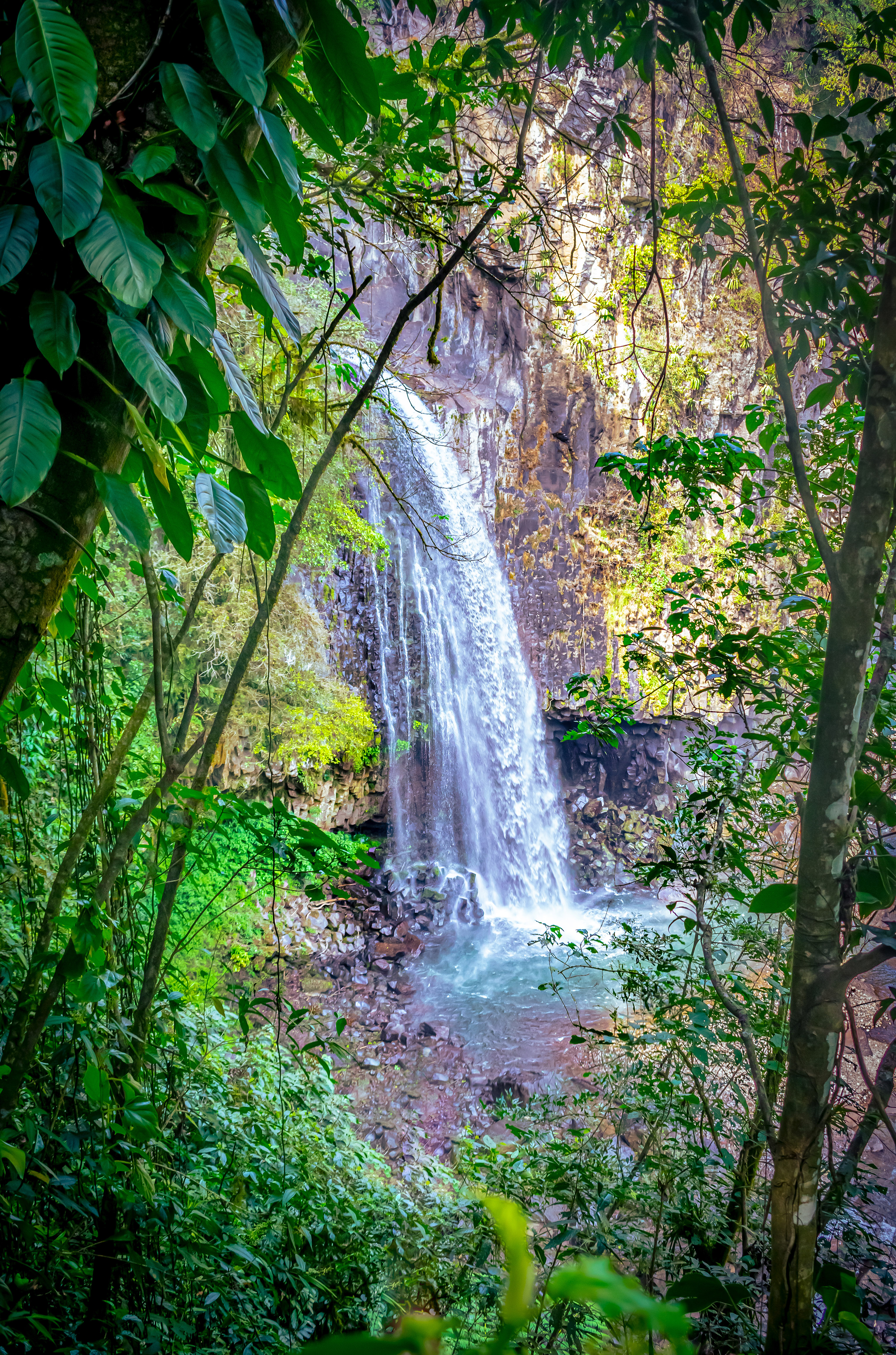
Waterfall Photo by Carlos Bausa
The digital twin created through this process enables:
The ArquiaVis team believe that creating online virtual tours is "one of the most effective ways to showcase remote locations and make them accessible to a global audience".
For conservation organizations, government agencies, and technical teams looking to implement similar projects:
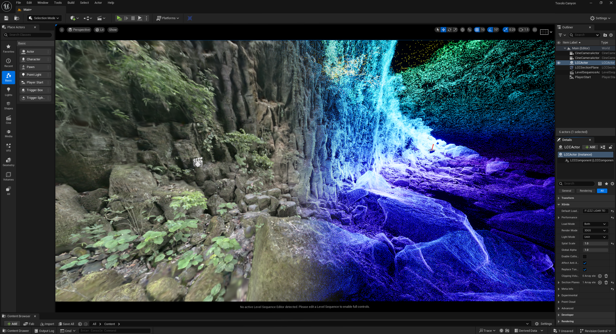
Unreal screenshot
The Veracruz project represents just one facet of ArquiaVis's broader vision. Founded by Carlos Bausa Martinez, an architect specialized in sustainable design and photographer, ArquiaVis captures the essence and stories of diverse spaces—from historical buildings like London's iconic architecture to natural environments affected by climate change.
ArquiaVis's portfolio extends across continents and contexts:
The team's approach breaks free from the constraints of traditional photography, using 3D technologies to offer immersive, multi-perspective experiences that connect viewers with spaces in entirely new ways.
By bringing Mexico's hidden waterfall and countless other threatened ecosystems into digital form with such fidelity, we expand the circle of those who can know these places, who can advocate for their protection, and who can ensure that when future generations ask what once existed in these forests, we can show them more than just photographs and statistics.
See how XGRIDS technology and ArquiaVis's vision come together to preserve our world's most precious places. Visit www.arquiavis.com to explore their complete portfolio of international projects and learn how similar approaches could be applied to conservation challenges in your region.
Reality capture let Netflix's Monster scout 35 Italian locations in four days with PortalCam, then plan shots remotely through virtual scouting of 3DGS scans.
.png?x-oss-process=image/resize,w_800/quality,Q_50)
A one-hour Lixel K1 scan of six Culver City blocks gave a generative film pipeline the fixed geometry it needed to keep six locations consistent.

Handheld 3DGS by PortalCam helped CyArk document three landmark interiors for America 250, solving mirror reflections and low-light field challenges.

Handheld 3D capture brings real museum spaces to LED volumes, replacing green screens and photogrammetry for fast, cinematic virtual camera moves.