
Case Studies
Virtual Pre-Production for Netflix's Monster: The Lizzie Borden Story.
Reality capture let Netflix's Monster scout 35 Italian locations in four days with PortalCam, then plan shots remotely through virtual scouting of 3DGS scans.
Atlıhan Surveying Engineering reduced project delivery time from days to hours by integrating XGRIDS Lixel L2 Pro handheld LiDAR with terrestrial scanners, enabling 1,000 m² documentation in just 7 minutes while maintaining 2-3cm accuracy.
Executive Summary: Atlıhan Surveying Engineering reduced project delivery time from days to hours by integrating XGRIDS Lixel L2 Pro handheld LiDAR with terrestrial scanners, enabling 1,000 m² documentation in just 7 minutes while maintaining 2-3cm accuracy.
| Decision Criterion | Terrestrial Scanner | XGRIDS L2 Pro |
| Typical field speed | Hours to days, requires expert setups | 1,000 m² in 7 min (0.9 m/s, walk and scan) |
| Accuracy delivered | Sub-cm | 2-3 cm—acceptable for plans/sections |
| Output options | Point cloud only | Point cloud + photorealistic 3D via LCC |
| Investment required | High | Significantly lower, faster pay-off |
Atlıhan Surveying Engineering Construction Co., Turkey's official XGRIDS distributor, faced increasing client demands for rapid 3D documentation while maintaining surveying accuracy standards. Traditional terrestrial laser scanning delivered precision but created bottlenecks:
XGRIDS Lixel L2 Pro Applications:
Terrestrial Scanners (Leica RTC360) Applications:
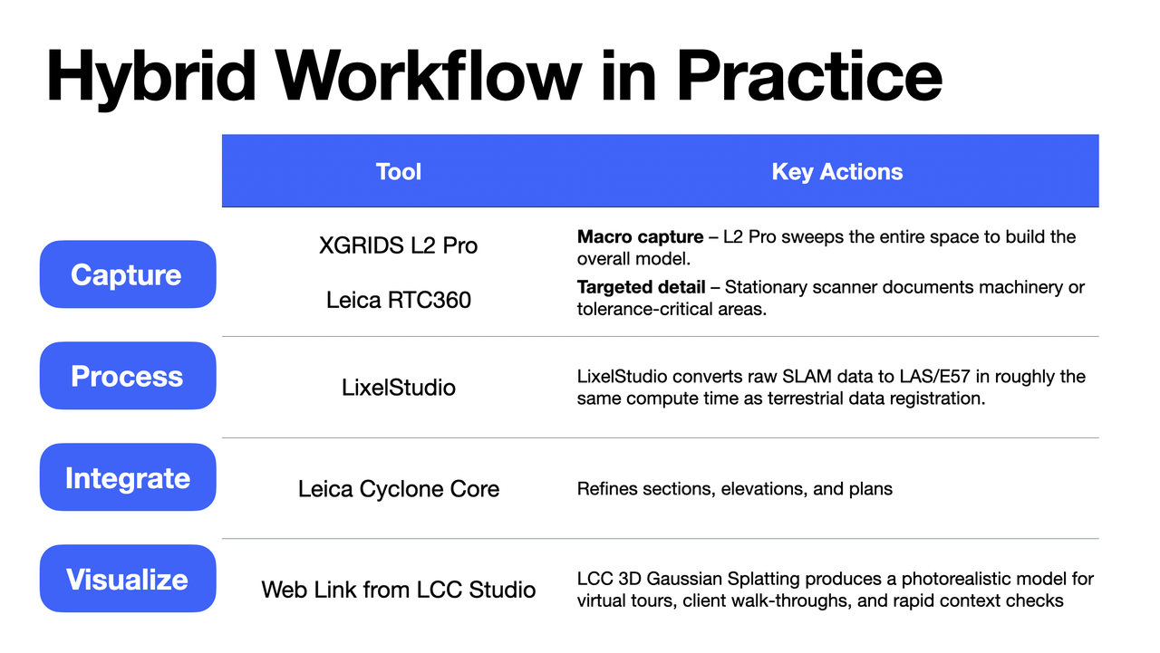
| Hybrid Workflow in Practice | ||
| Stage | Tool | Key Actions |
| Capture | XGRIDS L2 Pro Leica RTC360 | Macro capture – L2 Pro sweeps the entire space to build the overall model. Targeted detail – Stationary scanner documents machinery or tolerance-critical areas. |
| Process | LixelStudio | LixelStudio converts raw SLAM data to LAS/E57 in roughly the same compute time as terrestrial data registration. |
| Integrate | Leica Cyclone Core | Refines sections, elevations, and plans |
| Visualize | Web Link from LCC Studio | LCC 3D Gaussian Splatting produces a photorealistic model for virtual tours, client walk-throughs, and rapid context checks |
"If [clients] require high detail level and millimeter-grade accuracy - and have ample time - I recommend terrestrial scanners. But for large work areas where speed and cost-efficiency are prioritized, and 2-3 cm accuracy is sufficient, I suggest handheld solutions," explains Okan Atlıhan, Surveying Engineer at Atlıhan Surveying.
Project Metrics:
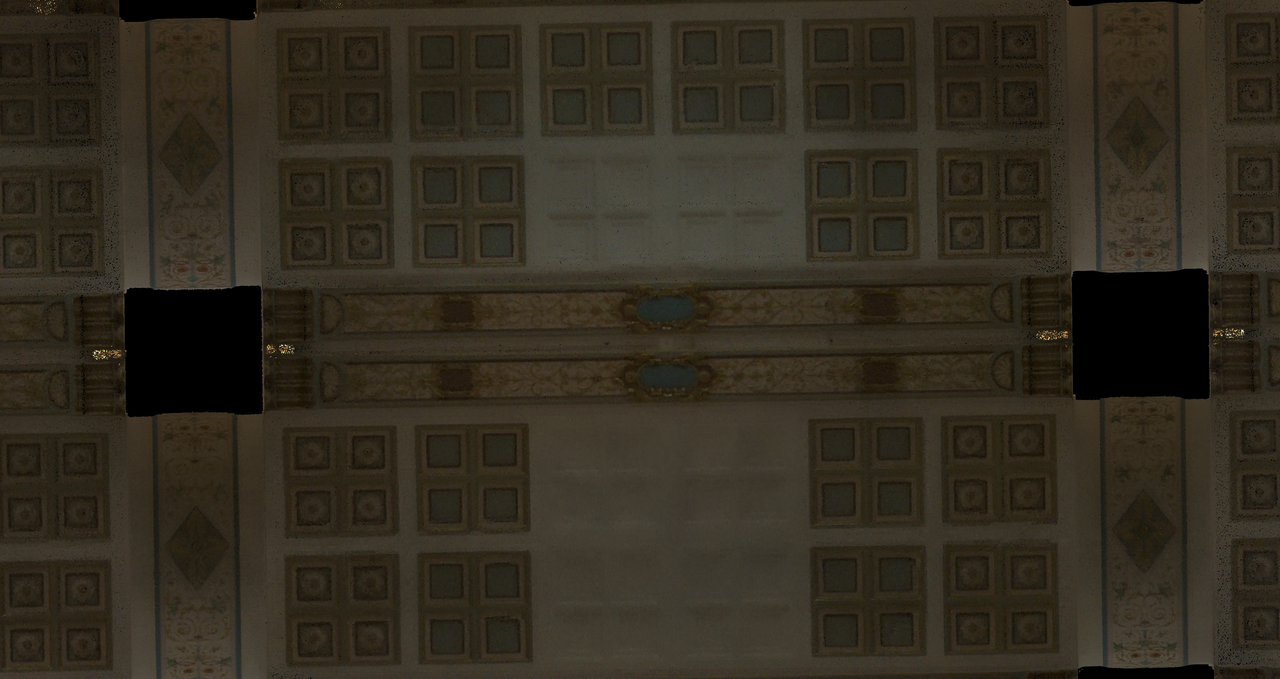
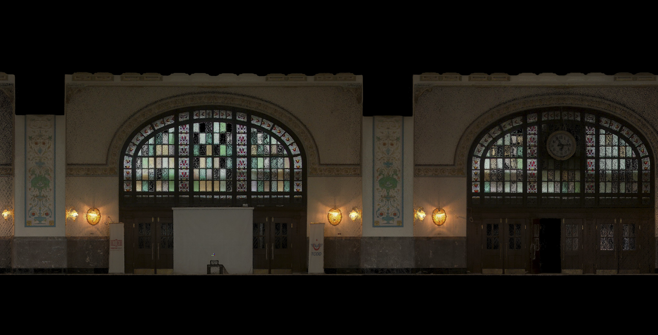
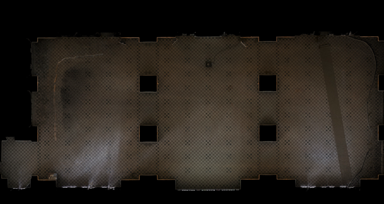
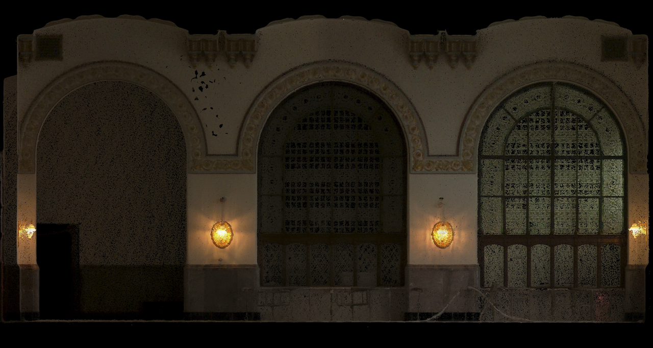
Quality Assessment: "Despite the high ceilings, the data quality remained satisfactory... This indicates that the data has been processed correctly and is free of geometric errors," notes Atlıhan.
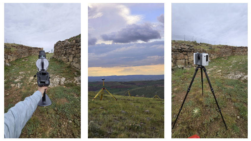
An academic partnership with Zemastek for scientific research documentation at the Kerkenes archaeological site gave Atlıhan an opportunity to execute a hybrid workflow on a large-scale, outdoor site.
Methodology:
Initial Feedback: "He was very impressed with both the hardware's usability and the software," with full evaluation pending.
The integration delivered measurable improvements across three key areas:
Economic Efficiency: Equipment investment proved "significantly more economical and at an affordable level" compared to terrestrial-only approaches, enabling previously cost-prohibitive projects.
Market Expansion: Project scope expanded dramatically - "scanning large structures such as hotels, industrial facilities, forested areas, and bridges has become significantly easier and faster."
Client Satisfaction: Reception varies by experience level. Professionals are "genuinely impressed by the L2 Pro's data quality compared to typical SLAM solutions," while newcomers require education on accuracy expectations versus terrestrial capabilities, as they may initially expect millimeter-level precision from all scanning approaches.
Testing XGRIDS LCC technology on historical building with ornate details and challenging lighting revealed potential for widespread implementation.
Advantages:
Technical Requirements:
"When rapid documentation is required, one must compromise on precision surveying... If centimeter-level accuracy suffices, the L2 Pro delivers both speed and precision simultaneously."
Quality Assessment Criteria:
Atlıhan's hybrid approach demonstrates that handheld LiDAR doesn't replace terrestrial scanning—it strategically complements it. By matching technology to project requirements, they've achieved faster delivery without compromising quality needed for most applications.
The key insight: "Compared to stationary scanners, the most significant advantage is the speed factor - and consequently, more cost-effective solutions." This decision framework enables surveying firms to expand service offerings while controlling costs, particularly valuable as "XGRIDS products are more than just SLAM – they offer unique features like LCC and 3DGS, which you won't find in any other SLAM system."
Reality capture let Netflix's Monster scout 35 Italian locations in four days with PortalCam, then plan shots remotely through virtual scouting of 3DGS scans.
.png?x-oss-process=image/resize,w_800/quality,Q_50)
A one-hour Lixel K1 scan of six Culver City blocks gave a generative film pipeline the fixed geometry it needed to keep six locations consistent.

Handheld 3DGS by PortalCam helped CyArk document three landmark interiors for America 250, solving mirror reflections and low-light field challenges.

Handheld 3D capture brings real museum spaces to LED volumes, replacing green screens and photogrammetry for fast, cinematic virtual camera moves.