
Case Studies
Virtual Pre-Production for Netflix's Monster: The Lizzie Borden Story.
Reality capture let Netflix's Monster scout 35 Italian locations in four days with PortalCam, then plan shots remotely through virtual scouting of 3DGS scans.
Immersive tech is reshaping heritage access. At the LWL Open-Air Museum Detmold, historic buildings are often off-limits to protect them. To solve this, a student team used XGRIDS's Lixel Kity K1 & PortalCam to create a navigable, photorealistic 3D twin of the entire 90-hectare site in days. Visitors can now explore every corner on a 4-meter touchscreen, gaining a holistic understanding before setting foot outside. This "capture once, deploy everywhere" model—extending to VR and web—proves that cutting-edge spatial computing can make fragile history universally accessible without compromise. Thanks for Prof. Dr. Alexander Kutter, LWL-Freilichtmuseum Detmold and Volinga help.
At one of Europe's largest open-air museums, the most historically significant buildings are often the ones visitors can never enter. LWL Open-Air Museum Detmold turned this paradox into an opportunity: if physical doors must stay closed, digital space can remain open.
LWL Open-Air Museum Detmold spans 90 hectares with 120 historic buildings scattered across the landscape, documenting 500 years of Westphalian everyday culture. That scale creates a structural dilemma. Visitors can never see the entire site in one visit, and some of its most important buildings cannot be entered — conservation requirements, structural fragility, and safety regulations restrict physical access for visitors.
If physical access is limited, orientation becomes critical. The museum's new entrance area was designed to orient first-time visitors before they begin exploring. But how do you introduce a site that visitors cannot fully enter? Guided tours protect the collections but increase wear and staffing demands. Photo panels and videos fragment the experience or impose linear narratives. None conveys how 120 buildings across 11 landscapes connect as a whole.
This challenge becomes even more pronounced during the winter months. While the museum’s new exhibition building and entrance area remain open year-round, the outdoor site is closed for extended maintenance and to protect the historic structures from harsh weather. As a result, winter visitors have no way to perceive the scale, structure, or breadth of the museum as a whole, despite being physically present on site.
What the museum needed was a new form of orientation: one that helps visitors build a reliable mental map of scale, structure, and key spatial relationships without opening doors or visiting every building.
To address this, KreativInstitut.OWL developed an immersive, navigable digital twin of the entire museum site.
Rather than relying on manual 3D modeling, which is slow, costly, and often visually artificial, the team adopted a direct spatial capture workflow that preserved real-world scale, detail, and continuity.
Project setup
Team: 5 students supervised by Prof. Dr. Alexander Kutter
Capture
Processing and Rendering
Despite the toolchain including multiple devices, the workflow proved accessible to a small, non-specialist team. The student group had little to no prior experience with 3D spatial capture or Unreal Engine at the outset of the project, aside from limited support from a student with previous Unreal Engine exposure.
In a traditional workflow, achieving a decent level of density and texture quality would typically require a seasoned surveying team. By contrast, XGRIDS’ automated processing and intuitive hardware significantly lowered the barrier to producing industrial-grade digital output. All core steps, from capture to reconstruction and interactive deployment, were learned and executed within the project timeframe itself.
The on-site capture phase demonstrated a level of efficiency that would be difficult to achieve with conventional methods. Traditional static LiDAR workflows for a site of this scale would typically require weeks or even months of fieldwork, involving fixed tripods, repeated station setups, and potential disruption to visitor flow.
By adopting the XGRIDS Lixel Kity K1 and PortalCam, the team could conduct continuous, walk-through capture, compressing the capture timeline from weeks to days. The entire Paderborn Village sector was digitized within just two days. Individual buildings, including narrow interiors, upper floors, and poorly lit spaces, were captured in single on-site sessions lasting approximately three to four hours each.
Even under challenging environmental conditions, such as interiors without installed lighting, the capture process remained stable and predictable, allowing scanning to be completed without extended site closures or disruption to museum operations.
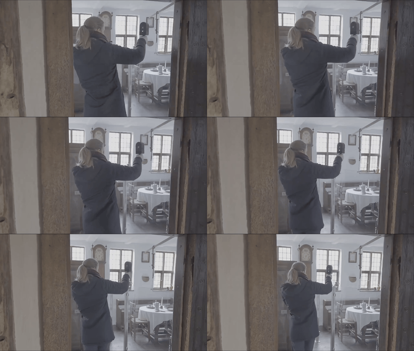
Scanning with PortalCam
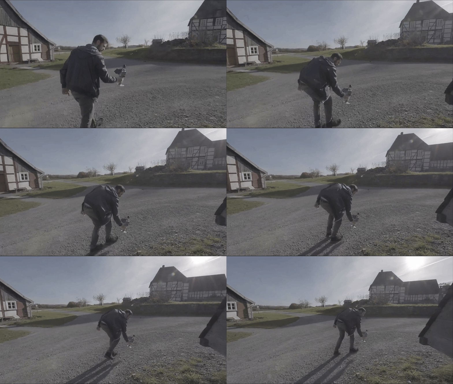
Scanning with Lixel Kity K1
Once the site had been captured, a deeper question emerged: how should this spatial knowledge actually be used by visitors?
The entrance area installation answers this with a navigable 3D model on a 4-meter screen controlled physically. Visitors move freely across the landscape, follow paths, and even enter normally off-limits interiors. Understanding is experiential rather than explanatory. Visitors grasp the museum’s scale by viewing it from above, understand spatial layouts by navigating through it, and trust its realism through meticulously crafted details. Even subtle touches — like seeing the pond surface at eye level alongside ducks — make the experience feel authentic and reliable.
The same captured environment powers multiple formats and extends beyond the entrance hall:
This "Create Once, Deploy Everywhere" approach transforms a static dataset into a living, long-term asset. This flexibility is inherent to the XGRIDS ecosystem: with an open LCC format and broad compatibility—ranging from native SDKs for Unreal Engine and Unity to partner tools like SuperSplat and Volinga—the technology ensures that data is never locked in, but remains ready for any future application.
The museum team explicitly described themselves as “especially happy and really impressed” by the visual fidelity and how effectively the infrastructure opens previously inaccessible spaces
Public launch is scheduled for mid-2026.

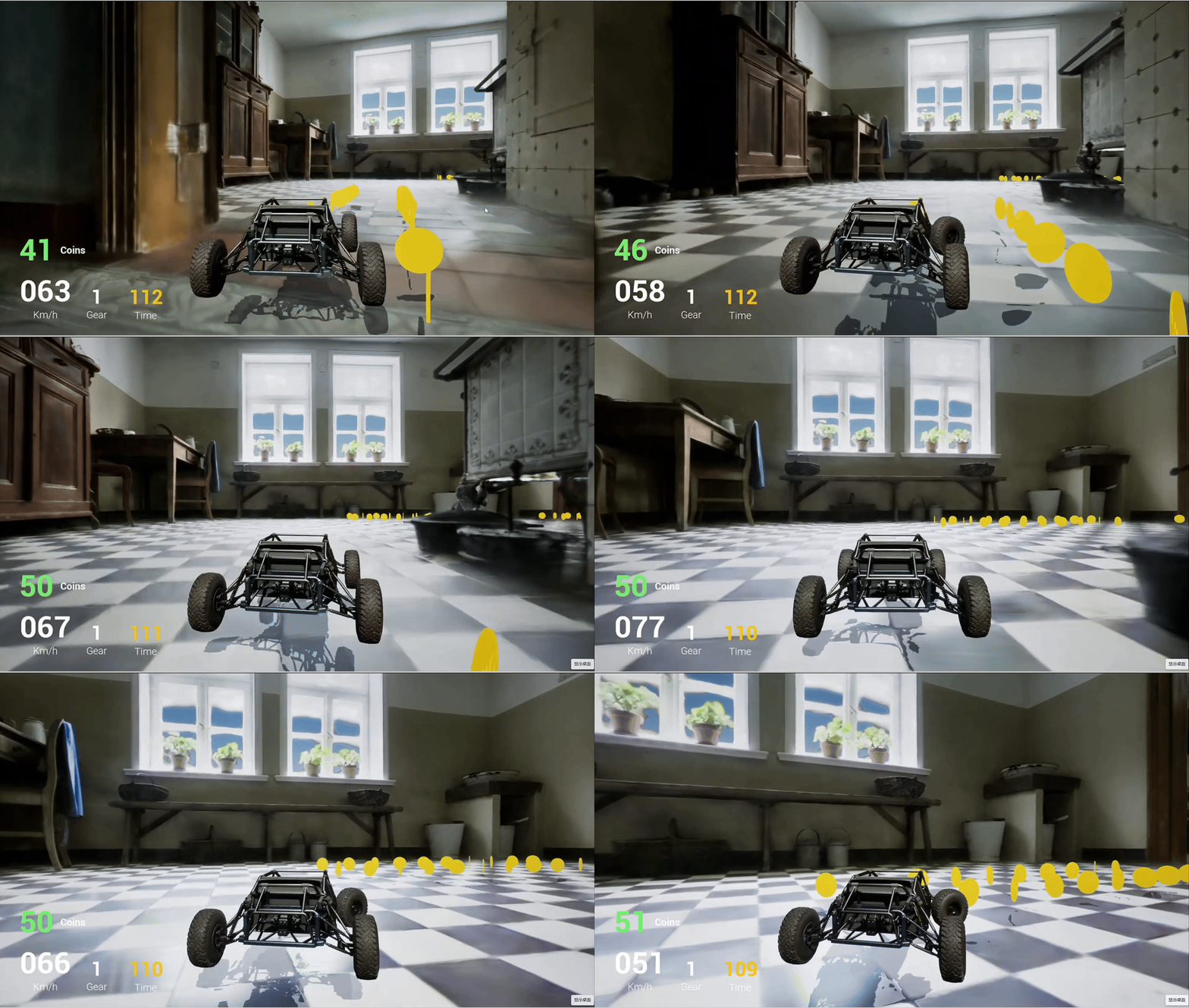
LWL Open Air Museum Detmold’s project demonstrates that restricted access no longer limits understanding. Visitors gain a holistic mental map before physically entering.
More importantly, this is not a one-off experiment. The workflow operates under real-world museum conditions, including limited staffing, mixed technical skill levels, operational constraints, and long-term public use requirements. Capture, reconstruction, and deployment were completed within a predictable timeline using a stable, repeatable pipeline that supports multiple platforms without duplication of effort.
For heritage institutions worldwide facing similar preservation and accessibility challenges, this project offers a validated reference. It demonstrates how the physical limits of historic sites can be addressed through cutting-edge technologies, transforming a single capture into durable infrastructure that supports orientation, education, and long-term engagement.
Spatial technologies by XGRIDS: https://www.xgrids.com/intl
LWL Open-Air Museum Detmold: https://www.lwl-freilichtmuseum-detmold.de/en/
KreativInstitut.OWL: https://kreativ.institute/en/
Reality capture let Netflix's Monster scout 35 Italian locations in four days with PortalCam, then plan shots remotely through virtual scouting of 3DGS scans.
.png?x-oss-process=image/resize,w_800/quality,Q_50)
A one-hour Lixel K1 scan of six Culver City blocks gave a generative film pipeline the fixed geometry it needed to keep six locations consistent.

Handheld 3DGS by PortalCam helped CyArk document three landmark interiors for America 250, solving mirror reflections and low-light field challenges.

Handheld 3D capture brings real museum spaces to LED volumes, replacing green screens and photogrammetry for fast, cinematic virtual camera moves.