
Case Studies
Virtual Pre-Production for Netflix's Monster: The Lizzie Borden Story.
Reality capture let Netflix's Monster scout 35 Italian locations in four days with PortalCam, then plan shots remotely through virtual scouting of 3DGS scans.
Overcoming traditional challenges in reverse modeling, Lixel L1 offers real-time modeling, high precision, and unparalleled portability.
With the promotion of the Construction and Promotion of the City Information Model (CIM) basic platform and the continuous deepening application of BIM technology in the construction industry, building reverse modeling of existing important buildings has been gradually carried out in various cities and regions since 2020s. The construction target market size of a single city exceeds 60 million USD. According to the "Accelerating the Application of Building Information Modeling (BIM) Technology" work plan released by a first-tier city in China, by the end of 2025, BIM models should be established and imported into the spatial platform for all important buildings, municipal infrastructure, and water engineering projects in the entire city.
In the buildings reverse modeling process, implementers often encounter problems such as missing or inaccurate original drawings of buildings. Traditional methods involve using diastimeters, total stations, laser rulers, etc., for measurements, combined with on-site photos for BIM modeling. This approach is inefficient and prone to errors.

With the development of new technologies, some users have started using handheld 3D laser scanning devices for scanning to BIM, aiming to efficiently acquire building point clouds to assist building reverse modeling. However, questions often arise during usage:
XGRIDS independently developed the handheld real-time 3D reconstruction device - Lixel L1. It innovatively introduces features such as real-time processing, real-time true color point cloud, photo-point cloud comparison, providing a more efficient method for scanning to BIM.
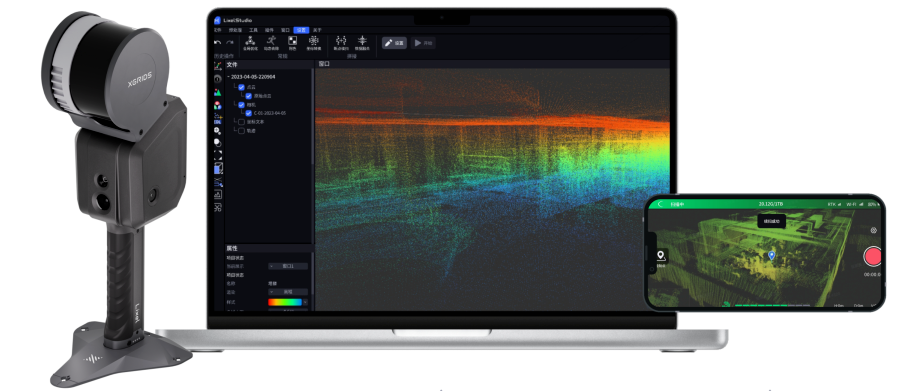
LixelL1+LixelStuio+LixelGo
Lixel L1 features real-time modeling, high precision, and portability. It does not require a separate battery or computer attachment, making it easy for beginners to use, enabling the rapid acquisition of high-precision point clouds and images of buildings, parks, and important facilities.

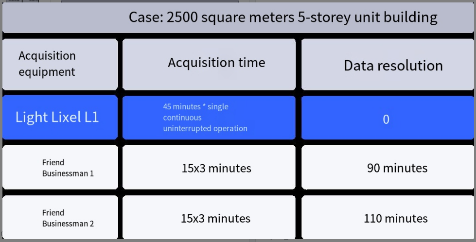
| Case: 2500 square meters 5-storey unit building | ||
| Acquisition equipment | Acquisition time | Data resolution |
| Light Lixel L1 | 45 minutes * single continuous uninterrupted operation | 0 |
| Friend Businessman 1 | 15x3 minutes | 90 minutes |
| Friend Businessman 2 | 15x3 minutes | 110 minutes |
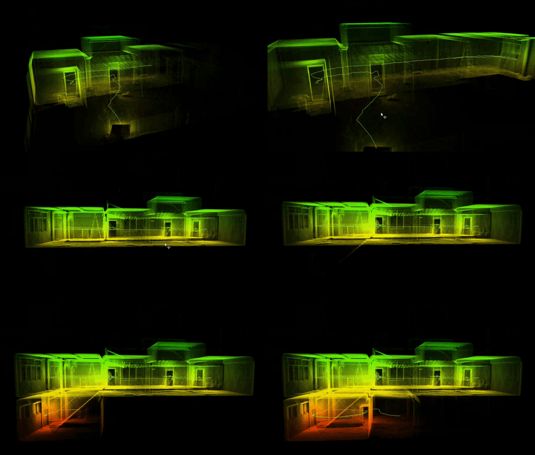
▲Point cloud processed in real-time
Lixel L1 is currently the only handheld 3D laser scanner on the market that can complete real-time processing and modeling inside the device. Point cloud data processed in real-time can be viewed instantly within the app, eliminating the need for lengthy post-processing time and avoiding rework caused by missed or incorrect data collection.
In addition to generating real-time true color point clouds, Lixel L1 also supports higher-density point clouds by post-prossing and colorization. The post-processed true color point cloud has clear details, accurate structure, and precise data, providing an accurate reference for further application.
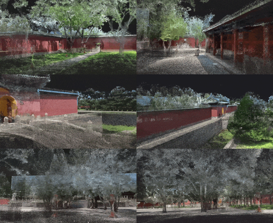
▲Color Point Cloud
If the true color point cloud does not meet your supreme persuit, LixelStudio,the 3D data intelligent processing software offers a "Photo-Point Cloud Comparison" data display method, overlaying point cloud data with panoramic images (the left). Users can select target areas for viewing on the small map (the right), greatly facilitating mapping, drawing and modeling work.
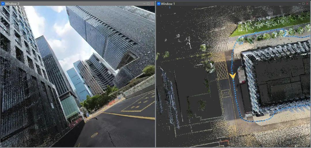
▲Photo-point cloud comparison for map drawing
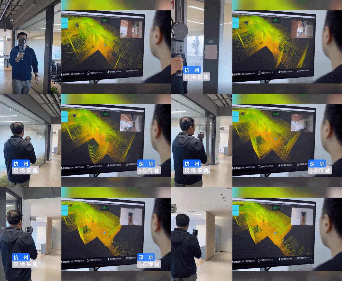
▲Collected data viewed from remote distance in real-time
In emergencies, how long does it take for lab work to obtain data collected in the field work? Lixel L1's answer is: 5 seconds! With the support of real-time processing, Lixel L1 can transmit collected data to lab work colleagues thousands of miles away in real-time, seamlessly connecting field work data collection and lab work processing.
The innovative Lixel series product family has brought a brand new efficient operation experience to the industry, helping our customers efficiently complete the implementation of BIM modeling for various government projects involving reverse modeling of existing buildings. Partnering with Shenzhen Wuce Spatial Information Co., Ltd. chose to directly use the real-time generated true color point cloud by Lixel L1 for existing building modeling, improving efficiency for both field and lab work simultaneously.
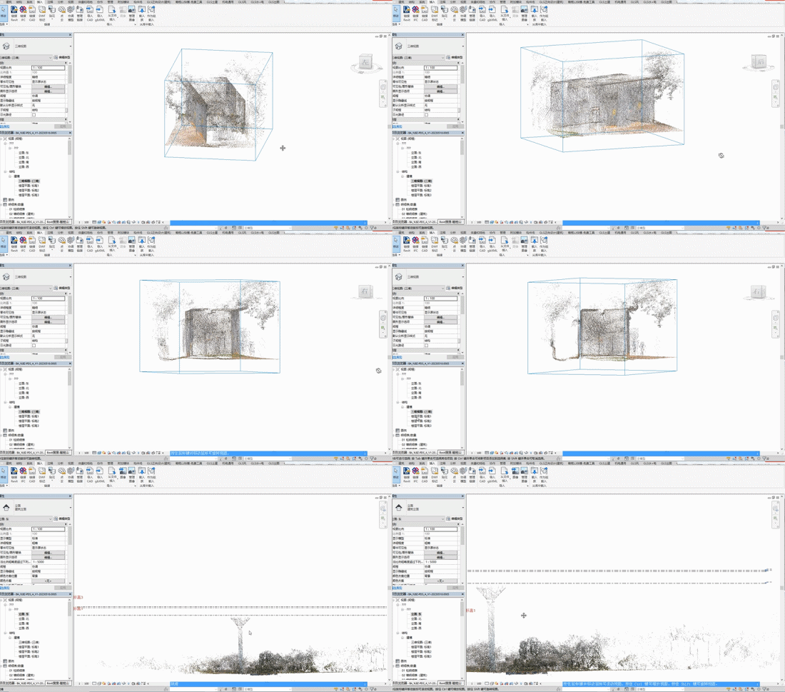
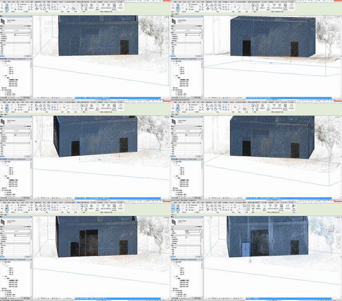
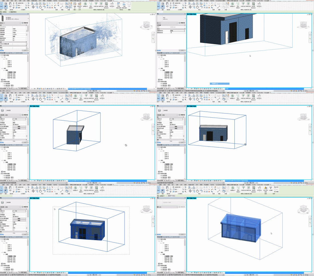
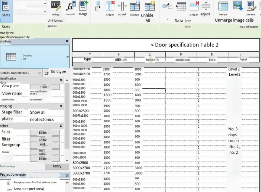
▲Deliverables Report
Lixel L1 integrates high-precision laser, vision, and inertial navigation modules, and is equipped with its independently developed Multi-SLAM algorithm. It efficiently conducts survey data collection and BIM model creation for existing buildings.
Reality capture let Netflix's Monster scout 35 Italian locations in four days with PortalCam, then plan shots remotely through virtual scouting of 3DGS scans.
.png?x-oss-process=image/resize,w_800/quality,Q_50)
A one-hour Lixel K1 scan of six Culver City blocks gave a generative film pipeline the fixed geometry it needed to keep six locations consistent.

Handheld 3DGS by PortalCam helped CyArk document three landmark interiors for America 250, solving mirror reflections and low-light field challenges.

Handheld 3D capture brings real museum spaces to LED volumes, replacing green screens and photogrammetry for fast, cinematic virtual camera moves.