
Case Studies
Virtual Pre-Production for Netflix's Monster: The Lizzie Borden Story.
Reality capture let Netflix's Monster scout 35 Italian locations in four days with PortalCam, then plan shots remotely through virtual scouting of 3DGS scans.
Cut property capture costs by up to 90% using 3D Gaussian splatting to deliver photorealistic browser-based spatial tours for real estate and hospitality.
Nucleus4D is a San Francisco spatial computing company serving real estate, hospitality, and venue clients across North America. It captures with XGRIDS PortalCam and publishes through its own browser-based platform, which reads the Lixel CyberColor (LCC) format.
The company has showcased more than 50 million square feet of property since launching in Q3 2025, raised a $1.5M pre-seed round in January 2026 backed by Antler and South Loop Ventures, and became the first 3DGS company approved to list immersive experiences inside Zillow.
As an authorized XGRIDS partner, Nucleus4D also sells and rents hardware, trains operators, runs capture services, and produces marketing content, giving North American clients a route into spatial capture without building the capability in-house.
Real estate has always sold spaces that buyers cannot easily visit. The tools for closing that gap have improved in resolution but not in kind. Photographs, video, and 360° panoramas each flatten a three-dimensional environment into a rectangle, and each commits you to the decisions made on shoot day. Change the staging, change the season, change the marketing angle, and you book another shoot.
Navjeet Chhina, Nucleus4D's co-founder and CEO, came at the problem from the production side. His previous studio built photorealistic digital twins using conventional 3D pipelines: six to eight months and hundreds of thousands of dollars per location, then roughly $2 per user-hour to stream from the cloud. The asset was expensive to make, expensive to deliver, and hard to reuse beyond the project that commissioned it.
"The legacy tools used previously were never designed to accurately represent physical space in a way that both people and machines could understand," Chhina said when the company announced its funding round.
3D Gaussian splatting reset the production economics. Chhina puts the reduction in time and cost at as much as 50-90% against his previous method, speaking on the PropMedia podcast in January 2026. Two problems remained: getting a reliable capture off the site quickly, and getting a photorealistic scene of a large property into a browser tab without a GPU and without a download.
Fast capture and low-friction delivery are the two things XGRIDS supplies. Nucleus4D uses both.
Before Nucleus4D built its platform, it put capture hardware through its paces: phones, DSLRs, custom rigs. Some were fast, others delivered quality. Capturing property at scale takes speed, fidelity, and a simple workflow together, and that combination is where the company landed on XGRIDS.
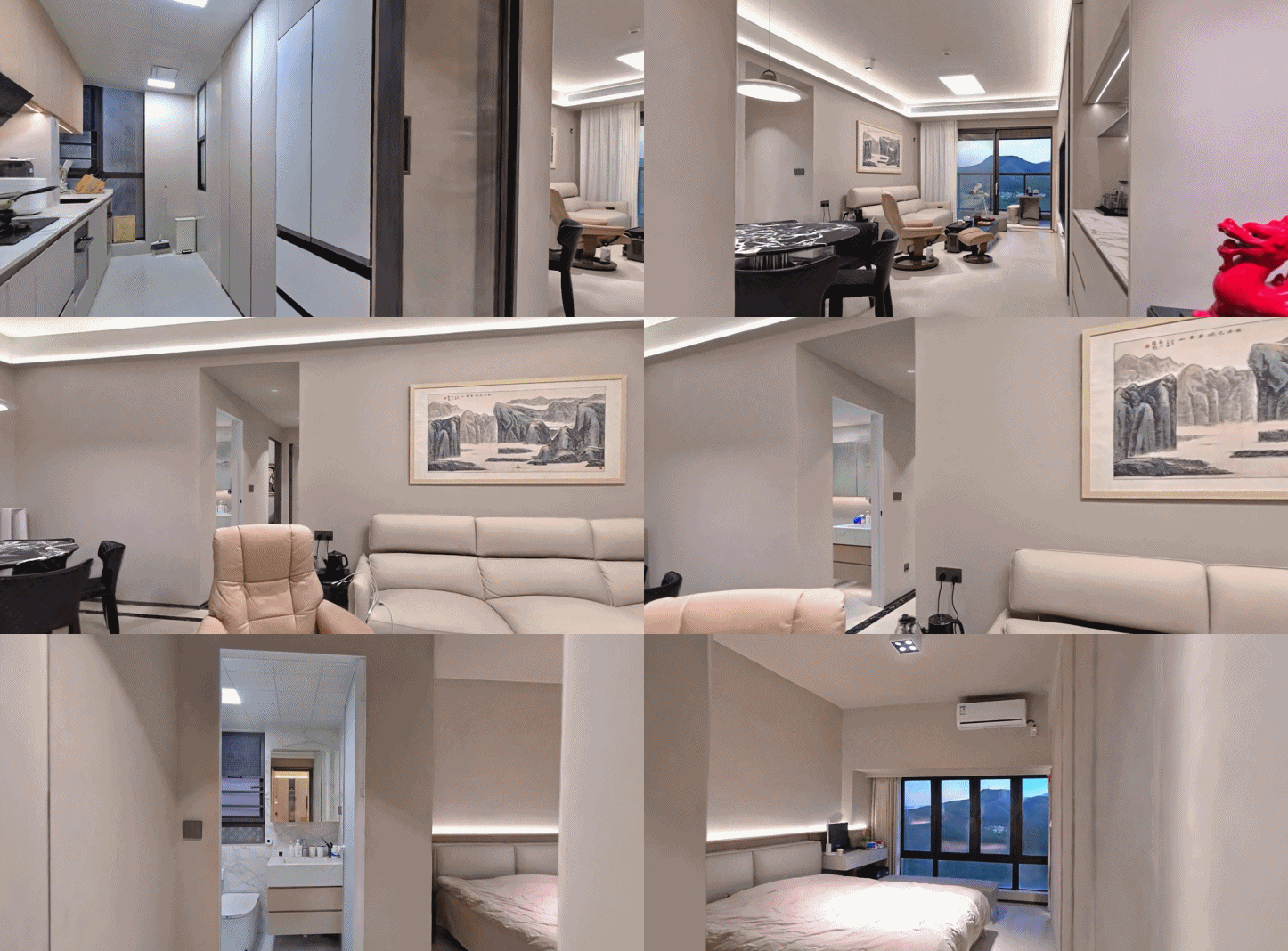
Using PortalCam, the company captured a 3,500-square-foot home—including both its interior and exterior—in 35 minutes, then distributed the resulting spatial experience through the Nucleus4D platform.
"Every building on Earth will have a digital twin, just like every business has a website. To get there, capturing physical spaces needs to be fast and frictionless."— Nucleus4D, August 2025
At six to eight months per location, that goal is unreachable. At 35 minutes per property, capture volume stops being the limiting factor.
.PNG)
On 11 November 2025, three months after the partnership began, XGRIDS published the LCC2 white paper and developer SDKs on GitHub, moving the format from a proprietary container to a documented, open one.
LCC2 addresses the condition most property tours are opened in: a large scene, a phone, a cellular connection. The format streams progressively, loading only the part of the property in view and fetching the rest as the viewer moves, and it holds files at roughly 90% smaller than equivalent PLY exports. A buyer taps a link and walks through the house without a download, an app installed, or dedicated graphics hardware, and gets the same experience in Chrome on a laptop or Safari on a phone.
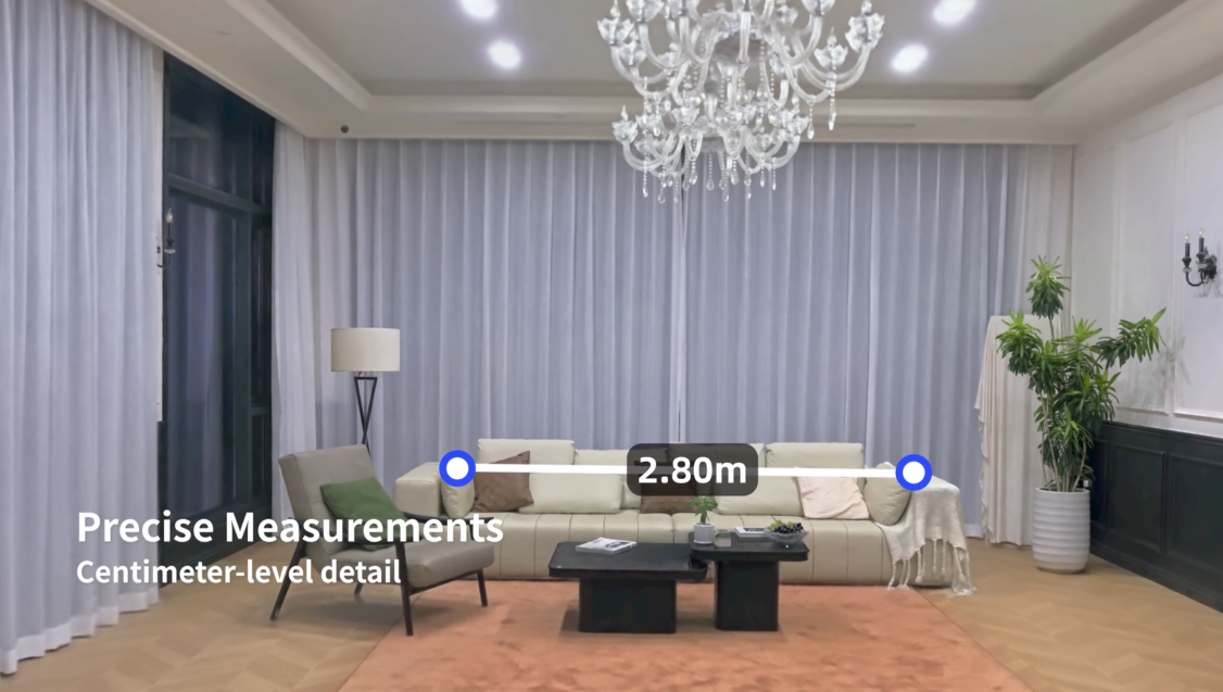
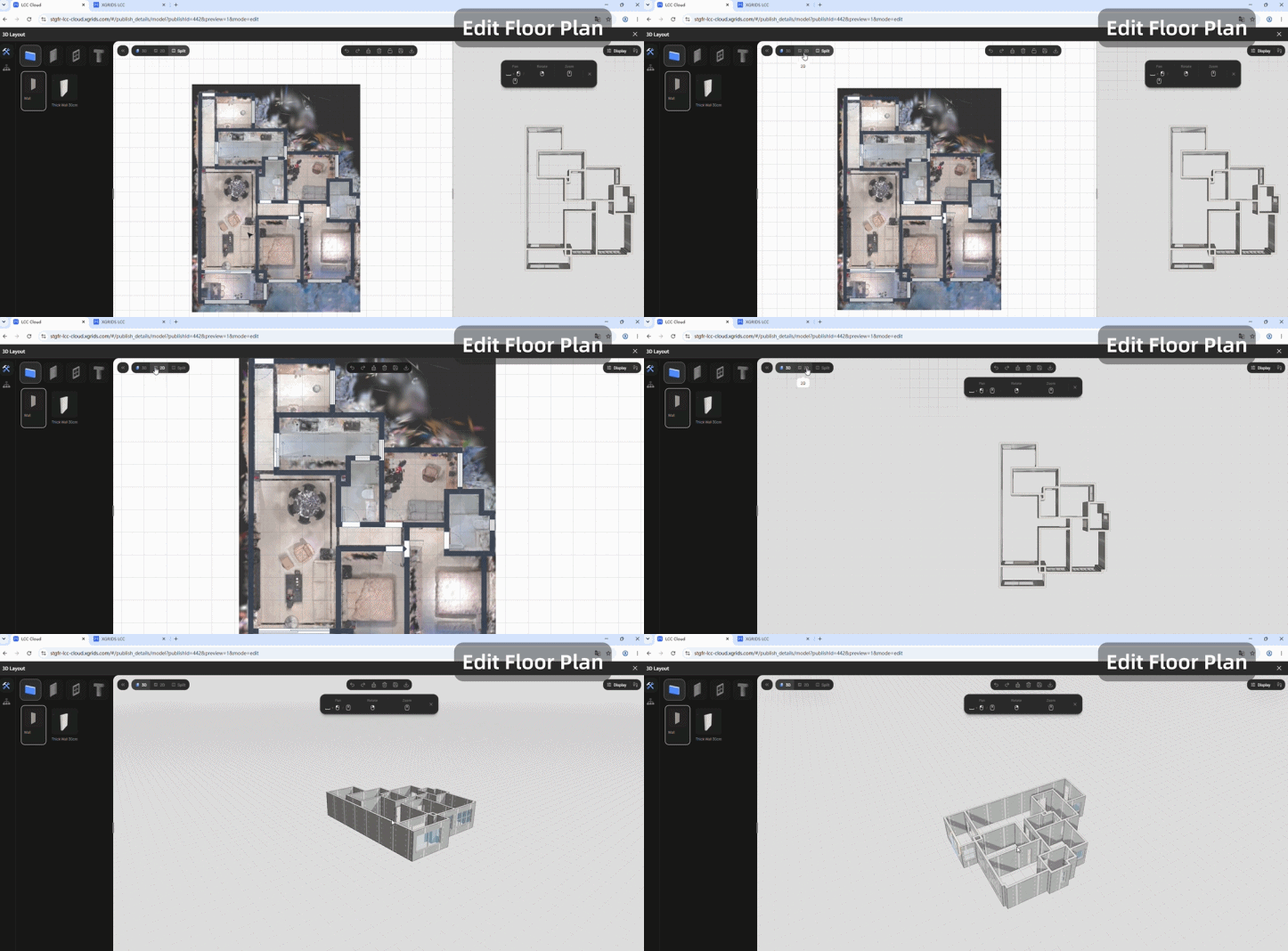
LCC2 also makes a tour useful beyond being viewable: geometry for measuring a room, collision data that lets someone walk a floor plan instead of orbiting a model, and access controls so a listing can be shared with a specified client and not the open internet.
Nucleus4D had already chosen XGRIDS hardware for capture performance. The open format meant one of the viewers in its platform could read the data directly.
A Nucleus4D capture session is a walk. An operator carries a PortalCam, a handheld spatial camera combining LiDAR, a four-camera system, and onboard AI processing, through the property. Everything after the capture involves data alone, without trips back to the property.
From a single capture, Nucleus4D produces:
| Deliverable | What it replaces |
| Self-guided tour | 360° virtual tour, node-based walkthrough |
| Live Guided Tours | In-person showing for remote clients |
| Cinematic video | Virtual Video Shoot |
| Floor plan | Separate floor plan draw-up |
| Measurements | On-site measurement visit |
| Intelligent Spaces | Static feature sheets and callouts |
Target turnaround is 24 to 48 hours from complete capture data.
The self-guided tour offers free navigation rather than node-hopping. Users move continuously through the space instead of jumping between fixed 360° bubbles, with reflections, lighting, textures, and shadows preserved as captured. The capture is not confined to interiors either. The yard, the street frontage, and the surrounding neighborhood weigh on any buying decision, and a 3DGS tour carries them the same way it carries the living room.
Live Showcase puts an agent and up to ten clients inside the same environment simultaneously, in a session structured like a video call held inside the property. Intelligent Spaces layers interactive hotspots onto the geometry: furnishing details, clickable links, audio, and advertising placements anchored to the objects they describe.
Virtual Video Shoot works because the scene is a navigable 3D environment and not recorded footage. Virtual cameras can be positioned and repositioned indefinitely, so new cinematic clips and stills can be cut from the same capture months later, for a different season, a different platform, or a different buyer profile, without returning to the property. A capture made for a listing stays useful after the listing closes.
For real estate media companies, one operator spends well under an hour on site and every deliverable the client ordered comes out of the same data. That improves the margin on each job as well as the quality of the output.
A platform does not, by itself, get a North American brokerage to adopt spatial capture. Someone has to put a camera in an operator's hands and teach them to use it.
As an authorized XGRIDS partner, Nucleus4D operates a service layer around the product line that lets clients enter at whatever level of commitment fits the work in front of them:
| Service | Barrier removed | Fits |
| Hardware sales | — | Teams with steady in-house capture volume |
| Hardware rental | Capital outlay per unit | Project-based or seasonal capture needs |
| Operator training | No in-house technical skill | Teams building their own capture capability |
| Capture services | No interest in owning or operating equipment | Clients who want deliverables, not a workflow |
| Marketing content production | No 3D content team | Clients needing campaign-ready output |
Taken together, the tiers cover the full path from capture to delivered application: equipment and the training to run it, or a crew who handles the scan, then processing, hosting, publishing, and campaign-ready content on the other side. A client can hand over the whole workflow or take on as much of it as they want.
Clients can move between tiers. A brokerage can commission a single capture as a service, move to rental during a busy quarter, then buy hardware and take training once volume justifies owning equipment. Each step is reversible, and none requires committing to a technology stack before knowing whether the output performs in the market.
Nucleus4D's client base spans hotels, event venues, residential homes, rentals, and commercial developments. The service tiers are what make that range serviceable from one company.
Nucleus4D built its own viewer layer, and the platform runs more than one renderer. One of them reads LCC2 directly.
On that path, LCC2 handles delivery: progressive streaming, so a large house opens on a phone, measurable geometry, a walkable floor plan, and access control on the link.
An open, documented format means the data is not the differentiator. Any developer can read the white paper, build against the SDKs, and ship against the same specification.
What Nucleus4D shows is what gets built on top. A property platform with features specific to how North American real estate actually works, and a service business that meets clients at whatever level of technical commitment suits them. Both were built on a foundation available to anyone in the XGRIDS partner network.
Capture requirements, publishing expectations, and buyer behavior differ across residential real estate, hospitality, construction, and cultural venues, and across regions. An open format lets each of those be solved locally, by teams who know the market, without waiting for a single vendor to build it for them.
Developers — LCC white paper · Web SDK · Unity SDK · developer portal
Prospective partners — XGRIDS Global Partner Program
Talk to Nucleus — nucleus4d.com
Reality capture let Netflix's Monster scout 35 Italian locations in four days with PortalCam, then plan shots remotely through virtual scouting of 3DGS scans.
.png?x-oss-process=image/resize,w_800/quality,Q_50)
A one-hour Lixel K1 scan of six Culver City blocks gave a generative film pipeline the fixed geometry it needed to keep six locations consistent.

Handheld 3DGS by PortalCam helped CyArk document three landmark interiors for America 250, solving mirror reflections and low-light field challenges.

Handheld 3D capture brings real museum spaces to LED volumes, replacing green screens and photogrammetry for fast, cinematic virtual camera moves.