
Case Studies
Virtual Pre-Production for Netflix's Monster: The Lizzie Borden Story.
Reality capture let Netflix's Monster scout 35 Italian locations in four days with PortalCam, then plan shots remotely through virtual scouting of 3DGS scans.
XGRIDS’ partner deployed the Lixel L2 Pro handheld 3D scanner, enabling high-precision mapping to support project validation and acceptance.
Underground utility corridors, often referred to as the "lifelines" of a city, house essential infrastructure such as electricity, telecommunications, and water supply systems. These complex networks require accurate surveying and mapping for both construction and maintenance.
Following the completion of a 8-kilometer-long underground pipe corridor in Ningbo, a comprehensive as-built survey was required. With an average depth of 15–20 meters below ground, the project presented significant technical challenges. To tackle this, XGRIDS’ partner deployed the Lixel L2 Pro handheld 3D scanner, enabling high-precision mapping to support project validation and acceptance.
The pipe corridor, measuring just 1.3 meters in width, presented significant mobility constraints. Traditional total stations were difficult to position, requiring frequent relocations that slowed down the survey process.
With its long, repetitive structure and lack of distinct reference points, the underground corridor posed challenges for SLAM-based mapping, making it prone to trajectory drift and data misalignment.
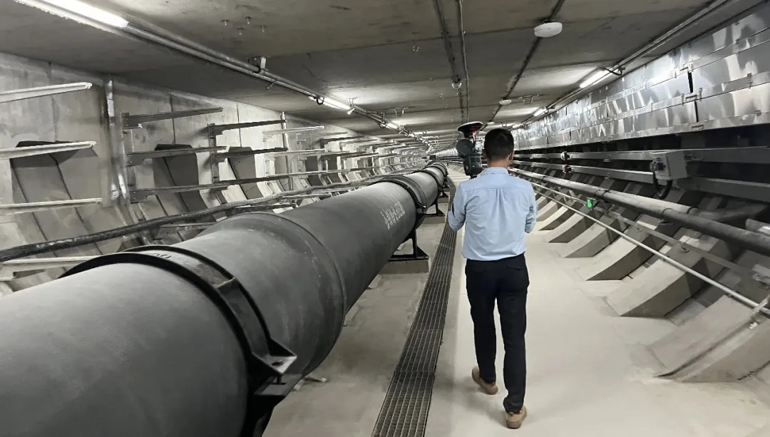
Surveying 8 kilometers using conventional total stations would require extensive time and labor. Additionally, long-distance scanning in a mobile SLAM workflow risks error accumulation, affecting overall data accuracy.
As XGRIDS' flagship handheld scanning device, the Lixel L2 Pro leverages its proprietary Multi-SLAM algorithm to enhance scene adaptability and mapping reliability. Even in sparse-feature environments like underground pipe corridors and tunnels, it ensures stable and accurate mapping.
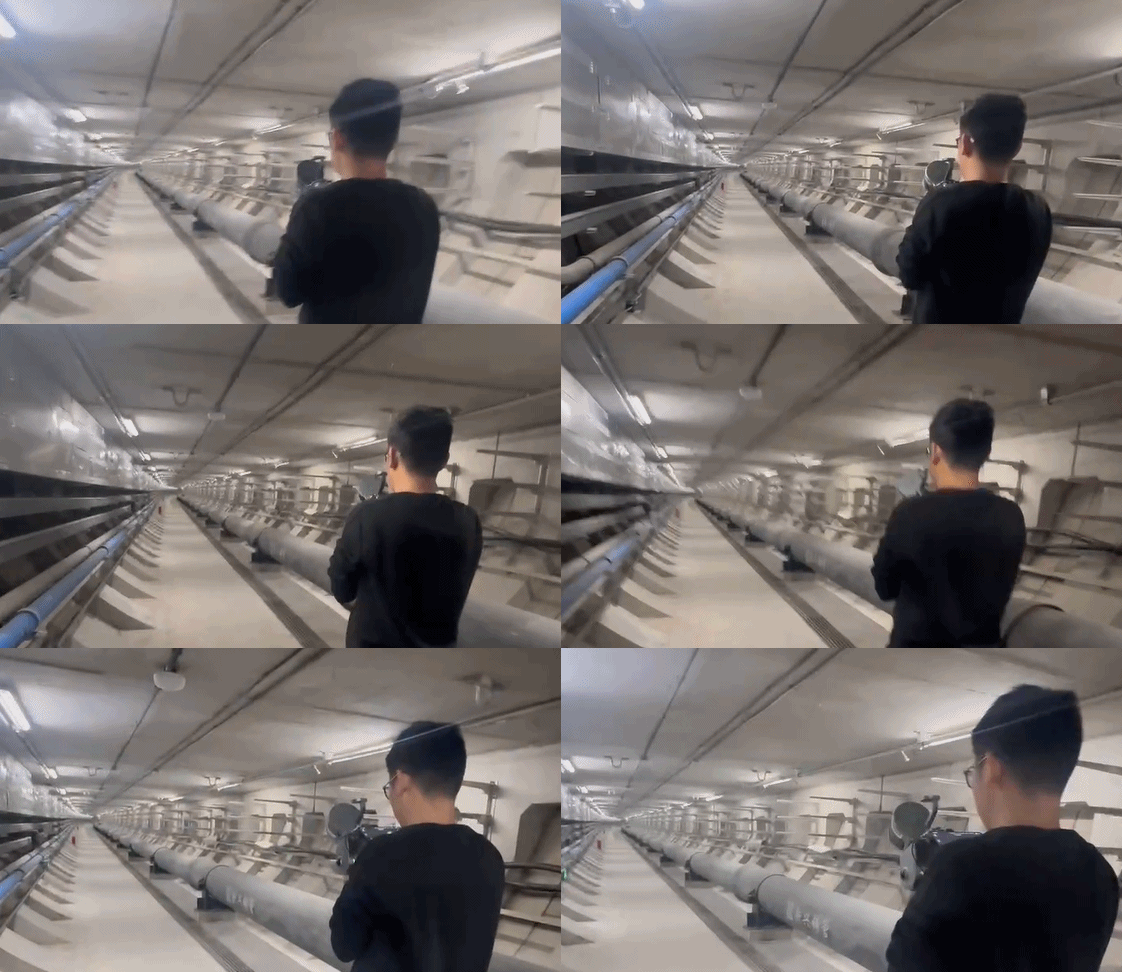
To ensure positional accuracy, ground control points (GCPs) were projected into the underground corridor using a laser vertical alignment instrument. A total of 75 control points (placed every 100 meters) were established along the 8km scanning path, allowing the relative coordinate system to be converted into an absolute coordinate system via total station survey.
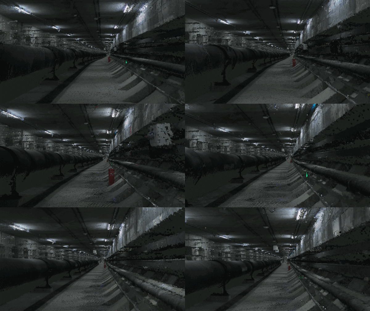
The corridor was divided into 13 sections, with data collected in segments using the Lixel L2 Pro. The real-time color point cloud provided instant feedback, ensuring no drift or misalignment before completing the scan of each section.
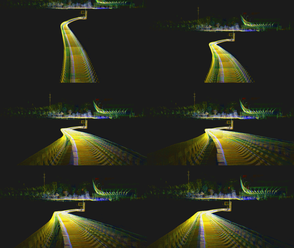
Point cloud data was processed in LixelStudio, ensuring precise alignment with no layering or misalignment. The color point cloud provided a detailed and realistic reconstruction of the underground environment, allowing all corridor features to be visualized clearly.
The processed point cloud was converted to RCS format in LixelStudio, enabling direct import into CAD software for floor plan drawing. The color point cloud helped distinguish structures, reducing object recognition errors.
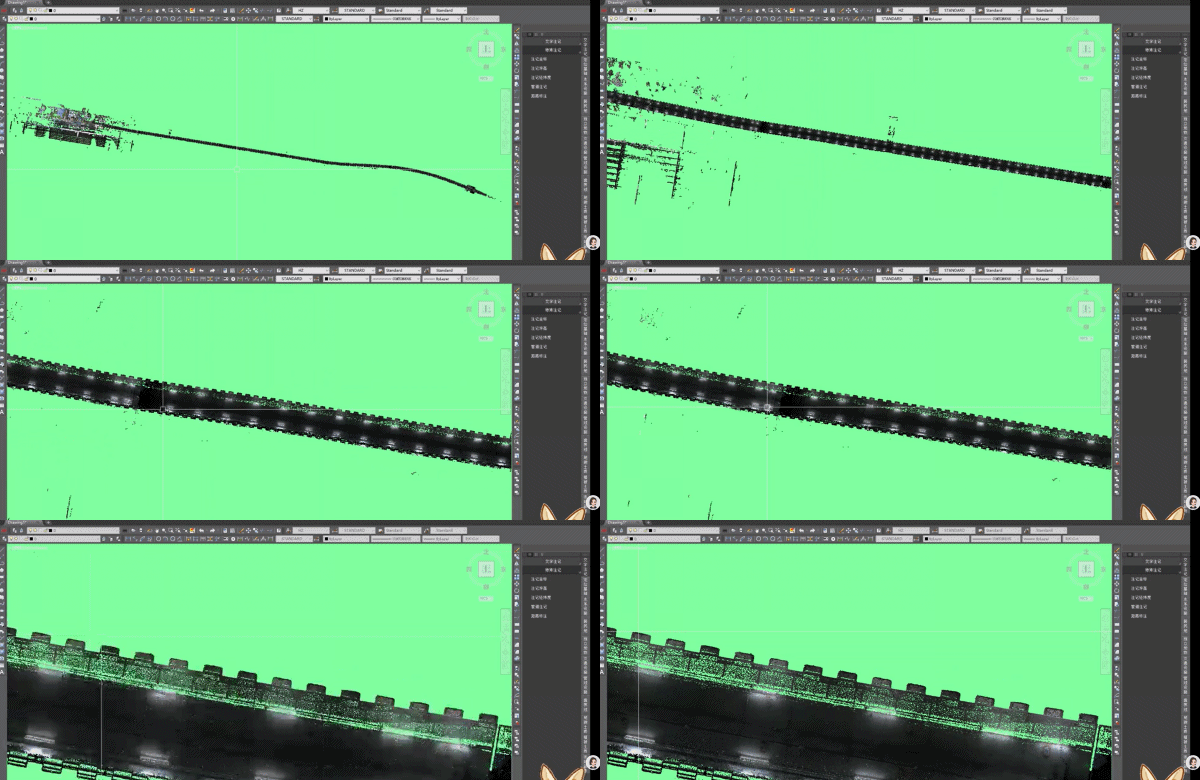
The Lixel L2 Pro combines LiDAR and visual sensors for Multi-SLAM positioning, maintaining stability in sparse-feature, repetitive structures without requiring manually placed feature points. No drift, no misalignment with the deliverables, and data accuracy meet high-standard underground mapping requirements.
Designed as a handheld device, the Lixel L2 Pro eliminates the need for station setups or frequent repositioning, making it ideal for tight spaces like pipe corridors. Unlike total stations that struggle with obstructions, the Lixel L2 Pro ensures seamless data capture with full structural coverage.
The real-time point cloud can be reviewed instantly via mobile phones and laptops, allowing users to validate the scans of key areas on-site. With LixelStudio, post-processing is streamlined—data is directly output in RCP format, ready for CAD integration, minimizing data processing time and maximizing workflow efficiency.
The client praised the Lixel L2 Pro for its stability and accuracy in the sparse-feature pipe corridor environment. Compared to traditional methods, the real-time handheld LiDAR scanner significantly improved efficiency while maintaining high precision. The final dataset was well-received by project stakeholders, acknowledging its value in expediting the project acceptance process.
The Lixel L2 Pro handheld scanner has proven to be a game-changer for underground infrastructure mapping, delivering a fast, accurate, and efficient alternative to traditional methods. By eliminating complex station setups and integrating seamlessly with CAD workflows, it is redefining how large-scale underground projects are surveyed and documented.
Discover how XGRIDS technology is transforming geospatial mapping and underground surveying. Visit www.xgrids.com for more details.
Reality capture let Netflix's Monster scout 35 Italian locations in four days with PortalCam, then plan shots remotely through virtual scouting of 3DGS scans.
.png?x-oss-process=image/resize,w_800/quality,Q_50)
A one-hour Lixel K1 scan of six Culver City blocks gave a generative film pipeline the fixed geometry it needed to keep six locations consistent.

Handheld 3DGS by PortalCam helped CyArk document three landmark interiors for America 250, solving mirror reflections and low-light field challenges.

Handheld 3D capture brings real museum spaces to LED volumes, replacing green screens and photogrammetry for fast, cinematic virtual camera moves.