
Case Studies
Virtual Pre-Production for Netflix's Monster: The Lizzie Borden Story.
Reality capture let Netflix's Monster scout 35 Italian locations in four days with PortalCam, then plan shots remotely through virtual scouting of 3DGS scans.
Recurring Stope Monitoring in an Active Underground Mine, Chile
Recurring Stope Monitoring in an Active Underground Mine, Chile
Partner:Engineering PR · Pablo Reyes, CEODealer:GEOCOM Chile
Chile is the world's top copper producer, accounting for 24% of global copper output, and mining contributes approximately 12% of the country's GDP while generating 57% of total exports. The sector has been the highest recipient of foreign direct investment in Chile since 2022, with $83 billion in mining projects planned for 2024–2033.
Much of that investment is going underground. As surface deposits deplete and ore grades decline, major producers like Collahuasi are transitioning from open pit to underground operations. Underground mining brings a specific surveying challenge: stopes — the open cavities left after ore extraction — must be measured accurately for volume reconciliation, structural stability assessment, and extraction planning. But stopes are, by definition, hazardous spaces that surveyors often cannot enter.
Traditional Cavity Monitoring Systems (CMS) address this with a LiDAR sensor mounted on a boom pole, extended into the void from a fixed position. These systems can be time-consuming to set up and costly to operate while running the risk of producing incomplete data due to shadowing from a single scan position. Drone-based SLAM LiDAR solves the coverage problem but introduces its own complexity: pilot requirements, flight permitting, and higher per-unit cost.
Engineering PR, a Chilean engineering firm, found a different path using the XGRIDS Lixel L2 Pro — a handheld SLAM scanner that can be extended into cavities on a pole, operated by a single surveyor, and integrated into the mine's existing recurring monitoring program.
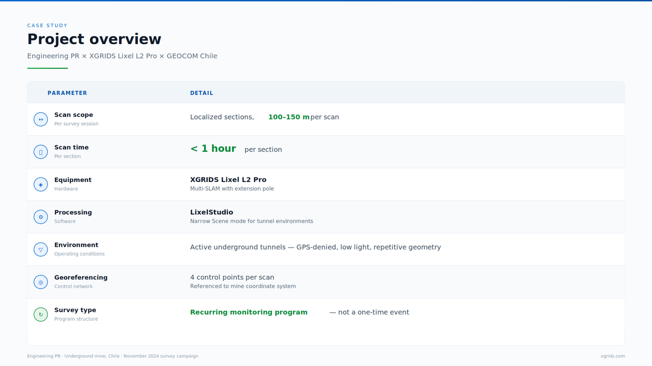
| Project overview Engineering PR × XGRIDS Lixel L2 Pro × GEOCOM Chile | |
| PARAMETER | DETAIL |
| Scan scope Per survey session | Localized sections, 100–150 m per scan |
| Scan time Per section | < 1 hour per section |
| Equipment Hardware | XGRIDS Lixel L2 Pro Multi-SLAM with extension pole |
| Processing Software | LixelStudio Narrow Scene mode for tunnel environments |
| Environment Operating conditions | Active underground tunnels — GPS-denied, low light, repetitive geometry |
| Georeferencing Control network | 4 control points per scan Referenced to mine coordinate system |
| Survey type Program structure | Recurring monitoring program — not a one-time event |
| Engineering PR · Underground mine, Chile · November 2024 survey campaign | |
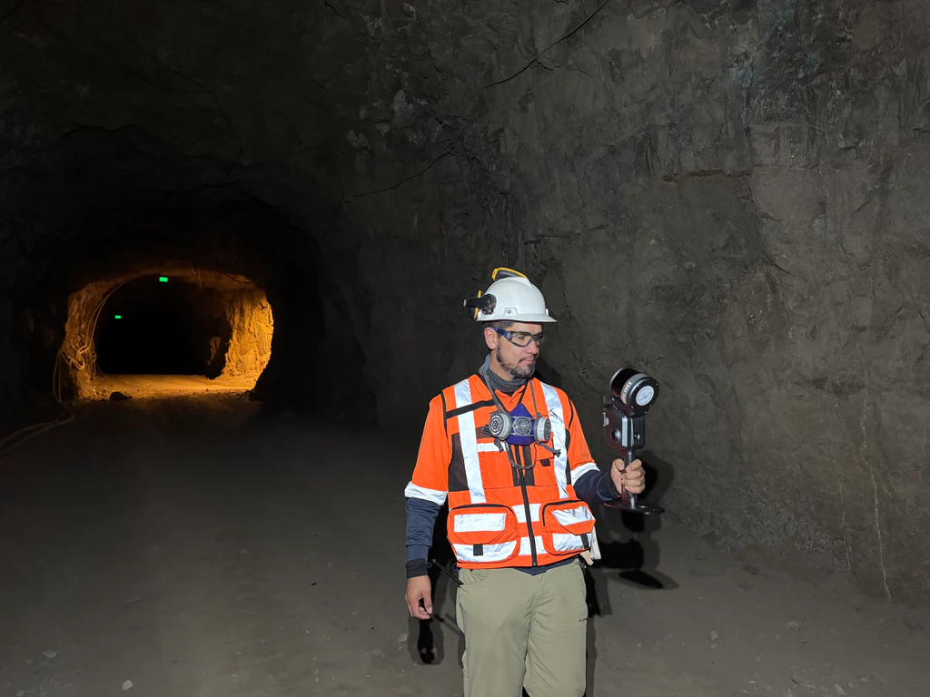
Working with GEOCOM as the local technology partner, Engineering PR runs periodic survey campaigns to audit the geometric advancement of stopes and tunnel sections across the mine's active zones. Each campaign's data is compared against previous scans to track how cavities evolve over time — verifying that excavation matches planning targets and that surrounding rock remains stable.
The primary constraint was not speed or cost. It was access.
Operators could not physically enter the highest-value scan zones — active stopes, unstable cavities, areas with rockfall potential. Previous sensors that could reach these areas were too heavy for practical deployment and captured at rates too low to produce usable point density. The result: entire sections of the mine existed as information voids, with volumes either estimated from incomplete measurements or simply not documented.
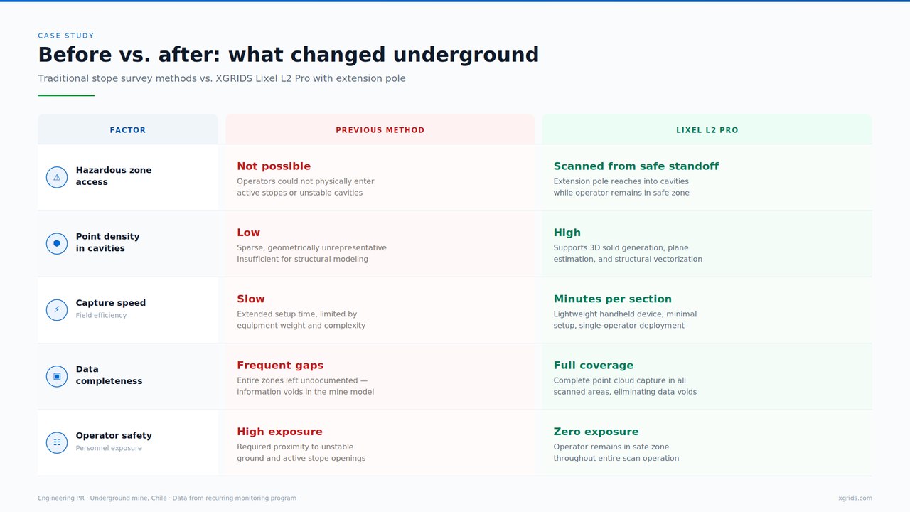
| Before vs. after: what changed underground Traditional stope survey methods vs. XGRIDS Lixel L2 Pro with extension pole | ||
| FACTOR | PREVIOUS METHOD | LIXEL L2 PRO |
| Hazardous zone access | Not possible Operators could not physically enter active stopes or unstable cavities | Scanned from safe standoff Extension pole reaches into cavities while operator remains in safe zone |
| Point density in cavities | Low Sparse, geometrically unrepresentative. Insufficient for structural modeling | High Supports 3D solid generation, plane estimation, and structural vectorization |
| Capture speed Field efficiency | Slow Extended setup time, limited by equipment weight and complexity | Minutes per section Lightweight handheld device, minimal setup, single-operator deployment |
| Data completeness | Frequent gaps Entire zones left undocumented — information voids in the mine model | Full coverage Complete point cloud capture in all scanned areas, eliminating data voids |
| Operator safety Personnel exposure | High exposure Required proximity to unstable ground and active stope openings | Zero exposure Operator remains in safe zone throughout entire scan operation |
| Engineering PR · Underground mine, Chile · Data from recurring monitoring program | ||
The L2 Pro's Multi-SLAM algorithm fuses LiDAR, visual, and inertial data to maintain trajectory accuracy through environments where GPS is unavailable and tunnel geometry is highly repetitive — conditions that challenge most SLAM systems. The operator can monitor scan progress in real time with the companion LixelGO app to ensure data completeness and quality.
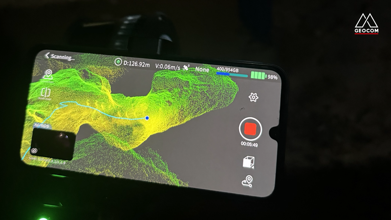
Four control points placed at strategic intervals tie the resulting point cloud to the mine's coordinate system. For localized surveys of this scope, four points are sufficient to meet the mine's expected tolerances.
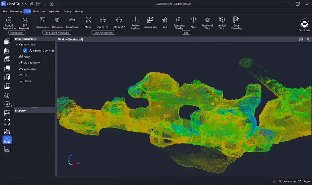
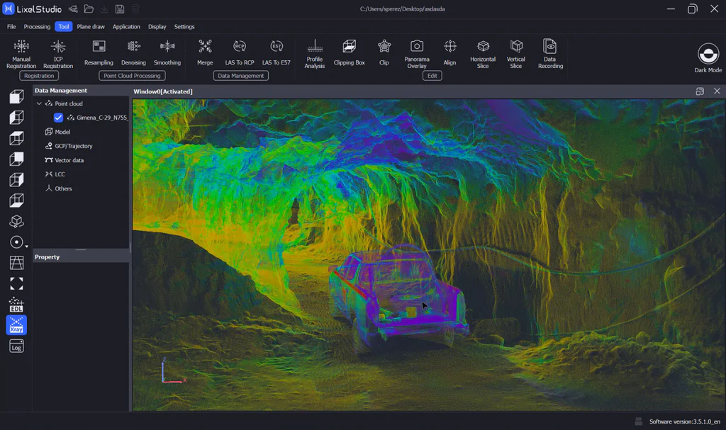
LixelStudio's Narrow Scene mode — designed specifically for tunnels, mine shafts, and long corridors — improves SLAM robustness within 500 m. For longer corridors, multiple scans with consistent control point naming feed into Map Fusion for alignment across sections.
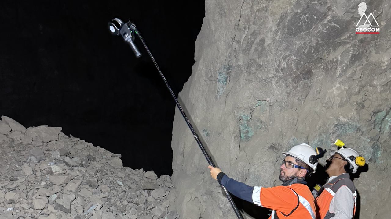
The extension pole is the critical operational detail. It allows the scanner to reach into stopes and cavities while the operator stays at the tunnel opening — capturing dense point cloud data from zones that were previously blank spots on the mine model.
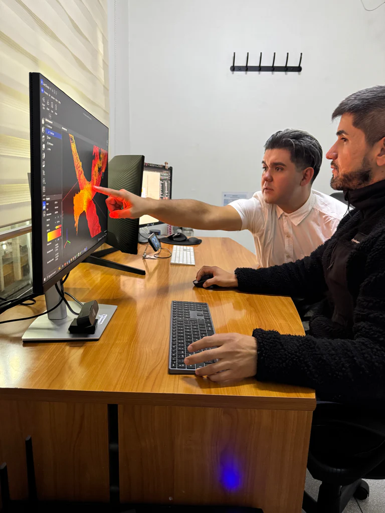
This case is defined by what happens after the scan. Pablo Reyes identifies four engineering outputs that depend directly on the L2 Pro's point density:
3D solid generation and volume calculation (cubicaciones)
Individual cavities are meshed to produce closed 3D bodies for precise volume computation. These volumes feed directly into extraction planning and reconciliation reporting. While other measurement methods exist — including drone-mounted SLAM LiDAR, which offers comparable or superior coverage — they are either more cumbersome to deploy or significantly more expensive. The L2 Pro provides a practical balance between data quality and investment, making recurring stope monitoring operationally viable for firms like Engineering PR.
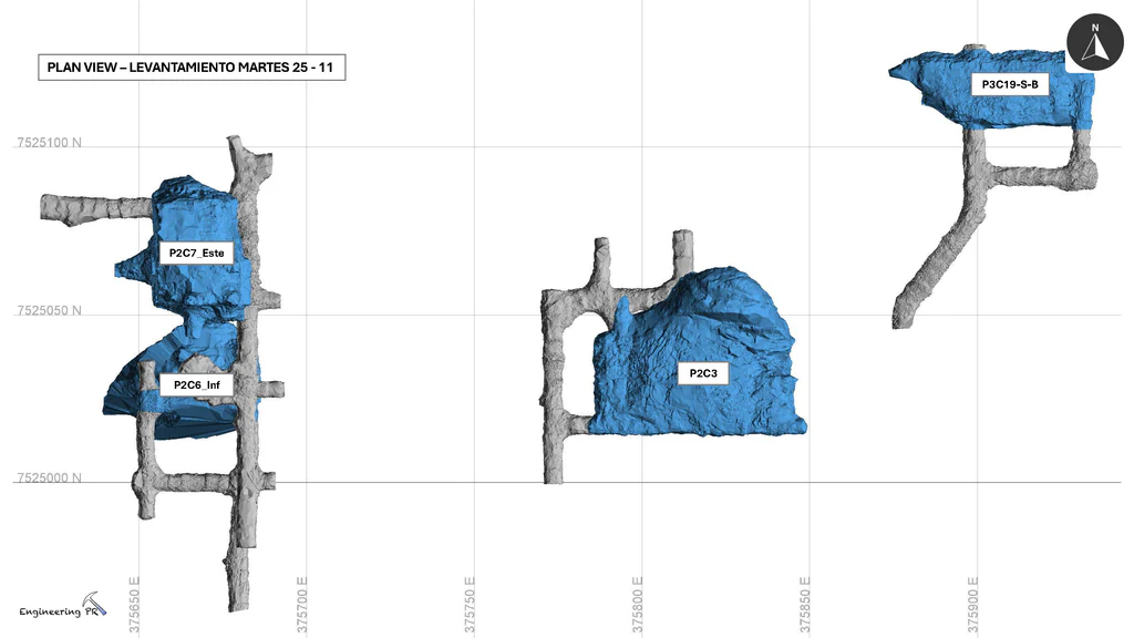
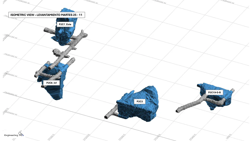
Isometric and plan views of stope solids (blue) and tunnel geometry (gray) from the November 25 survey campaign. Each cavity is meshed independently for volume calculation. Coordinates reference the mine's local grid. Source: Engineering PR.
Plane estimation and geometric modeling. Exposed rock face surfaces are fitted and analyzed from the point cloud rather than approximated from sparse measurements.
Structural model vectorization. Geological structures — joints, faults, foliation planes — are identified and mapped directly from the point cloud. This feeds into the mine's geological and geotechnical models and is, according to Reyes, one of the main advantages the L2 Pro's point density provides.
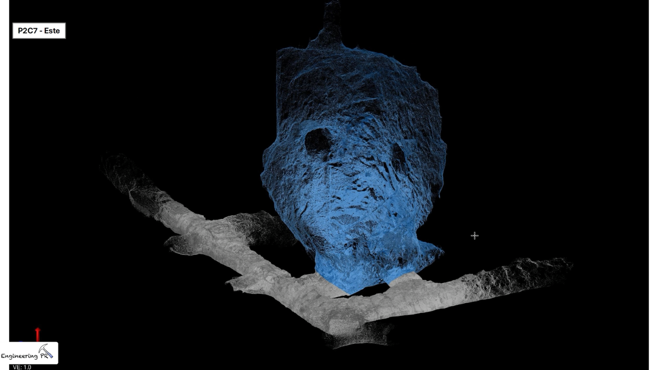
Meshed 3D solid of stope P2C7-Este (blue) generated from L2 Pro point cloud data. The closed mesh enables precise volume calculation for extraction reconciliation. Gray geometry shows surrounding tunnel corridors captured in the same scan. Source: Engineering PR.
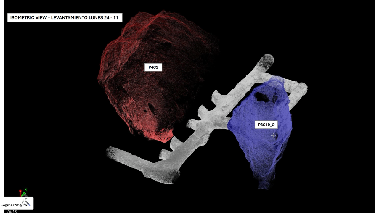
Isometric view from the November 24 survey campaign showing two individually meshed stope bodies — P4C2 (red) and P3C19_O (blue) — connected by tunnel corridors (gray). Color-coding distinguishes discrete cavities for independent volume calculation and temporal comparison across monitoring cycles. Source: Engineering PR.
Temporal comparison across survey campaigns. Each campaign's data is compared against previous scans to track cavity growth over time, supporting compliance verification and structural stability monitoring.
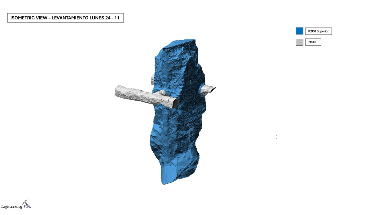
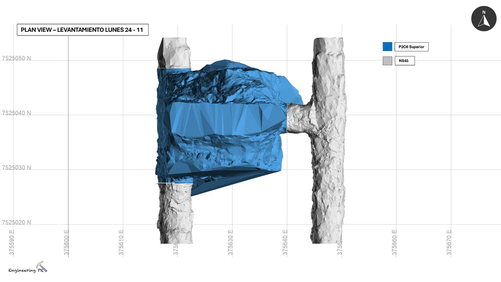
Isometric and plan views of stope P2C6 Superior scanned on November 24, showing the meshed cavity body intersecting tunnel N845. Source: Engineering PR.
"With the level of detail in the point cloud, we can estimate planes, model them, and vectorize the structural model. That's one of the main advantages this density gives us."
— Pablo Reyes, CEO, Engineering PR
This is not a story about scanning faster or cheaper. Other methods can reach these zones but none offered Engineering PR the combination of data quality, operational simplicity, and cost that made recurring stope monitoring viable.
For volumetrics specifically, the L2 Pro is the most practical method available — drone-based SLAM alternatives exist but at significantly higher cost and operational complexity. The geometry is too complex and the access too constrained for total station cross-sections or photogrammetry. The mesh-derived volumes are the operational record, used directly for extraction reporting and mine planning.
In an industry context where mining companies are deploying automation and remote operations technologies to improve efficiency and safety International Trade Administration, the L2 Pro represents a practical, operator-level entry point: a single surveyor with a handheld scanner producing engineering-grade deliverables from areas that were previously undocumented.
Reality capture let Netflix's Monster scout 35 Italian locations in four days with PortalCam, then plan shots remotely through virtual scouting of 3DGS scans.
.png?x-oss-process=image/resize,w_800/quality,Q_50)
A one-hour Lixel K1 scan of six Culver City blocks gave a generative film pipeline the fixed geometry it needed to keep six locations consistent.

Handheld 3DGS by PortalCam helped CyArk document three landmark interiors for America 250, solving mirror reflections and low-light field challenges.

Handheld 3D capture brings real museum spaces to LED volumes, replacing green screens and photogrammetry for fast, cinematic virtual camera moves.