
Case Studies
Virtual Pre-Production for Netflix's Monster: The Lizzie Borden Story.
Reality capture let Netflix's Monster scout 35 Italian locations in four days with PortalCam, then plan shots remotely through virtual scouting of 3DGS scans.
ISL Engineering reduced urban visualization time from weeks to hours using XGRIDS L2 Pro scanner and 3D Gaussian Splatting technology. The solution captured 500m of Edmonton's Jasper Avenue with centimeter-level accuracy in 40 minutes, enabled real-time stakeholder interaction, and eliminated approximately 80 hours of modeling work while improving public engagement.
When ISL Engineering, a leading civil engineering company in Western Canada, faced the task of presenting Edmonton's Imagine Jasper Avenue Phase 2 to the public, they confronted a fundamental problem: how to show stakeholders something that doesn't exist yet.
Jasper Avenue has been Edmonton's commercial heart since 1871, featuring a complex urban fabric of heritage buildings, modern high-rises, and diverse architectural styles. As both a transportation corridor and commercial hub, its revitalization called for visualization technology that could accurately represent this complexity.
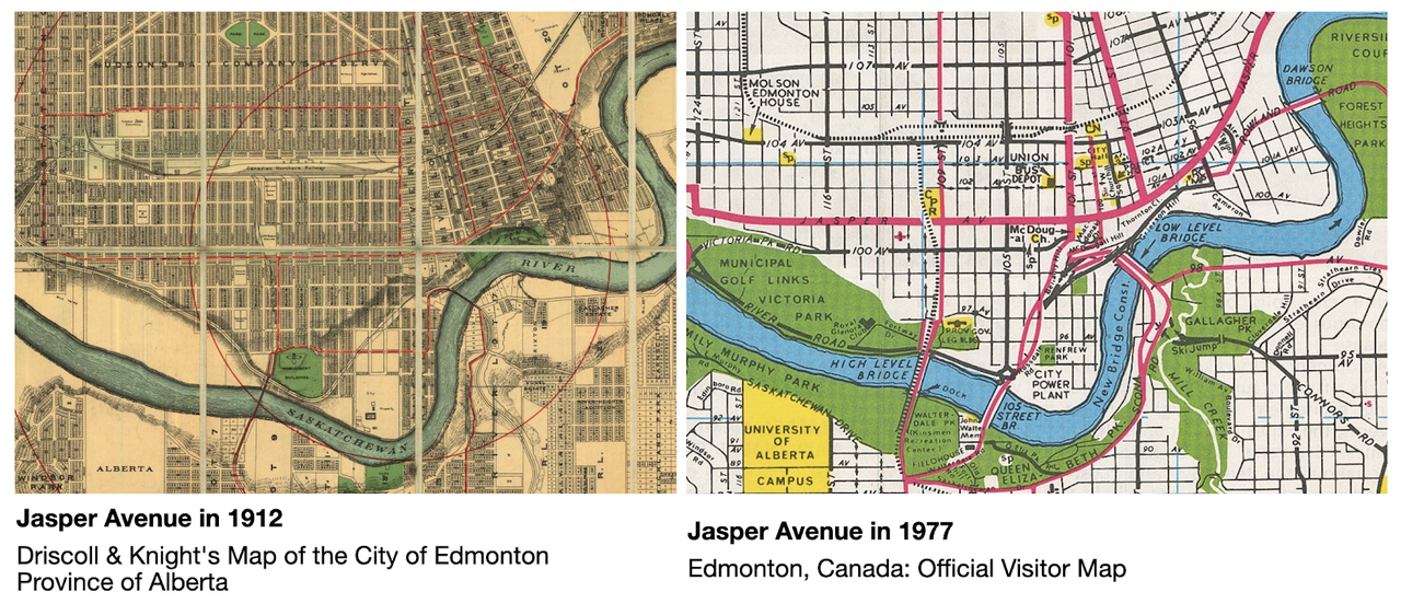
Driscoll & Knight's Map of the City of Edmonton Province of Alberta
Edmonton, Canada: Official Visitor Map
https://cityarchives.gov.edmonton.ab.ca/edmonton-canada-official-visitor-map
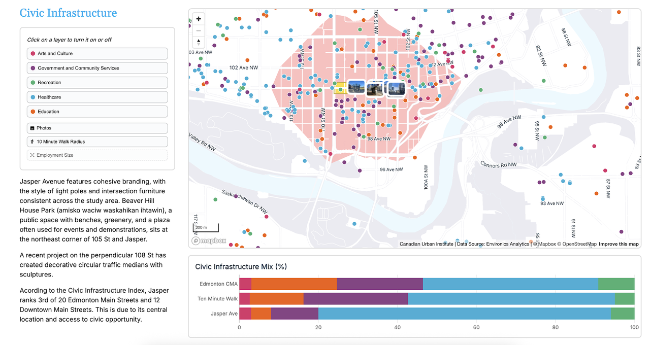
Current day Jasper Avenue - Civil Infrastructure, Measuring Main Streets
https://measuringmainstreets.ca/casestudies/edmonton/jasperavenue/
"Our traditional visualization workflow hit three critical bottlenecks," explains Arthur Chin, Senior 3D Visualization Specialist at ISL. "First, capturing existing conditions required multiple days of field work with specialized equipment. Second, processing this data into usable models consumed weeks of expert time. Finally, even after all this work, our visualization options were limited to less accurate reality capture workflows that failed to convey the street-level experience stakeholders needed to provide meaningful feedback."
Previous attempts to solve this using Cesium's Google Earth tilesets did not provide enough visual fidelity. "The quality of these tilesets becomes less detailed the closer we are to street level," notes Chin. Without accurate context, stakeholders struggled to visualize how proposed improvements would integrate with existing buildings.
Rather than spending weeks creating adequate 3D models of existing buildings or settling for low-resolution environment tiles, ISL implemented a streamlined reality capture workflow built around three core XGRIDS technologies:
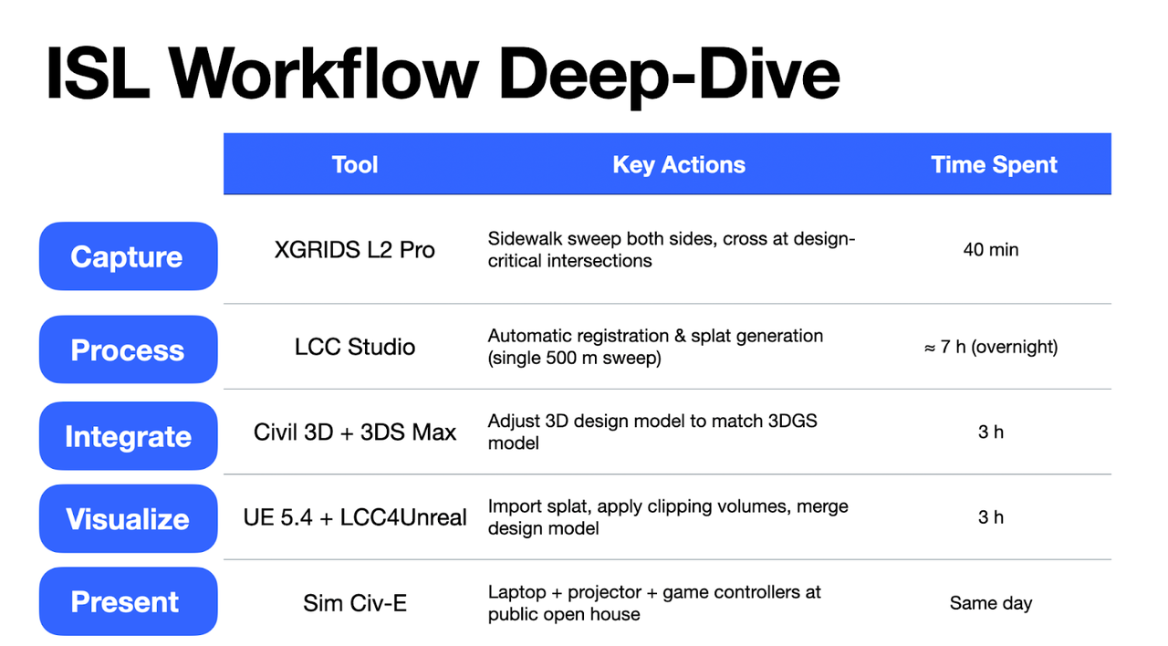
| ISL Workflow Deep-Dive | |||
| Stage | Tool | Key Actions | Time Spent |
| Capture | XGRIDS L2 Pro | Sidewalk sweep both sides, cross at design-critical intersections | 40 min |
| Process | LCC Studio | Automatic registration & splat generation (single 500 m sweep) | ≈ 7 h (overnight) |
| Integrate | Civil 3D + 3DS Max | Adjust 3D design model to match 3DGS model | 3 h |
| Visualize | UE 5.4 + LCC4Unreal | Import splat, apply clipping volumes, merge design model | 3 h |
| Present | Sim Civ-E | Laptop + projector + game controllers at public open house | Same day |
This end-to-end solution enabled ISL to:
| Process Stage | Traditional Method | XGRIDS Solution | Improvement |
| Field capture | 2-3 days, multi-person team, dozens of scanner setups | 40 minutes, single operator walking | 97% time reduction |
| Data processing | 1-2 weeks manual registration & meshing | Overnight automated processing | 90% labor reduction |
| Context modeling | 80+ hours creating approximate building models | Eliminated - captured directly | 100% labor reduction |
| Accuracy | 3-5 cm after survey tie-in | < 3 cm without RTK | 40% accuracy improvement |
| Stakeholder experience | Static renders & presentation boards | Interactive real-time navigation with game controller input | Qualitative improvement |
"The overall site scan and processing was completed in around 7 hours with processing done overnight and automated," notes Chin. "This was a massive time savings which provided results not comparable to traditional modelling techniques."
Explore interactive flythrough: https://lcc-viewer.xgrids.com/pub/dbtift-jasperave
"The 3DGS model lined up very well in X,Y,Z positions at each end of the 3D design model without any manipulation or adjustment," Chin explains. "This validated the position and extents of our design model which is based on CAD coordinates."
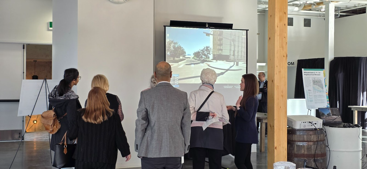
ISL presented the combined model to the public with an innovative, hands-on approach. At a pre-construction event, attendees were able to navigate through a projected visualization of the future streetscape themselves using the interactive model.
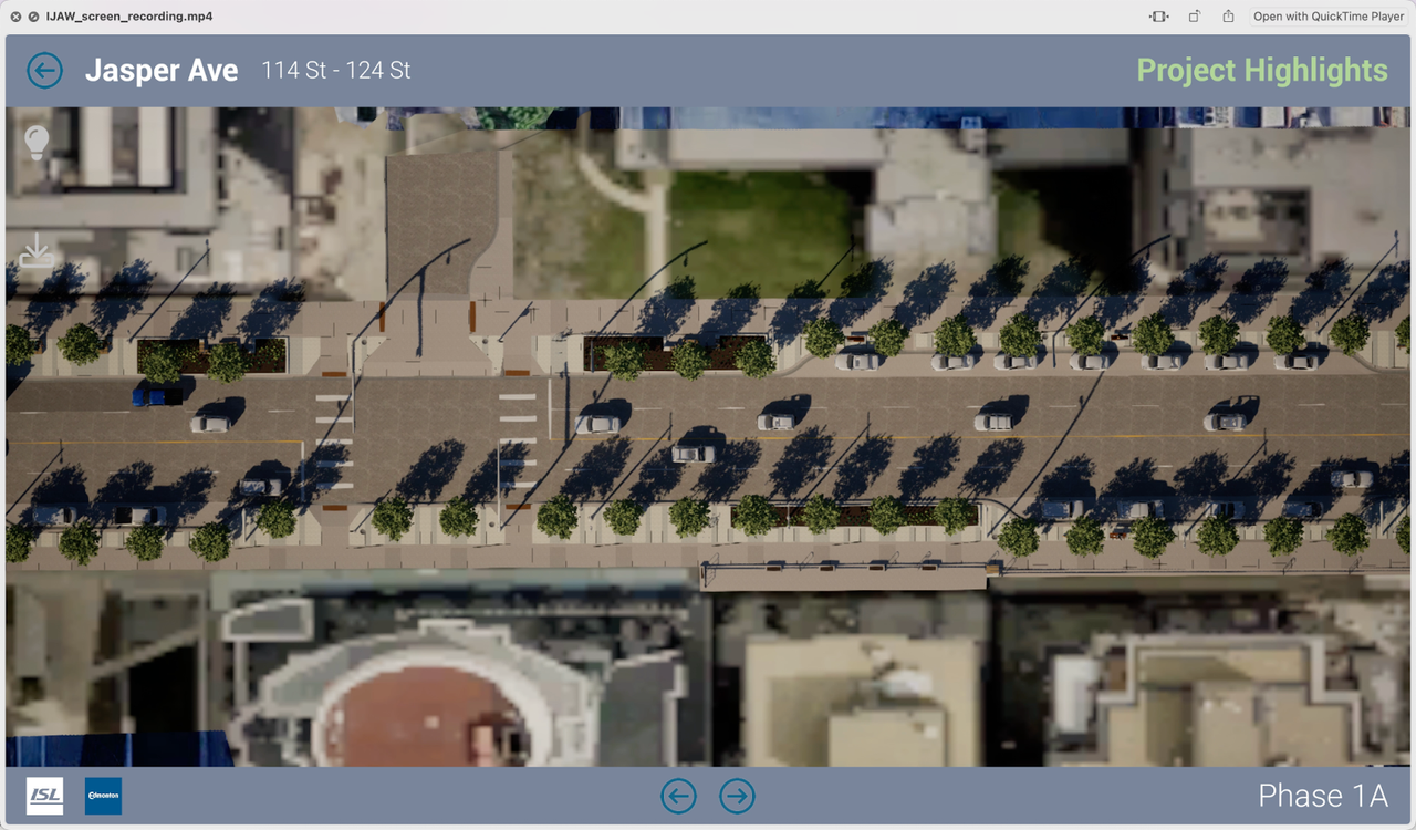
"With the ability to move anywhere within the design model in Sim Civ-E, attendees were able to navigate directly to specific areas of interest to view the project design at those locations," says Chin.
What made this experience unique was the ability to experience the design from various perspectives:
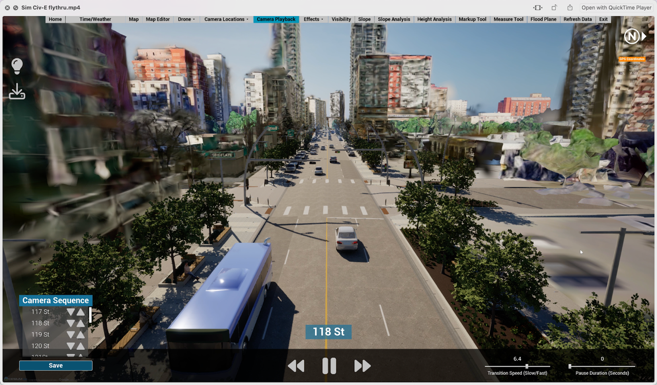
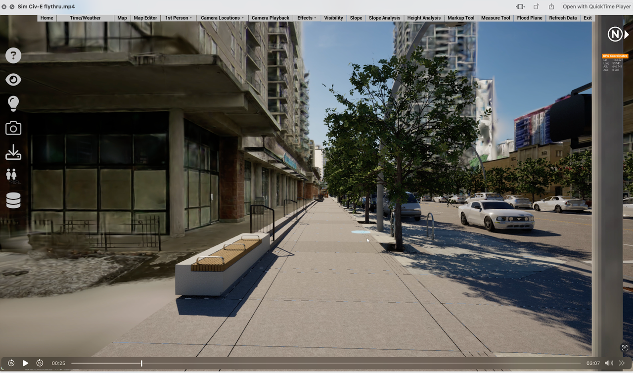
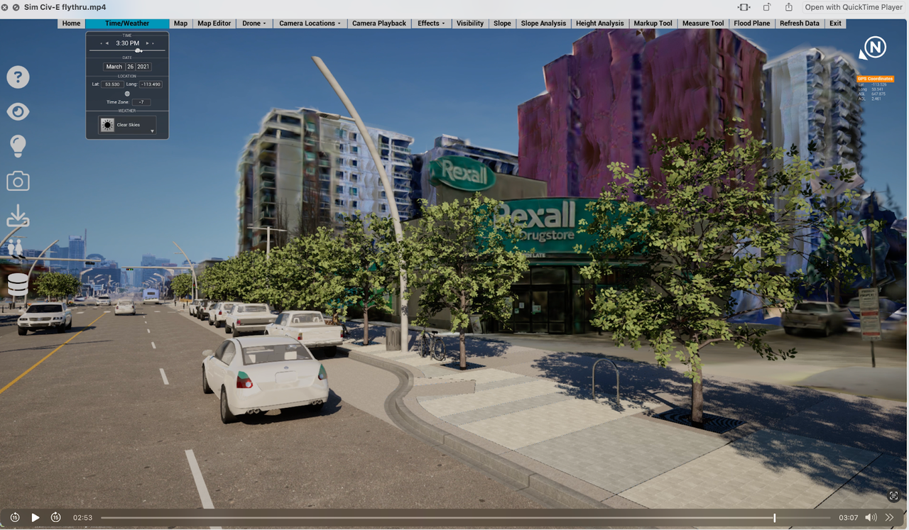
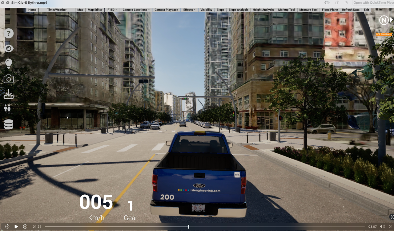
The collision properties of the XGRIDS 3DGS model provided natural boundaries for vehicle travel, enhancing the realism of the experience.
The implementation delivered immediate, measurable benefits for the Jasper Avenue project:
Based on ISL's experience, engineering and planning firms can follow this streamlined approach to implement XGRIDS technology:
The success of the Jasper Avenue implementation has opened new possibilities for XGRIDS technology in civil engineering:
Ready to compress your streetscape pipeline from weeks to one day?
Contact XGRIDS at enterprise@xgrids.com to learn how your engineering or planning firm can implement reality capture and 3DGS technology to create photorealistic, measurable digital twins.
Reality capture let Netflix's Monster scout 35 Italian locations in four days with PortalCam, then plan shots remotely through virtual scouting of 3DGS scans.
.png?x-oss-process=image/resize,w_800/quality,Q_50)
A one-hour Lixel K1 scan of six Culver City blocks gave a generative film pipeline the fixed geometry it needed to keep six locations consistent.

Handheld 3DGS by PortalCam helped CyArk document three landmark interiors for America 250, solving mirror reflections and low-light field challenges.

Handheld 3D capture brings real museum spaces to LED volumes, replacing green screens and photogrammetry for fast, cinematic virtual camera moves.